Tuesday, 15 September 2026

Green Link Walk Section 4: Bankside to Peckham

14th September 2026

Up in town for an evening meeting at the London Transport Museum I had enough time to go south of the river and complete the Green Link Walk to Peckham. I took the path leading away from the Thames down the side of Tate Modern to Holland Street and round the back of the gallery, grabbed a sandwich from the Co-Op in Summer Street and crossed Southwark Street.

In Great Suffolk Street I passed the Hilton Hotel and then under three bridges, the first carrying a service road and the other two railways to Blackfriars and Charing Cross.

Green Link Walk Section 4, Great Suffolk Street, Southwark

This area is defined by its railway bridges carrying multiple lines over the streets of Southwark so when I turned right into Pocock Street I passed under the line from Blackfriars again. At the end of the road by the huge mural on the end wall of Friars House I turned left onto the noisy Blackfriars Road heading south.

I soon reached St. George’s Circus with its tall stone obelisk. Constructed in 1771 as a grand southern entrance to the City of London it is now a busy roundabout. The base of the obelisk bears on one face the inscription Erected in XI year of the reign of King George MDCCLXXI, with the inscriptions on the other three sides reflecting the obelisk’s distances from certain London landmarks. One Mile From Palace Yard, One Mile XXXX Feet From London Bridge (one mile 40 feet) and One Mile CCCL Feet From Fleet Street (one mile 350 feet).

Green Link Walk Section 4, St George's Circus

I turned left at the circus down Borough Road and once beyond the red brick and terracotta Passmore Centre (formerly the Passmore Edwards St George the Martyr Public Library and now used by London South Bank University) I crossed over the road and went down Keyworth Street, somewhat against the flow of students. A small plaza between two of the university buildings provided a bench on which to pause and eat my sandwich, watched over by a security guard.

After lunch I carried on to Newington Causeway, turned right to Elephant & Castle. It had been a long time since I was here last and it has changed through redevelopment (gentrification?) almost beyond recognition. The early 1960s’ Elephant and Castle Shopping Centre (the first of its kind in Europe) has gone. Tall towers have sprung up. The slightly silly name “Elephant Park” has appeared. At least the landmark colourful Elephant & Castle sculpture from the old shopping centre has found a new home on top of the small Castle Square retail area off Elephant Road.

Green Link Walk Section 4, Castle Square, Elephant & Castle

Opposite the railway station I turned left through Castle Square and Elephant Park (I don’t know if you are allowed to park an elephant there, I didn’t see any) and at the end of Ash Avenue crossed over into Victory Community Park. I turned south along Balfour Street then east along Chatham Street to reach the next bit of green space, Salisbury Row.

Green Link Walk Section 4, The Eternal Sacred Order of the Cherubim & Seraphim, Chatham Street, Walworth

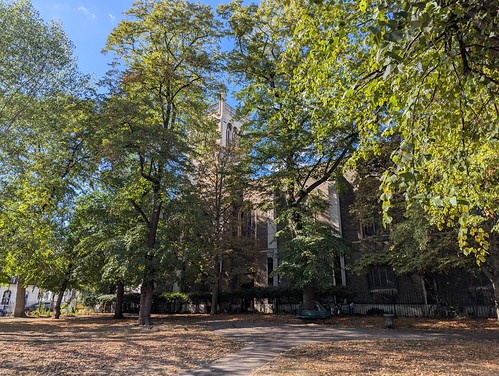
I followed the Green Link waymarks across the park which differ from the directions in the guide which exit into Barlow Street and then pass under the bulky block of flats, Eugene Cotter House to reach Tatum Street. Following the signs I exited the park to the north east of Eugene Cotter House, went along Beckway Street and passed between Eugene Cotter House and Ellery House to turn left along Tatum Street. I don’t know who has signposted this alternative route or why. There were hardly any people on the streets here mid-afternoon which was slightly eerie. I did feel that I wouldn’t want to walk through here after dark.

A right turn and then left by the Huntsman pub followed by a succession of back streets heading roughly south east brought me to Surrey Square.

Green Link Walk Section 4, Surrey Square Park

Straight across the park and out beside Tenterden House through the postwar Kinglake Estate to Albany Road and across into the wide open and sunny expanse of Burgess Park. I turned right at the lake and followed the broad path alongside it to a bench where I sat a while watching the world go by for here at last there were people. Also geese. Photo-bombing pigeons as well.

Green Link Walk Section 4, Burgess Park

I carried on west across the park to Chumleigh Gardens, formerly a set of almshouses called the Female Friendly Society Asylum. The multi-cultural garden, established in 1995, in which the Georgian buildings stand are “Designed to reflect the area’s diversity, Mediterranean, Islamic, Oriental, African & English gardens rest side by side.” There’s a cafe here with a large unfriendly sign outside the door pointing out that Public Conveniences are located in the next building. Inconveniently these were closed due to vandalism 😒

Green Link Walk Section 4, Chumleigh Gardens, Burgess Park

Turning first south and then east along the south side of Burgess Park I joined the route of the Grand Surrey Canal. Constructed in the early 19th century to carry timber from Surrey Commercial Docks in Rotherhithe through South London to Camberwell and Peckham (and was initially planned to go further still but that didn’t happen). The canal closed between the 1940s and 1970s and was filled in. parts were built over but other parts turned into roads or linear parks. In Burgess Park a redundant bridge over the canal was left in place and became known as The Bridge to Nowhere.

Green Link Walk Section 4, Grand Surrey Canal, Burgess Park

I passed beneath The Bridge to Nowhere and left Burgess Park crossing Sumner Road to join the Surrey Canal Walk which heads south along the route of the Peckham Branch of the Grand Surrey Canal, passing under two more former canal bridges which at least still carry traffic, first on Willowbrook Road and then Commercial Way.

Green Link Walk Section 4, Surrey Canal Walk, Peckham

The canal route ends at Peckham Square - the Library is built on the site of the terminal basin - and the Green Link Walk finishes on the other side of the Square, underneath Peckham Arch on the High Street. A high street that was occupied by a Metropolitan Police Live Facial Recognition operation with cameras set up in the street. I don’t know who they were looking for. Two brothers selling dodgy goods out of a suitcase perhaps? Mange tout, Rodders!

Green Link Walk Section 4, Police Facial Recognition camera, Peckham High Street. End of the Green Link Walk.

Green Link Walk ✅

33 photos from Green Link Walk section 4 on Flickr. Opens in a new page or as a slideshow below if your viewer supports it.

Green Link Walk Section 4

A few thoughts. The Green Link Walk cuts across London from North to South linking some 40 areas of green space - although some are small enough that you’ll miss them - and keeps where it can to mostly quiet streets. On the way it passes through quiet residential areas, the City, tourist hotspots, and bits of London you probably never thought to visit. At 15 (or 16) miles it’s easily doable in three outings. Two if you’re fit and keen. One if you’re a lunatic.

Route guidance is downloadable for free from the Inner London Ramblers here.

The four sections are marked on openstreetmap.org

GPX files for mapping on your phone can be downloaded from Footways.

Monday, 7 September 2026

Green Link Walk Section 3: Regent's Canal to Bankside

Saturday 5th September (late afternoon)

Section 3 of the Green Link Walk is only two and a half miles, from the Regent’s Canal to Bankside on the other side of the River Thames. After sitting for about half an hour in Duncan Terrace Gardens I decided to carry on walking rather than quitting and heading for Angel tube station.

After all it was a sunny Saturday afternoon, how busy could the City be?

I left Duncan Terrace through the gate at the southern end and crossed City Road, passed the large octagonal vent shaft building above Angel station on the Northern Line then crossed Goswell Road into Owen Street with Owen Square on my left and St. John Street into Chadwell Street to reach Myddelton Square, keeping left of St. Mark’s Church.

Green Link Walk Section 3, St. Mark's Church, Myddelton Square

The name of the square along with several other streets nearby is from Sir Hugh Myddelton (1560-1631), a Welsh born clothmaker, goldsmith, banker, entrepreneur and engineer who is mainly remembered as the driving force behind the New River, an artificial waterway opened in 1613 to bring fresh water from springs in Hertfordshire London, which in part it still does. The original route of the New River (and the current New River Path walking route) runs through Duncan Terrace and Owen Street before veering south to the former waterworks at New River Head.

The Green Link Walk continues west to cross Amwell Street (named after one of the springs near Ware which fed the New River) and on to Lloyd Square safely locked away behind its railings. From the westernmost corner Lloyd Square you can see the former Post Office Tower over in Fitzrovia.

Green Link Walk Section 3, Lloyd Square, Islington - view of the former Post Office Tower

I turned left and passed a guided walking tour in Wilmington Square, which sounded as if it was New River related, past the end of Exmouth Market and then on down Tysoe Street to Spa Fields. I’ve been here a few times because the adjacent London Archives has very interesting free exhibitions. The current offering is Londoners on Trial - Crime, Courts and the Public 1244–1924. I must arrange to come back and pay another visit.

I was now in Clerkenwell, - the area derives its name from the Clerks’ Well, clerken being the Middle English plural of clerk, a literate person or clergyman. It being Saturday Clerkenwell was fairly quiet save for someone doing a fashion photo shoot at The Horseshoe pub and a wedding at St. James’s Church.

Green Link Walk Section 3, The Horseshoe pub, Clerkenwell Close

Jerusalem Passage brought me out in St. John’s Square and I crossed Clerkenwell Road to pass through the arch of St. John’s Gate, originally built in 1504 as the south entrance to the inner precinct of Clerkenwell Priory, the English headquarters of the Knights of the Order of St John known as the Knights Hospitaller. The order was re-established in the nineteenth century, they’re the St. Johns with the ambulances. The building has had a variety of uses since the Dissolution of the Monasteries by Henry VIII including a printing house, William Hogarth’s father’s Coffee House and a tavern. It is now the Museum of the Order of St. John. I’ve passed many times but not had the time to go in and the same applied today.

Green Link Walk Section 3, St. John's Gate

St. John’s Lane (with the aeroplane clock) and St. John’s Street brought me to Charterhouse Street. I was tempted to nip into The Hope for refreshment but it was very busy. Instead I crossed Charterhouse Street into the Grand Avenue of Smithfield Market. It being Saturday afternoon rather than early on a weekday morning the market was closed and empty, the usual smell of meat absent.

Green Link Walk Section 3, Grand Avenue, Smithfield Market

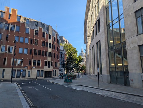
I emerged into West Smithfield and made a short diversion up Cloth Fair to check out the oldest house in the City then returned past the St. Bartholomew’s Gatehouse into Little Britain, getting my first sight on the walk of the dome of St. Paul’s Cathedral. It was about to get much busier.

Green Link Walk Section 3, St. Paul's Cathedral glimpsed from Little Britain

I stopped by Postman’s Park for a look at the ceramic tiles of the Memorial to Heroic Self Sacrifice and a sit down before heading into the mêlée.

Green Link Walk Section 3, Postman's Park, Memorial to Heroic Self Sacrifice

I passed between Christchurch Greyfriars Garden, which was a Christopher Wren church until the Luftwaffe visited on 29th December 1940 and 81 Newgate Street which until December 2021 was the headquarters of BT. This was on the site of the Central Telegraph Office, which also had a visit from the Luftwaffe on 29th December 1940 but was partially rebuilt and not replaced by the BT Centre until 1967. Also on this site Guglielmo Marconi made the first public transmission of wireless signals on 27 July 1896.

And on into “tourist central”. Queen’s Head Passage into Cannon Alley to the north side of St. Paul’s Churchyard.

Green Link Walk Section 3, St Paul's Cathedral School

I skirted around the east side of the cathedral past St Paul’s Cathedral School and then dodged through the wheelie suitcases and Nikons to cross the road into Peter’s Hill. Not far to go now.

Down the steps of Peter’s Hill to the no-longer-wobbly Millennium Bridge which was packed. Yes of course you can walk six abreast or stand in a big circle, not like anyone wants to get across the river. Bloody tourists! 😆

The Thames looked glorious as usual in the sunshine mind you.

Green Link Walk Section 3, The Thames east of Millennium Bridge

So with impeccable bad timing I arrived on Bankside just as Tate Modern was closing.

Green Link Walk Section 3, Tate Modern (formerly Bankside Power Station)

Green Link Walk Section 3 ✅

35 photos on Flickr from Green Link Walk Section 3. Opens in a new page or as a slideshow below if your viewer supports it.

Green Link Walk Section 3

Sunday, 6 September 2026

Green Link Walk Section 2: Lea Bridge to the Regent's Canal

Saturday 5th September

Back to Lea bridge to continue the Green Link Walk. I set out on Section 2 at half past midday which was slightly later than anticipated because the TFL Go app directed me to a bus stop in Hackney which doesn’t exist. I got off the number 56 bus at Chatsworth Road and walked down to the River Lee, ducking under Lea Bridge, passing the now familiar Princess of Wales pub which was doing a good Saturday lunchtime trade. I’d been along here on the Capital Ring recently but this time once past the weir and the hump where there used to be a canal arm I turned right, leaving the river and the Ring behind and striking out south across Millfields Park. I didn’t strike out very far though before finding shaded bench on which to eat the sandwich I’d bought while hunting to the right bus stop in Hackney. Today’s expedition had been a spur of the moment thing and I’d not had breakfast.

Green Link Walk Section 2, Millfields Park

Thus refuelled for the walk ahead I carried on. It was fairly busy in Millfields Park but probably quieter than in the year 527. According to tradition it’s believed that the Battle of Hackney took place here when Æscwine of Essex rebelled against Octa, the Anglo Saxon King of Kent, defeating him to establish the Kingdom of Essex. There’s not much evidence that Æscwine existed mind you so it could all be bol… erm, a myth 😀

On the far side of the park I crossed into Millfields Road which took me all the way to Clapton Pond which was very photogenic in the sunshine.

Green Link Walk Section 2, Clapton Pond

I passed the pond, crossed Lower Clapton Road and carried on along Downs Road to Hackney Downs. Rather than following the main route of the Green Link along the east side of the downs I headed straight to the centre because there’s something quite rare for London in the middle of Hackney Downs. Public Conveniences. I sat a while and watched someone grooming a large black dog which was standing on top of a large grey rock and then returned to the south-east corner of the downs to rejoin the walk.

The next 500 metres brought me to Clapton Square which I cut through to reach Lower Clapton Road opposite the former Police Station, now a school, and then along Churchwell Path into the grounds of Hackney Church. Somewhere in the churchyard is the grave of Rear Admiral Sir Francis Beaufort of Beaufort Scale of wind strength fame. I did a loop of the church but somehow failed to spot his amongst the many tombs. I rejoined Churchwell Path south of the churchyard and followed it all the way to Morning Lane, passing under the Mildmay Line on the way, and then continued south into the centre of Hackney.

Hackney is quite hellish for pedestrians because of cyclists who ride just wherever they like. Roadway, footway, across parks, the wrong way up one-way streets, diagonally across junctions frequently without actually looking where they are going or even while looking at their mobile phones held in one hand. You really need eyes in the back of your head while walking and I witnessed several near misses.

Turning west I passed Hackney Telephone Exchange, the Picturehouse, and the Town Hall before turning left along Hackney Grove and then Martello Street, going under the railway line to reach London Fields. Standing by the railings near the Pub on the Park to check my route I was suddenly struck in the kidneys by a set of bicycle handlebars. Some gormless idiot was pushing his bike along the footway without taking any notice of where he was going or anyone else around him apart from the girl he was with. I had to resist the urge to knock the c*** into the middle of next week 😡 Like I said above, hellish.

Green Link Walk Section 2, London Fields

I followed the footpath across the middle of London Fields (now even more aware of two-wheeled terrors) crossing Lansdowne Drive on the other side where two bicycles almost collided, their riders both having decided to ride diagonally across the junction with Shrubland Road, down which I continued. I made the very short detour to get a photo of the corrugated iron Sight of Eternal Life Church, a “tin tabernacle” built in 1858 at a cost of just £1250 and believed to be the oldest surviving example of an iron church in existence.

Green Link Walk Section 2, "Tin Tabernacle", Shrubland Road (Sight of Eternal Life Church)

Amazingly it’s not yet been converted into or replaced by flats.

I returned to the walk along Albion Drive, crossing Queensbridge Road and arriving at Albion Square Gardens. Sitting in the shade on a bench under a tree, with palm trees and the gentle sound of someone playing Steel Pan Drums somewhere nearby it felt like anywhere but Haggerston in the middle of London. A little oasis of cool and calm.

Green Link Walk Section 2, "Tin Tabernacle", Shrubland Road (Sight of Eternal Life Church)

Crossing the corner of Stonebridge Common and passing beneath the East London Line railway I reached Kingsland Road. It’s a fact that anyone who is lost will always first ask directions of someone who isn’t local and this was proven by the young guy who approached me as I was about to cross Kingsland Road who had apparently got off at the wrong station and was trying to find the way to King’s Cross. I said I wasn’t local so couldn’t help him. It’s a sad indictment of these times that my first thought was “do not get your mobile out to check for directions if you want to keep it” 😟

Through De Beauvoir Town (and yes I pronounce it Da Beaver because 1, it’s correct and 2, it’s funny) I walked to the left of De Beauvoir Square and onward along Northchurch Road. This section of the Green Link follows the same route as Cycleway 27. Say no more 😉 

Everyone appeared to be having a good Saturday afternoon in The De Beauvoir Arms when I passed though as far as I can make out they don’t sell Beavertown beers which is strangely disappointing. Another half mile or so along residential streets brought me to the New North Road, having left De Beauvoir Town and entered Islington. I took Spellbrook Walk to Prebend Street and the well-tended little front gardens of Islesden House. I took these to be almshouses but they are general needs housing and sheltered accommodation run by the loacl authority. They’re not as old as I first assumed either, the estate was built in 1948 by the Trustees of the London Parochial Charities. In 1953, the Trustees conveyed the property to the City of London. They’re very different to most of the buildings around here.

Green Link Walk Section 2, Isleden House, Prebend Road, Islington

The spire of St. James pointed at a bright blue sky with hardly a cloud in it as I walked down Prebend Street and it was turning into another warm afternoon. I stopped at a local shop on the corner of Packington Street for a cold drink. I’d have bought an ice cream too if they’d had any. I realised afterwards that I could have turned left here and gone through Packington Square and Canalside Square to take the alternative route along the Regent’s Canal towpath but that was on the next page of the walking instructions. Instead I carried on along the street to cross the canal at Danbury Street bridge.

Green Link Walk Section 2, Regent's Canal,  Danbury Street Bridge, Islington

On the other side of the bridge I turned left along Vincent Terrace parallel to the canal, dodged around the twat in a suit with no spatial awareness who just stepped backwards into my path outside the Plaquemine Lock pub completely oblivious to his surroundings, and reached the end of Section 2 at Colebrooke Row adjacent to the portal to the Islington Tunnel. 

Which I couldn’t see because it was cordoned off with roadworks barriers.

Green Link Walk Section 2, Islington Tunnel (Regent's Canal) - somewhere behind the barriers

It was twenty past three. I went and sat down in the shade in Duncan Terrace Gardens.

Green Link Walk Section 2 ✅

42 Photos on Flickr from Green Link Walk Section 2. Opens in a new page or as a slide show below if your viewer supports it.

Green Link Walk Section 2