May 10th
Nice day for a walk, let’s find out what the second part of London Loop Section 11 looks like. It might have dried out by now. (Spoiler: Nope.)
I got a train to West Drayton then returned to the canal towpath under bridge 192 and headed north past the large Tesco supermarket and under a couple of bridges to reach the junction with the Slough Arm of the Grand Union Canal. Crossing over the main line of the canal on a black metal footbridge to the Slough Arm towpath.

This canal was the last canal to be built in the country apart from the larger ship canals, opening in 1882 and running for five miles and servicing the local brickfields. Fortunately i didn’t have to walk the whole five miles so avoided going to Slough. I passed first the entrance to the Packet Boat Marina on the far bank, crossed the Frays River on the aqueduct, and crossed over the canal at Trout Lane. The route leaves the canal here and winds its way through the woods, eventually arriving at a gate into a small car park at the end of Packet Boat Lane. Earlier in the year this was reported as flooded, the River Colne being adjacent on the left but the puddle now was only an inch or two deep so no problem.
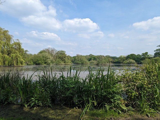
The other side of the car park lies Little Britain Lake, so named because it’s shaped - very vaguely - like the mainland of the British Isles. Obviously you can’t tell that from ground level.
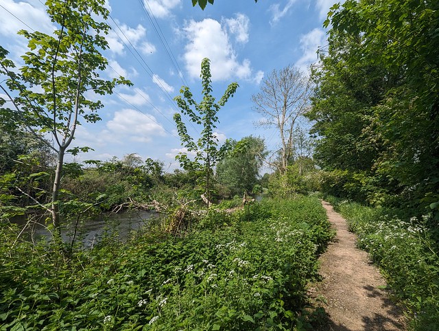
From here there’s a bridge over the River Colne and the Loop runs along the Buckinghamshire side of the river. Except not today. Today it runs in the river, being flooded and impassable from the bottom of the ramp down from the footbridge. I sent the Inner London Ramblers an update to confirm that Section 11 is still blocked here.

So I retraced my steps and went along Packet Boat Lane, past the Public Toilets (the Gents was locked, disappointingly) and left up Old Mill Lane. This is the unofficial diversion route which if the Colne continues to flood in future probably ought to become official. Although Old Mill Lane is a little narrow and once past the lake there’s no footpath. It wasn’t too busy today though that might be different at the weekends or school holidays. It does pass between the River Colne and the Frays River though and at one point all that separates them is the raised road.

This lane is part of the Colne Valley Trail way marked route and I followed it until reaching Iver Lane opposite the West London Industrial Park which has a large collection of what used to be called “man lifts” but these days are usually referred to as “cherry-pickers”, or officially Mobile Elevating Work Platforms. Available in blue, red, or yellow they were an unexpected burst of colour in the bright sunshine. Turning left up Iver Lane and crossing over I rejoined the Loop where it headed off north between the industrial park and the River Colne, here thankfully keeping within its banks. With the high steel fence of the industrial park on the right this is potentially a pretty grim bit of footpath but today with the sun reflecting off the river I found myself walking through large clouds (or whatever the collective noun is) of blue Dragonflies which alleviated the scene quite a bit, even if none of them would remain still long enough to capture a photo. Once past the fence and away from the sounds of industry the way along the river was quite rural so long as you didn’t look up at the cables and towers carrying 275,000 volts between Iver and Laleham and 132,000 volts between Iver and Slough.
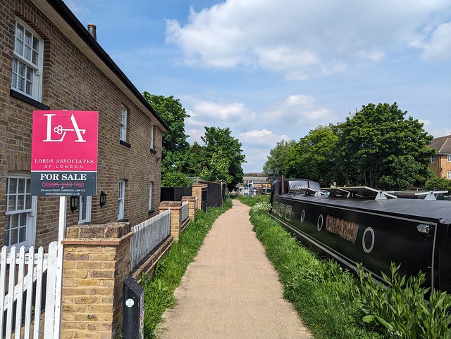
Eventually I had to leave this bucolic scene behind, curving away from the riverside to join Longbridge Way, crossing Cowley Mill Road, and going down Culvert Way to meet the Grand Union Canal again on the outskirts of Uxbridge. I turned left onto the towpath by a house that was up for sale, out of curiosity I later looked up what a 3 bedroom, 2 bathroom canalside property might fetch in Uxbridge and at a guide price of fifty quid short of £800k I decided I wouldn’t want every bugger walking right past my front door 😀
From here it was all along the towpath to the end of Section 11, with lots of interesting boats and a bridge with a built-in defensive Pillbox until just past some big steel and glass buildings on the far bank I got to Bridge 185 where the Oxford Road crosses the canal and which marks the end of Section 11.

Section 11 ✔︎
Just the other side of the bridge lies the Swan & Bottle pub, with a waterside garden (because we’ve met up with the River Colne again) where it would have been rude not to stop and sit with a nice pint of Yardbird and consider my next steps. It was still sunny, it was only twenty past one, Section 12 beckoned...

No comments:
Post a Comment