Showing posts with label LondonLOOP. Show all posts

Monday, 17 June 2024

London Loop Section 13

Harefield West to Moor Park
 
A bit of a spur of the moment thing since the forecast was mostly dry. Parked at Hounslow West and got a bus to Uxbridge then a second one to the turning loop at Harefield West where I’d last been back in the middle of May. A short walk down the road to Summerhouse Lane and turn right to begin Section 13. Unlike the sections I’ve done so far this one is hillier and soon begins a long climb up into and through Park Wood. The path is largely fenced in but at some time the fence line must have been different because just off to one side there’s a random set of isolated cast iron gateposts.
 
 London LOOP Section 13, iron gateposts, Park Wood, West Harefield
 
 I carried on past Old Park Wood Nature Reserve, the meadows opening up on the left and then the allotments emerging onto Hill End Road. A left then right past houses and then over a stile where the terrain opened out and the path went onward across undulating fields in a most un-London like manner. It was quiet and rural following the field hedge boundaries and between each field a stile, footbridge, or a combination of the two.
 
 London LOOP Section 13, Foxgloves & Stile
 
 Crossing the border from Middlesex (I’m old enough to have been born in the County of Middlesex & for me it still exists) into Hertfordshire I passed some large farm buildings and could see a Police van parked at the far end of the track ahead. A peeling painted sign on the side of a big shed said “Police Animal Training Centre” and the signs on the paddock fences warned that “These horses will bite and kick”. Presumably if they kick you  they’ll claim that you fell down the stairs guv’ 😉
 
By the gateway the Loop turns right behind the Police van, an abandoned looking old Vauxhall Vivaro, running along the field edge parallel to the road and emerging into the car park of the Rose & Crown which looked like a nice pub but it was too early. I crossed the road and found the entrance to the tightly fenced-in footpath which led up Woodcock Hill into open fields heading towards the Nine Of Hearts Golf Course. 
 
 London LOOP Section 13, Woodcock Hill
 
 There are a lot of golf courses around here but before getting as far as the Nine of Hearts the Loop turns right into the trees onto a permissive bridleway, churned up at this point by many horses turning around since they aren’t permitted to go out into the meadow I’d just crossed. A bit of an odd equine dead end. A wide clear path leads into Bishops Wood and oh good, a bench on which to stop and eat my picnic lunch. Indeed the first place I’d come across to sit down since I got off the bus. Not much of a view though, just trees.
 
 London LOOP Section 13, a welcome seat, Bishops Wood
 
 Carrying on after a brief lunch stop I almost missed the sign where the Loop does a sharp left off the wide obvious track and heads off alongside a stream and starts weaving through the woods, fortunately quite well waymarked. In places the path has been well churned up by the horsey girls and I was glad that the recent weather hadn’t been as wet as earlier in the summer.
 
 London LOOP Section 13, where the horses have been, Bishops Wood
 
 The woods eventually opened out and I passed under the electricity pylons to reach the A404 at Betchworth Heath. The Loop turns right and follows the busy road past the Prince of Wales pub (not recommended for walkers says the route guide, I feel there must be a tale behind that) and then by the white Coal Tax Post you take your life in your hands and cross the A404 to the footpath leading into the woods the other side. It’s a sketchy place to be crossing a main road, the sight lines are not good 😟
 
 London LOOP Section 13, Coal Tax post, Batchworth Heath
 
 About a hundred yards in I met my first real obstacle, a tree fallen across the path. Not a huge tree but no way to go around it, too high to step over it, and too low to duck under it unless you’ve legs like a dachshund or are a champion limbo-dancer. I don’t qualify on either count and only by sending my rucksack through first did I manage to squeeze under without getting muddy knees. 
 
 London LOOP Section 13, awkward branch at Batchworth Heath
 
 Once past that obstacle it was easy going on sometimes grassy paths in and out of the trees until popping out between a fence and a wall into Kewferry Road, turn left, cross Batchworth Lane and join the very private Bedford Road into the very private indeed Moor Park Estate. Six square miles of gated, private residential roads with large expensive houses tucked away behind trees and hedges and gates and CCTV cameras. Lots of CCTV cameras. And restriction signs, and LED signs. You can almost smell the money and rather get the feeling you’re only allowed there under sufferance. Still, London Loop Section 13 goes straight up Bedford Road before turning right down an alleyway between high fences , so sod ‘em. 
 
 London LOOP Section 13, Moor Park Estate
 
 I risked taking one photo then passed underneath the Metropolitan Line to find the metal barrier and fingerpost that marks the end of Section 13. Straight on to go to Moor Park Station or bear right to continue onto Section 14 to Hatch End. I bore right but that’s another blog post to come.
 
Still, London Loop Section 13 ✔︎
 
 
 London LOOP Section 13


Sunday, 2 June 2024

London Loop Section 9

June 1st

I got up early to do section 9 as the forecast was warm and sunny and I wanted to avoid the hottest part of the day. As it turned out the forecast was wrong, it was mostly cloudy but dry and with a cool breeze. Ideal really for walking ten miles. I got a bus, a train, and another train to Hampton Wick and made my way down to where the section starts near Kingston Bridge.
 
Kingston Bridge to Hatton Cross
 
The first bit from the bridge is just a bit of road walking but only a few hundred yards and through the metal gate into Church Grove Passage which leads into Bushy Park. Section 9 leads right the way across Bushy Park to Teddington and this is probably the nicest bit of the section, starting with traversing an open meadow that’s Skylark central so you are accompanied by their singing as you walk.
 
 London LOOP Section 9, entering Bushy Park
 
It’s also the busiest bit of section 9 especially today as it’s Bushy parkrun day and this corner is full of energetic, colourful people of every size and shape running, jogging, or plodding the main paths near Heron Pond. Now the “musical” accompaniment was someone rhythmically bashing what sounded like an old saucepan and yelling encouragement to the flagging parkrunners. I preferred the Skylarks.
 
 I timed my crossing of the sweaty stream of bodies crowding the main path, passed the pond and carried on across Chestnut Avenue, carefully as the lycra-louts were out in peloton-style force, and on to the area called The Pheasantry Plantation, where I spotted an interloping heron.
 
 London LOOP Section 9, misplaced Heron at The Pheasantry Plantation, Bushy Park.
 
 I suppose he should have been at Heron Pond but perhaps he didn’t appreciate the saucepan player either. I was now into the Woodland Gardens where there was a welcome loo by the cafe. Dogs aren’t allowed in here so there’s an alternative route for loopers with dogs. The people just in front of me decided No Dogs Allowed didn’t apply if you picked it up and carried it through to the car park beyond 🙄
 
The path here wiggles its way through the gardens, under the trees and near the water and the birdsong here is mainly provided by London’s resident Ring Necked Parakeets, occasionally glimpsed in the canopy above. So for birdsong read loud, penetrating screeches 😀 Passing through two gates I entered the next, less busy part of the gardens, too late in the season for daffodils however.
 
 London LOOP Section 9, in The Waterhouse Plantation, Bushy Park.
 
 I followed the path out of the gardens, through the trees past a pond to Cobblers Walk and then right and left to the wide open space where the deer roam, and along by the Longford River where indeed the deer were roaming. Well largely they were lying in the long grass pretending no one could see them.
 
 London LOOP Section 9, No one can see us, right? Bushy Park deer.
 
Or trimming the lower branches of the trees to an impressive horizontal line at maximum deer-tongue height.
 
 London LOOP Section 9, Bushy Park deer.
 
 I passed out of the park through the large metal gate designed to keep deer in and traffic out and for the next quite a while it was back to pounding the pavements. Hampton Road, King’s Road, Connaught Road, Burton’s Road, over the railway to Shepperton and past Fulwell golf course to the busy Uxbridge Road. Then thankfully through a gate into more green space. Slightly muddy green space with a rough overgrown games pitch containing one set of miniature goalposts made from flaking blue-painted steel tubing. The day was warming up a bit and it was time to take off my long sleeved top. Squeezed down the alley between the golf centre car park and the sports centre car park and through a woodland to Staines Road. Back onto suburban streets again for a while.
 
At Hospital Bridge Road I crossed the River Crane and turned into Crane Park, under the very low subway under Great Chertsey Road, and follow the River Crane for a while, along muddy paths past the remains of the old gunpowder works, or the earthen banks that surrounded them at least. If you can spot them that is. I think this is them behind the wild Lime Bike.
 
 London LOOP Section 9, wild Lime, Crane Park.
 
 A bit easier to spot, although not from the direction I was was walking, is the "Shot Tower”. The last remaining building from Hounslow Gunpowder Mills and thought to be used to make musket balls by dropping molten lead from a great height into cold water. Except it might not have been. It was quite likely a windmill, there are millstones next to it and gunpowder was milled in a similar fashion to flour but with larger bangs if things went awry. The door was open but I didn’t have time go and climb the tower today. Ian visited earlier this year though and you can read more about the tower here.
 
 London LOOP Section 9, The Shot Tower, Crane Park.
 
 I carried on through Crane Park and out onto the Hanworth Road where I was able to pick up something to eat at the shops, which I’d forgotten to do in Hampton Wick, for lunchtime was approaching. As was Hounslow Heath. Up Hanworth Road past the cemetery with it’s boarded up chapel, over the Waterloo to Reading railway, and left through a recreation ground, through a strip of woodland, out of the Borough of Richmond and into that of Hounslow. Up onto Hounslow Heath, a nature reserve now the haunt of Adders (see warning notices) but no longer of Highwaymen (at least, there are no warning notices). Sit on a bench to picnic on felafel wrap and watch the jets pass overhead.
 
 London LOOP Section 9, on Hounslow Heath.
 
 Those planes will feature prominently on the rest of this walk as it passes under the flight path of Heathrow’s southern runway (27L), at times they will be only 300 feet above and I was taken back to my schooldays at Springwell where lessons were punctuated by pauses every few minutes to allow them to pass until the teacher could be heard again. Also to my childhood back garden where in the summer (which of course was always sunny back then) you could see a line of as many as 5 planes coming in to land, two going away from you, one directly above, and the lights of two more approaching you. When the Boeing 747 came in it was so much bigger than the others it almost looked as if the wheels would touch the chimney pots. I digress. Back to Section 9.
 
The path takes a zig-zag route off the heath through woods and along brambly, narrow paths along a gully next to a high bank, over a footbridge and eventually to the River Crane again. I had to reference the directions and check against GPS on the phone quite a bit to follow this section. Crossing over the Crane I turned left and followed it along its southern bank through Brazil Mill Woods, where there is occasionally what looks like evidence of former industrial use of the river.
 
 London LOOP Section 9, River Crane, Brazil Mill Woods.
 
It should be hard to take a wrong turn while following a river but I still managed to come out on a street unexpectedly and had to retrace my steps 50 yards to regain the correct route 🙄 eventually bringing me to Staines Road, crossing it by a clothing donation container wrapped in hazard tape and “Environmental Crime Scene” notices. No idea, there weren’t any details. I crossed over in a break in the traffic and entered Donkey Wood for the final stretch. Through Donkey Wood the route still follows the River Crane but along one of its marshier stretches so there are a number of little footbridges and a long section of boardwalk, the boards made of recycled plastic but firmly supported, unlike a stretch near home which is disturbingly bouncy. Passing under a road bridge and then up some steps onto it, it was immediately clear that I was now standing directly under the runway 27L flightpath 🙆 I crossed the river, turned left through the gap in the fence and along Causeway Walk through the woods with the River Crane on my left until I came out on the A30 Great South West Road where section 9 ends, opposite the start of Section 10 where I’d been back on April 19th, although the impenetrable barrier of the Great South West Road means that’s nearly a mile away on foot.
 
 London LOOP Section 9, British Airways East Base, Heathrow.
 
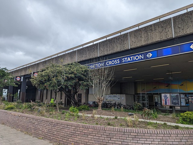
 I turned right and walked to Hatton Cross Station, got the tube to Heathrow Terminal 5 and two buses and an hour and three quarters later was home with the kettle on.
 
London Loop Section 9 ✔︎
 
 
The Inner London Ramblers guide to Section 9 (PDF) is here.


Tuesday, 14 May 2024

London Loop Section 12

May 10th

It’s a little after lunchtime and I’m sitting by the River Colne in an Uxbridge pub garden having walked about four and a half miles from West Drayton to complete Section 11 of the London Loop. The weather’s nice. I have beer. I have a choice, I can call it here and get a bus back to West Drayton and the train home in time for tea or I can carry on and do Section 12. It’s only another 5.3 miles, that should be OK even for a fat old bloke, right? I check the public transport options to get back, they’re a bit vague but it’s Londonish so something should work out. Finish beer, have a pee, return to the canal towpath...
 
Uxbridge to Harefield West
 
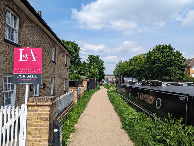
Most of this section follows the Grand Union Canal main line and before long I’m at Uxbridge Lock where I cross the canal on the turnover bridge, a brick built bridge designed with ramps so that horses towing the boats could cross from one side to the other without having to be unhitched. I noted that the lock keeper’s house is for sale and although this one has 4 bedrooms, 3 bathrooms, and the same guide price £799,950 my previous comment about having everyone and his dog trekking past your front door applies here too.
 
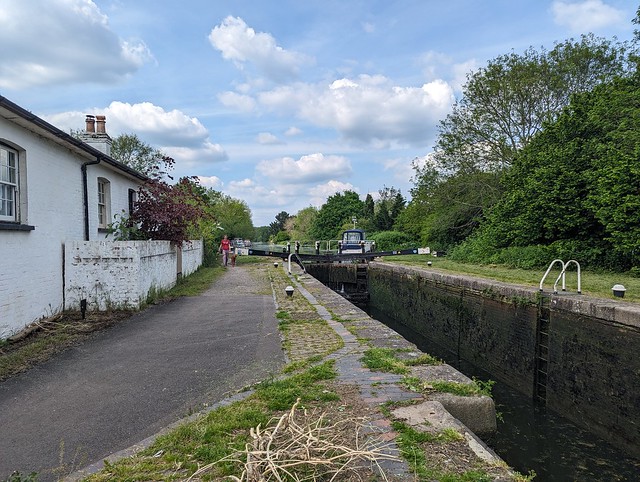
 London LOOP Section 12, Grand Union Canal, Uxbridge Lock
 
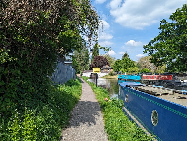
 There were plenty of boats moored along this pleasant stretch of canal although I only saw one moving. Carrying on and we’re 81 miles from Braunston and soon a branch of our old companion the River Colne joins the canal on the far side before the canal passes under the A40 Western Avenue, just before it becomes the M40 motorway. Both will eventually take you to Birmingham but one is a bit quicker than the other. At Bridge 183 I recrossed the canal and saw a boat that sadly wasn’t going anywhere soon.
 
 London LOOP Section 12, sunken boat, Grand Union Canal north of Western Avenue
 
 Again I could see glimpses of the River Colne off to the left running parallel to the canal and the trees along this section gave welcome shade. I’d noticed earlier a couple of  orange ships’ or maybe oil rig lifeboats converted to houseboats and here were two more. I’m not sure how practical it is to move these particularly through locks, or even if they do move given that one looked to have a look of permanency about its mooring, as well as more fenders than would seem necessary.
 
 London LOOP Section 12, canal boat variety
 
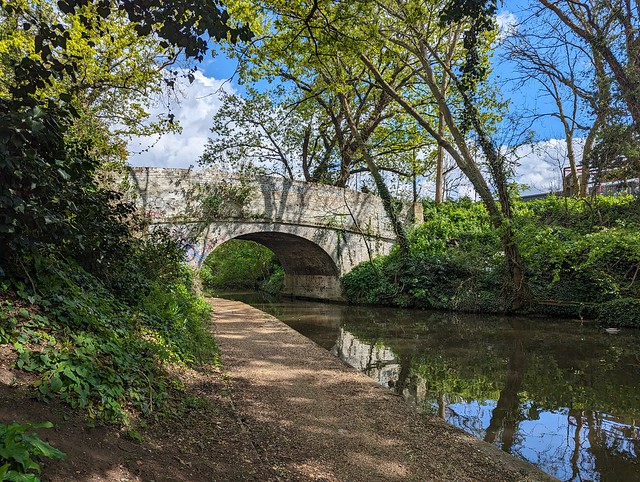
 At Denham Deep Lock the guide says the lock cottage is the beautifully set Fran’s Tea Garden. It was shut so I didn’t linger but carried on to Bridge 182. The bridge and lock numbers go down as you travel away from London since the canal was built from the midlands to London. This is the opposite to what you might expect, we’re used to roads etc. numbering the other way. At Bridge 182 I crossed the canal again and turned left onto the wide path of the Colne Valley Trail between the canal and Long Lake. This tree lined track then passed under Denham Railway Viaduct which carries the Chiltern Main Line linking London Marylebone with Birmingham over the canal and a branch of the River Colne.
 
 London LOOP Section 12, Denham Railway Viaduct, Chiltern Main Line
 
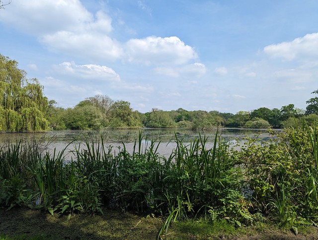
 Beyond the Denham Viaduct on the right is Harefield Lake No.2 and here I realised something that hadn’t previously occurred to me. I hadn’t made the connection between the Colne Valley and HS2 until I looked across the lake and saw the construction of the new Colne Valley Viaduct in progress. I’d seen photos but only in the “flesh” is the scale of this fabulous piece of civil engineering apparent.
 
 London LOOP Section 12, Colne Valley Viaduct (HS2)
 
 What a shame that due to short-sighted government it might never realize its full potential, at least not in any timescale I’m likely to see 🙁
At the end of the lake the Loop passes under the completed section of the viaduct deck on temporary pontoons around one of the supports so you get a fairly close up look at the structure and I don’t care what anyone says, it’s pretty cool. Oh and you have to press the button and wait for a green light before proceeding under the viaduct, which felt a little odd.
 
 London LOOP Section 12, Colne Valley Viaduct (HS2)
 
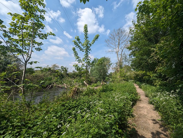
 Beyond the lakes and Harefield Marina the way follows a wide track and then winds through the woods. The guide and the way marks aren’t particularly clear on this part and I had to resort to GPS to ensure I was on the right path to eventually emerge onto Moorhall Road. Left here and up over a bridge and down some sketchy steps through the nettles and fly-tipped rubbish to join the Grand Union Canal again. Back on the towpath and beginning to question my life choices but now determined to complete Section 12 today I passed by Widewater Lock.
 
 London LOOP Section 12, Widewater Lock, Grand Union Canal
 
 Then under a rather decrepit bridge and onwards to Black Jack’s Lock. I can’t find anything to say who Black Jack was but Black Jack’s Mill stood between the river and canal, was apparently a location in Dr. Who and the 1964 comedy film The Bargee starring Harry H. Corbett, better known as Harold from Steptoe and Son. The Bargee  is worth looking out for if you’ve never seen it.
 
 London LOOP Section 12, Black Jacks Lock, Grand Union Canal
 
The lock was used in The Bargee as well and apparently the nearby thatched Jack’s Cottage was once the home of actress Ann Todd (The Seventh Veil) and was a filming location for Basil Brush. We’re in that area here, West London not far from several film studios. Full disclosure, I gleaned the above information from the blog Edith’s Streets which I’ve just bookmarked as a future time sink 🙂
 
I continued along the towpath over a footbridge above a rushing weir (the River Colne again) and over a high footbridge across the Troy Arm, past offices on the far side of the canal, and eventually to the Coy Carp Inn (yes, it is spelt like that) where Section 12 leaves the canal, crossing it on a narrow busy bridge with traffic lights and up a winding lane to finish at a nondescript junction with Summerhouse Lane.
 
 London LOOP Section 12, Summerhouse lane, end of Section 12.
 
Section 12 ✔︎
 
And then I went back to the Coy Carp and had what I felt was a well earned pint!
 
 London LOOP Section 12, section completion treat!
 
 While enjoying that I checked the TfL Go app for how to get back to West Drayton for the train home. It said U9 from just up the hill to New Park Rd. Harefield then cross the road and get U9 to Uxbridge and U1 from there to West Drayton Station. So I followed those instructions despite a nagging suspicion and having got off the first bus I then rejoined it on the other side of the road a few minutes later, albeit it was now much fuller having been to the hospital in the meantime. The driver gave me a funny look, I just rolled my eyes and said “TfL Go app”. Fortunately Uncle Sadiq’s Hopper Fare meant this pointless exercise didn’t cost any extra, all three buses were covered by a single journey charge.
 
I arrived home a bit after 8pm, knackered but with at least some sense of achievement. Then I dozed off watching Top of the Pops on BBC4, went to bed, and completely missed the Aurora Borealis, not imagining it would be visible from my house. The photos posted on Instagram by a near-neighbour prove I was very wrong. Bugger 🙁
 
 
 London LOOP Section 12
 

London Loop Section 11 (part 2).

May 10th

 
Nice day for a walk, let’s find out what the second part of London Loop Section 11 looks like. It might have dried out by now. (Spoiler: Nope.)
I got a train to West Drayton then returned to the canal towpath under bridge 192 and headed north past the large Tesco supermarket and under a couple of bridges to reach the junction with the Slough Arm of the Grand Union Canal. Crossing over the main line of the canal on a black metal footbridge to the Slough Arm towpath.
 
 London LOOP Section 11, Grand Union Canal, Slough Arm
 
 This canal was the last canal to be built in the country apart from the larger ship canals, opening in 1882 and running for five miles and servicing the local brickfields. Fortunately i didn’t have to walk the whole five miles so avoided going to Slough. I passed first the entrance to the Packet Boat Marina on the far bank, crossed the Frays River on the aqueduct, and crossed over the canal at Trout Lane. The route leaves the canal here and winds its way through the woods, eventually arriving at a gate into a small car park at the end of Packet Boat Lane. Earlier in the year this was reported as flooded, the River Colne being adjacent on the left but the puddle now was only an inch or two deep so no problem.
The other side of the car park lies Little Britain Lake, so named because it’s shaped - very vaguely - like the mainland of the British Isles. Obviously you can’t tell that from ground level.
 
 London LOOP Section 11, Little Britain Lake
 
 From here there’s a bridge over the River Colne and the Loop runs along the Buckinghamshire side of the river. Except not today. Today it runs in the river, being flooded and impassable from the bottom of the ramp down from the footbridge. I sent the Inner London Ramblers an update to confirm that Section 11 is still blocked here.
 
 London LOOP Section 11, River Colne in flood near Little Britain Lake
 
 So I retraced my steps and went along Packet Boat Lane, past the Public Toilets (the Gents was locked, disappointingly) and left up Old Mill Lane. This is the unofficial diversion route which if the Colne continues to flood in future probably ought to become official. Although Old Mill Lane is a little narrow and once past the lake there’s no footpath. It wasn’t too busy today though that might be different at the weekends or school holidays. It does pass between the River Colne and the Frays River though and at one point all that separates them is the raised road.
 
 London LOOP Section 11, Old Mill Lane, River Colne to left, Frays River to right.
 
 This lane is part of the Colne Valley Trail way marked route and I followed it until reaching Iver Lane opposite the West London Industrial Park which has a large collection of what used to be called “man lifts” but these days are usually referred to as “cherry-pickers”, or officially Mobile Elevating Work Platforms. Available in blue, red, or yellow they were an unexpected burst of colour in the bright sunshine. Turning left up Iver Lane and crossing over I rejoined the Loop where it headed off north between the industrial park and the River Colne, here thankfully keeping within its banks. With the high steel fence of the industrial park on the right this is potentially a pretty grim bit of footpath but today with the sun reflecting off the river I found myself walking through large clouds (or whatever the collective noun is) of blue Dragonflies which alleviated the scene quite a bit, even if none of them would remain still long enough to capture a photo. Once past the fence and away from the sounds of industry the way along the river was quite rural so long as you didn’t look up at the cables and towers carrying 275,000 volts between Iver and Laleham and 132,000 volts between Iver and Slough.
 
 London LOOP Section 11, River Colne near Uxbridge
 
 Eventually I had to leave this bucolic scene behind, curving away from the riverside to join Longbridge Way, crossing Cowley Mill Road, and going down Culvert Way to meet the Grand Union Canal again on the outskirts of Uxbridge. I turned left onto the towpath by a house that was up for sale, out of curiosity I later looked up what a 3 bedroom, 2 bathroom canalside property might fetch in Uxbridge and at a guide price of fifty quid short of £800k I decided I wouldn’t want every bugger walking right past my front door 😀
 
 London LOOP Section 11, Grand Union Canal, Culvert lane, Uxbridge
 
 From here it was all along the towpath to the end of Section 11, with lots of interesting boats and a bridge with a built-in defensive Pillbox until just past some big steel and glass buildings on the far bank I got to Bridge 185 where the Oxford Road crosses the canal and which marks the end of Section 11.
 
 London LOOP Section 11, Bridge 185, Oxford Road, Uxbridge
 
 Section 11 ✔︎
 
Just the other side of the bridge lies the Swan & Bottle pub, with a waterside garden (because we’ve met up with the River Colne again) where it would have been rude not to stop and sit with a nice pint of Yardbird and consider my next steps. It was still sunny, it was only twenty past one, Section 12 beckoned...
 
 
 London LOOP Section 11


Wednesday, 24 April 2024

London Loop, Section 11 (part one).

April 19th

At the end of section 10 I could have got a train home from Hayes & Harlington station but chose to press on along Section 11 to West Drayton, a convenient point for me to both break off and to return another day to complete the section. Reports had suggested that the latter part of Section 11 might still be impassable due to flooding from the River Colne or at least if not then probably very muddy. That’s my excuse anyway. So having stopped briefly in Hayes town centre to grab a coffee and find a loo I rejoined the LOOP under Bridge 200 and headed west along the Grand Union towpath, past a cast iron milepost “Braunston 87 Miles”, and under bridges 199 and 198, past a Mallard mum with 10 (or 11, you try counting them!) very small fuzzy ducklings. Then under bridge 196 (I don’t know where 197 went) where a convenient bench presented itself on which to pause, watch a couple of boats go by, and eat the piece of home-made bread pudding I remembered I’d packed that morning.
 
 London LOOP Section 11, Bridge 196, Rigby Lane.
 
 Just before the next cast iron milepost (Braunston 86 Miles) the LOOP leaves the nice level towpath and turns right through a metal gate leading to Stockley Park. This 1980s business park, golf course, and country park is built on former brickfields and dumping ground, upon which about 140,000 new trees and shrubs were planted to create a woodland area.
 
 London LOOP Section 11, Stockley Park, an avenue of Lime trees.
 
 Across the entrance drive and alongside the golf course the route passes through an avenue of Lime trees, their spring foliage bright green, then through the edge of the business park and past the modern Golf Clubhouse where it bears right and starts to climb up past the entrance to the tenth tee and onward to the A-frame bridge across Stockley Road. About here I encountered the only other obvious “LOOPer” that day, closely and a little uncertainly following the route on his mobile phone screen.
 
 London LOOP Section 11, Stockley Road bridge.
 
 I passed ‘phone man’ on the way up the gravel track towards the viewpoint, which I diverted to up the short steep climb to the right of the path. You can see quite a way from this high point in Stockley Country Park although most of the details are obscured by tree cover. ‘Phone man’ passed by below while I was taking in the view.
 
 London LOOP Section 11, Stockley Country Park, viewpoint panorama.
 
Down from the viewpoint and back on the main path SSW across the country park and into the woodland along narrow paths partly obstructed by fallen trees until I got to the metal gate at Horton Road. Where ‘phone man’ suddenly appeared behind me so I’ve no idea which way his phone had taken him through the woods. On the other side of the road there is a choice of onward route, either following the roads or the “recommended alternative” along a new gravel path, Weston Walk, through a small park to an odd grassy mound like an Iron Age tumulus with a path around the base. I chose the latter obviously.
 
 London LOOP Section 11, Weston Walk mound.
 
 Beyond the mound a set of steps leads back down to the Grand Union towpath, to turn right to rejoin section 11 of the LOOP. Seems to be popular with afternoon joggers and pram-pushers but from here it’s straight along the canal, with the Great Western main line on the other side, under Horton Road bridge (193) towards West Drayton.
 
 London LOOP Section 11, Grand Union Canal, West Drayton.
 
 The next bridge (192) is adjacent to West Drayton railway station so that’s where I called it for the day and got the train home. I hope to be back when things have had a chance to dry out a bit on the rest of Section 11 when I’ll continue along the Grand Union and then up by the Colne to Uxbridge.
 
 
 London LOOP Section 11
 
 And I didn’t even get wet on this bit.
 

Tuesday, 23 April 2024

London LOOP, section 10.

April 19th

I want to walk the London Outer Orbital Path, usually tautologically referred to as the London Loop. This trail, nearly 150 miles long almost encircles Greater London, split into 24 sections between Erith station and Purfleet. The sections all start/finish close to public transport nodes making it really convenient if you live inside the loop. I don’t live inside the loop so it will be quite inconvenient, especially given the limited public transport options where I do live. I might never actually complete the whole thing but if I don’t start somewhere then I certainly won’t finish it. So what better place to start than the nearest bit, Section 10 from Hatton Cross to Hayes & Harlington. I downloaded the map and guides for Section 10 from the Inner London Ramblers website and picked the following Friday as the day to make a start. Yes of course that turned out to be the only day that week when rain was forecast because Sod’s Law applies. 🙄
 
Two buses and a tube got me to Hatton Cross Underground station, at which I’d never previously got on or off, so ✔︎. From there it’s a short walk alongside the A30 Great South West Road to the start of Section 10 proper by the bridge over the River Crane.
 
 London LOOP Section 10, Cranebank.
 
 This is River Crane Park and the path heads north through the woods beside the river and out into an open space and once you are away from the road it almost feels like countryside. On leaving the open space the route runs through suburban semis with double glazed windows to mitigate the sound of the jets on the flightpath overhead, streets not too dissimilar to the one on which I was born. On reaching the A4 Bath Road I crossed and turned left, at which point enough rain arrived that I had to put on my waterproof coat and then crossed back over the River Crane on the road bridge.
 
 London LOOP Section 10, Bath Road bridge over the River Crane.
 
 Shortly after which the route turned right into the next green bit, Berkeley Meadows, named after the ancient English landowning family whose name also gave us the square in which nightingales sang and the hunt from which we get the rhyming slang, "berk". Exiting the path at the north end and crossing the road carefully it’s into the woods along muddy paths alongside the Crane until reaching the large open field which is Cranford Country Park. Across which the rain was now blowing horizontally from the left 💦
 
 London LOOP Section 10, Cranford Country Park.
 
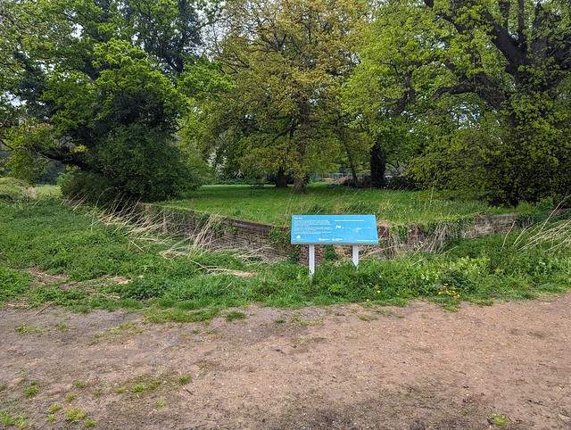
 And across which I had to walk diagonally to get to the exit after passing the Ha-Ha which separated the garden of Cranford House, one of the homes of the Earls of Berkeley (now demolished) from the open parkland. A Ha-Ha being a ditch with a vertical wall on the inner side designed to keep deer, livestock, peasants etc. out of the garden without the wall spoiling the view from the house. Ha-ha supposedly being what people said when they saw it. Or fell into it. 
 
 London LOOP Section 10, Ha-Ha, Cranford House.
 
 I was too wet to laugh at it but by the time I’d crossed the car park the sun had come out and I found a dryish bench under a large Yew in the churchyard of St. Dunstan’s Cranford on which to pause and eat my picnic sandwich. Doesn’t look like it’s right next to the M4 Motorway, does it?
 
 London LOOP Section 10, St. Dunstan's Church, Cranford.
 
 They didn’t build it next to the motorway of course because that wasn’t there when the Saxons built the first church, or in the 15th and 17th centuries when the current building was constructed. The church is locked outside of mass times so I missed seeing the memorial to the comedian Tony Hancock and the memorials to the many berks sorry, Berkeleys that lie within. Picnic consumed I crossed the cobbled (setts) yard and passed under the arch of the old stable block, then under the motorway and turned right into the wonderfully named Dog Kennel Covert, a strip of woodland through which runs the Loop, the Hillingdon Trail, and the River Crane also known here as the Yeading Brook which forms the boundary between the boroughs of Hounslow and Hillingdon. For a bit of urban edgelands it had a pretty good display of Bluebells.
 
 London LOOP Section 10, Dog Kennel Covert bluebells.
 
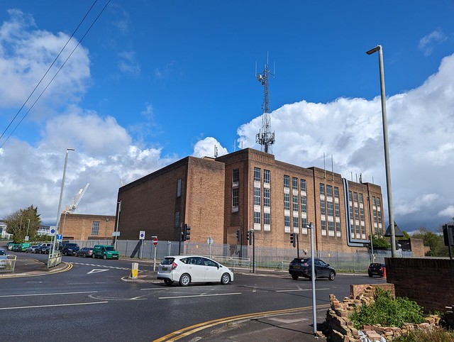
 Emerging from the park via Watersplash Lane my eye was drawn to a large art deco factory or office on North Hyde Road, topped by an incongruously large cellsite aerial tower. I can’t find any information about this building, it seems to be outside the area of the former Nestle factory site across North Hyde Gardens. Something to do with the electricity substation to its north maybe?  If you know, comment below.
 
 London LOOP Section 10, North Hyde Road, what's this building?
 
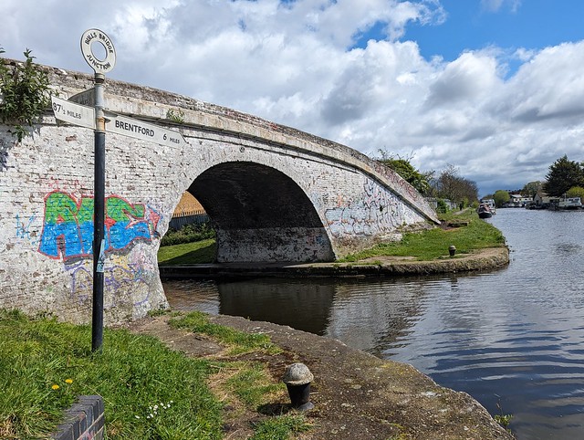
 Passing the above building and bearing round to the left and up onto the  flyover of The Parkway (A312), across the Grand Union Canal and down a long zig-zag ramp to the canal towpath and a little diversion to Bull’s Bridge Junction where the Paddington Arm joins the main Grand Union, giving London a direct link to the national canal network rather than via the Thames at Brentford. Next to the white painted brick Bull's Bridge is a finger post giving the distances to Brentford 6 miles, Paddington 13½ miles, and Braunston 87½ miles. Or it would do if some twat hadn’t snapped off half the sign pointing to Braunston. Cut off their goolies I say.
 
 London LOOP Section 10, Bull's Bridge Junction, Grand Union Canal.
 
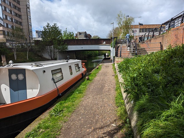
 Retracing my steps along the canal towards Braunston  and under the flyover the end of section 10 was almost in sight. Just a stroll along the towpath underneath the railway bridge carrying the Great Western main line and Crossrail Purple train Elizabeth Line then to Bridge 200, Station Road, the end of Section 10 near Hayes & Harlington Station.
 
 London LOOP Section 10, Grand Union Canal, Hayes, End of LL10.
 
 Section 10 ✔︎
 
I could have got the train home from here but the sun was out, it was only half past one, and I could manage another few miles so I continued on Section 11 to West Drayton. Post about that to follow.
 
 
 London LOOP Section 10