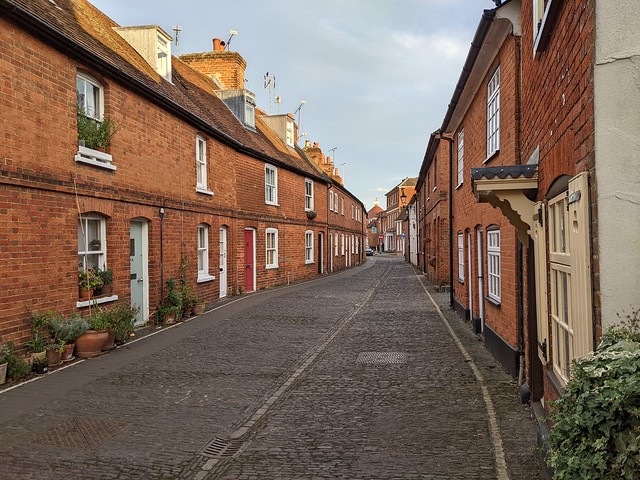
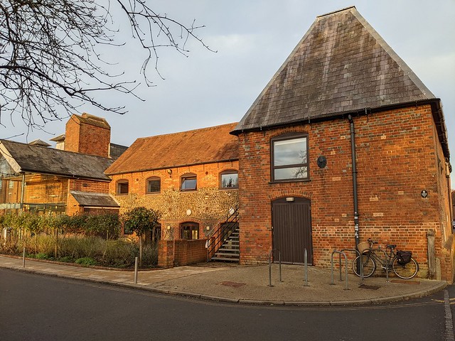
Showing posts with label Walks. Show all posts

Wednesday, 6 May 2026

Capital Ring, Crystal Palace to Balham

5th May

Capital Ring Section 4

At twenty past one I arrived at Crystal Palace station after a journey which had very much not gone as intended, ready to walk the 4.4 miles of Capital Ring Section 4. The guide describes this shorter section as a ‘rollercoaster’ among the ridges and valleys of the former Great North Wood. That sounds more bucolic than the reality but it does have its moments. First stop after leaving the station was Tesco Express to grab a cheeky meal deal then up Anerley Hill and along Playdell Avenue to Palace Square. Palace Square does not look like you would imagine from the name. Unless you are imagining two large rectangular blocks of late 20th century flats one behind the other on the side of a steep hill. I imagine that they have a very good view of Croydon from the upper storeys although whether that’s a good or bad thing I leave up to you. A steep zig zag path led from the square to a pocket park on Belvedere Road where I made a picnic of the meal deal on a bench facing some large Victorian houses and an octagonal Victorian pillar box, the latter is something you don’t see often, the former would be a major feature of today’s walk.

Capital Ring Section 4, Octagonal Victorian pillar box, Belvedere Road.

Climbing further up Belvedere Road I passed the former home of Benjamin Waterhouse-Hawkins, creator of the famous Crystal Palace dinosaurs and paused at the top to turn around and admire the view over Kent - and not just to get my breath back honestly. A couple more streets of big houses brought me to the A212 Church Road over which I crossed into Westow Park, the first piece of greenery of any size so far.

Capital Ring Section 4, Westow Park.

Having walked the length of Westow Park and exited at the west end it was only another couple of minutes before I got to the wide open space of Upper Norwood Recreation Ground. The Ring first follows the north side of the open space adjacent to Chevening road before cutting straight across and then turning right to follow Eversley Road along the south side. Which was also downwind so benefited from a strong scent of weed on the breeze. This brought me to Hermitage Road where I ascended what whoever wrote the guide refers to as a “gentle rise” and I assume that is an attempt at humour since it’s steeper than that term would suggest. That it brings you out on top of Beulah Hill is a bit of a clue. There’s a stinkpipe opposite on Beulah Hill so I claim my two points then turn left and walk along Beulah Hill which is a typical South London suburbia main road.

Capital Ring Section 4, suburbia, Beulah Hill.

I turn down a road called Biggin Hill which drops steeply, with views all the way across the North Downs before it loses height and the Ring turns right down a footpath to Biggin Woods. Biggin Woods (or Biggin Wood depending on which map you look at) is a remnant of the Great North Wood, an ancient oak woodland which once covered a huge area between the Thames at Deptford and Croydon. I bet that it didn’t have large numbers of Ring Necked Parakeets back then though.

Capital Ring Section 4, Ring-necked Parakeet, Biggin Wood.

I followed the undulating Covington Way across a couple of ridges to find the gate at the bottom corner of Norwood Grove. Norwood Grove is probably the highlight of section 4, which climbs up the hill through the parkland to the white painted Grade II listed mansion, built in the 1840s for Arthur Anderson, joint founder of the P&O steam Navigation Company.

Capital Ring Section 4, Norwood Grove.

Approaching the house the Ring actually passes through a metal rose arch, already carrying a lot of large yellow blooms. This does give you the feeling that you’re walking through someone’s garden though the house is now owned by Croydon Council and used as an education centre. As I passed around the house a group of small children were being asked to pronounce “precipitation” with varying amounts of success. I was just glad that there wasn’t any. A blue plaque on the wall records that it was from 1878 to 1913 the home of Mr. and Mrs. Frederick Nettlefold, Frederick being the chairman of the fixings maker Guest, Keen, and Nettlefolds. Which is the former name of the automotive and aerospace components business GKN Ltd. Nope, I had to look him up 😀

Leaving the house along Copgate Path I passed from the London Borough of Croydon to the London Borough of Lambeth and into the eastern end of Streatham Common. I took a short detour around the Rookery Gardens, which is a maze of small paths through formal gardens. Returning to the Ring I headed west around Streatham Common South (having gratefully taken advantage of the “facilities” behind the Rookery Cafe) and then across the common to Streatham High Road.

Capital Ring Section 4, Streatham Common.

Crossing the High Road in front of the War Memorial I walked down the long, straight, villa lined Lewin Road to arrive at the end of Section 4 at a nondescript road junction in front of the railway.

Capital Ring Section 4 Finish, Estreham Road, Streatham.

It was half past three.

45 Photos on Flickr from Capital Ring section 4 (opens in a new page)

But wait, there’s more...

Capital Ring Section 5

It was only half past three.

So plenty of time to continue on the Ring for another two and a half miles to Balham. And why wouldn’t you? It is famously  The Gateway to the South! ðŸ˜ƒ

I turned right alongside the railway and then left along Potter’s Lane, a narrow alleyway through an arched tunnel underneath the railway. Where this met Conyer’s Road I turned left past the Streatham Pumping Station, a late nineteenth century waterworks building which could at first glance be mistaken for a mosque with its domes, minarets and fancy windows.

Capital Ring Section 5, Streatham Pumping Station.

From the pumping station it was a straight walk north along residential streets parallel to the Brighton Main Line railway, crossing Mitcham Lane and continuing north on Riggindale Road to reach Tooting Bec Road, turning left to cross the railway and then crossing the busy road to reach Tooting Bec Common near the entrance to the Lido.

Capital Ring Section 5, Tooting Bec Road.

The Ring cuts across the eastern half of Tooting Bec Common between the sports pitches and the pond - though that’s hidden in the trees - on a tarmac path lined with mature trees and pink-flowering Hawthorn. Just before the path reached Bedford Hill I spotted the cafe and threaded my way through the dog walkers and yummy mummies for a coffee break and a sit down at a table outside.

Capital Ring Section 5, Tooting Bec Common.

Re-caffeinated I carried on across Bedford Hill onto a path along the edge of the northern part of the common but only for two hundred yards before the Ring took me left down an alley to rejoin leafy suburbia in Fontenoy Road. This was a classic Capital Ring pointless loop to avoid a short stretch of main road and soon I was back at Bedford Hill only half the distance away that I’d actually walked from the point I’d crossed it. Still, nice Wisteria.

Capital Ring Section 5, leafy suburbia, Fontenoy Rd. Balham.

After crossing Bedford Hill I walked a dog leg route along streets of large Victorian villas to Elmfield Road. On the corner of Cheriton Square I spotted a tall round steel column standing in the footway with a conical cap. I reckon that’s a modern stinkpipe so I’m claiming another two points.

Elmfield Road emerged onto the very busy Balham High Road opposite Du Cane Court, a 1937 Art Deco apartment block the rather plain exterior of which hides some of the most elegant flats in South London. When built it was the largest privately owned block of flats in Europe, has been home to many celebrities including the comedian and Fulham FC supporter Tommy Trinder and was allegedly planned to be used by high ranking Nazi officers in the event of a successful German invasion. It’s said that because of this it was spared bombing by the Luftwaffe but given the (lack of) accuracy of 1940s aerial bombing that’s probably bollocks and the residents were indeed just ‘lucky people’.

Capital Ring Section 5, Du Cane Court, Balham High Road.

I continued up Balham High Road but where the Ring turned left onto Balham Park Road I carried on to the centre of Balham, the rest of Section 5 will wait for another day, I needed beer which I found at the Regent, a pub in Chestnut Grove. Having refreshed myself with Hobgoblin and my phone with a handy socket outlet I decided to avoid the rush hour tube and instead took a gentle stroll up the High Road to Clapham Common, saw some cute chicks by the Long Pond, and then got the tube from Clapham Common Station instead.

20 Photos (so far) from Capital Ring Section 5 on Flickr (opens in a new page)


Slideshow for section 4 if your viewer supports it.

 Capital Ring Section 4

Slideshow for section 5 if your viewer supports it.

 Capital Ring Section 5

Tuesday, 15 July 2025

London Loop Section 20, Chigwell to Havering-Atte-Bower

10th July

You’d have to be slightly unhinged to go hiking when the temperature was forecast to reach 29° C, wouldn’t you?

So a week after completing Section 19 I was back at Chigwell Station to carry on along Section 20. I wasn’t the only hiker out but they must have been going somewhere else since I didn’t see any of them on the trail.

London Loop Section 20, St. Mary's Chigwell.

I walked up High Road to rejoin the Loop at the junction with Chigwell Rise and carried on northward past St. Mary’s Church before turning right up an alleyway on a footpath signposted as Epping Forest Countrycare walk. This came out on Vicarage Lane, which I crossed and went through the gap opposite, climbed over two fallen trees and walked through a scruffy bit of woodland to find a Loop waymark and a realization that it would have been easier to have carried on up Vicarage Lane and turned left up a much clearer footpath. Here I turned left through a small open field then through a gap to follow the path along the edge of a field of wheat about ready to harvest.

London Loop Section 20, ready to harvest, Old Farm, Chigwell.

OpenStreetMap showed the Loop going diagonally right through this crop but there definitely isn’t a footpath there so I’ve edited it to show the correct route as per the guide directions. Which say continue to a meeting of several paths near Old Farm then turn right down a track and then left onto a green lane. This led gently uphill around two sides of another field of ripe wheat to cross the Chigwell Brook. You wouldn’t know you were crossing a brook unless you checked the map though, it seems to be partly culverted and the ditch by the hedge was dry. At the end of a hedge I bore left to follow the footpath across the next field. Which had been ploughed up.

London Loop Section 20, ploughed up footpath, Chigwell.

Too much trouble to run a tractor wheel across to make a path obviously. Just keep filling in the forms for the tax handouts and complaining about townies coming into the countryside. I made it across but it was treacherous to walk on and twice I almost turned an ankle. Also it was getting quite hot. On the far side I joined the path along the outside fence of the Chigwell Water Treatment Works. A path goes left off the drive to the water works, behind some unseen houses then left at what was a stile into a paddock, under some trees to a gate and through part of the garden of the house on the left then past another stile (the stile-free alternative route in the Loop guide seems currently to be unnecessary) to go between fence and trees to eventually reach Chapel Lane.

London Loop Section 20, Victorian chapel, Chigwell Row.

At the end of Chapel lane I paused to look at the Victorian chapel before crossing over Lambourne Road and turning left then right through the recreation ground to the edge of Chigwell Row Wood. The route turns right after a short distance into the wood over a small wooden bridge. Or in this case beside a small wooden bridge because a sizeable working party, complete with roadworks signs, were rebuilding it. Fortunately the ditch which it spans was completely dry. I met other members of the working party clearing undergrowth and tidying up as I made my way through the wood to emerge at the A1112 Romford Road dual-carriageway. There is no pedestrian crossing here, you just have to take your chances crossing first the northbound two lanes to the broad central reservation then the same for the southbound. Once across I found the squeeze stile and entered Hainault Forest Country Park. Follow the path through scrub. Bear right on reaching a more open area by an isolated oak tree. says the Loop guide. This might be easier to follow at a different time of year but with several overgrown paths leading into, if not necessarily out of, the scrub I couldn’t say for sure if I took the right one(s). The one I did take at least passed a fallen log under a fairly shady tree (did I mention it was hot?) and so there I stopped to eat my picnic lunch, accompanied by the calls of Chiffchaffs and Blue Tits.
London Loop Section 20, picnic lunch time, Hainault Forest

After lunch I carried on through the wooded part of the country park until I reached the Boating Lake, which appeared to be free of boats but not of Canada Geese who all chose that moment to get out and walk across my path while giving me funny looks. Being in the middle of a flock of geese is a little intimidating.

London Loop Section 20, goose stepping, Hainault Country Park

The section through the country park is a bit short of Loop waymarks and having followed the track uphill along the edge of the woods and looking back for a distant view of that London in the heat haze.

London Loop Section 20, view of that London from Hainault Forest

I inevitably then took the wrong left turn through the woods, eventually doubling back at the top of the hill to find the entrance to the golf course on my left rather than right.

I crossed the fairway noticing a huge column of thick black smoke far to the south and followed the path along the length of the narrow strip of woodland called Mile Long Plantation. There are a few Loop markers through here along with yellow paint marks on the trees to mark the footpath - although there’s no consistency as to which side of the path the painted trees are which is erm, helpful. Before crossing the final fairway and leaving the golf course I had a rest on a bench beneath a tree. Diagonally across the next field and then by field edge paths I came out on a metalled track that led through Lower Park Farm and its barking dogs and left onto another farm track, crossing the River Rom and heading up a long slope.

London Loop Section 20, crossing the River Rom, Lower Park Farm, Havering

The way ahead continued to rise steadily, turning left at Clockhouse Lane with more views of London and then into the woods of Havering Country Park. The way through the woods lies along Wellingtonia Avenue, with Giant Sequoia tress either side which were planted in the 19th century so not quite as giant as Giant Sequoias can get. Although it was partially shaded in the woods there wasn’t a breath of wind so the long slog up the slope was hard going in the afternoon heat. Eventually the path levelled out and left the country park, passing St. John the Evangelist church and somewhat bizarrely Den’s Nosh Burger Van (open Thurs - Sun 0930-1600) with its very welcome cold drinks fridge. I bought a bottle of Iced Tea and went and hid in the shade behind the bus stop while I waited for the 375 to Romford.

London Loop Section 20, waiting for a No.375 bus, The Green, Havering-Atte-Bower

London Loop Section 20 tick.

If any of the embedded photos in this post fail to display it will be due to Flickr’s increasing unreliability. At the time of writing even I can’t see them. Apparently they are aware of the problem and have added my account to the list of those affected. Here’s a link to the FlickrAlbum for Section 20 but whether you’ll be able to see it is anyone’s guess.

London Loop Section 20

Here's an alternative link to the album on Google Photos just in case Flickr remains broken.

Sunday, 7 July 2024

Footpath 47

 I had a bit of time on my hands so I took a random ride out to Barking Riverside to see if it had changed much since my previous visit in August 2022 not long after the new station opened. Back then it was very much a building site.

Barking Riverside

 Now? Still a building site really, a bit tidier but not a lot going on on a Friday afternoon.

Barking Riverside Station

The area outside the river side of the station is a bit more finished and there's a horse box, which I assume dispenses coffee at some unspecified times but it wasn't open. I took a stroll down to the riverboat pier again but this time it was chained shut it being about 4 p.m. and there being no boats between 11:35 and 17:12 on a weekday.

Barking Riverside Pier

So no escape that way. Not wanting to get straight back on the train I looked for something else to do and found Footpath 47 signposted from the "esplanade" near the pier. It's not a long walk, roughly a mile, but it takes you along the river side eastwards along what is currently a grassy bank with a large open space fenced off on the landward side which no doubt one day will be covered in blocks of identikit flats. Best make the most of this prime outdoor facility while it's here then. 

The Thames is around half a mile wide here giving a view over to Cross Ness and the water works which I visited in 2019 and more prominently the white and blue Belvedere Incinerator at the Riverside Resource Recovery Energy from Waste Facility, turning London's rubbish into power.

Footpath 47, looking towards Cross Ness

There was a fairly strong south-westerly breeze coming across the river, bending the long grass and short, scrubby trees on the riverbank but not disturbing the birds feeding on the exposed mudflats below - although they did all take care to keep their heads pointing into the wind.

Footpath 47, seabirds on the mud


Looking back past Barking Riverside Pier the horizon was studded with south east London towers and the cranes at the new Barking Riverside developments.

Footpath 47, looking back from Horseshoe Corner

Intermittently aircraft bound for London City Airport made their way westwards following the Thames. Despite which it feels quite remote out here and is fairly quiet. I'm sure that will change as the flats and houses get closer.

Footpath 47, Lufthansa to London City

After half a mile or so Footpath 47 reaches Horseshoe Corner where it turns inland to follow The Gores stream from its confluence with the Thames up a short valley with reed beds in the bottom to come out on Choats Road. The far side of The Gores is very different to the Footpath 47 side for here are the industrial estates of Dagenham Docks, with an aggregate plant blocking any further Thames side progress.

Footpath 47, art thing, Horseshoe Corner

Over a high bank and a fence on the left of the path I could just make out ground works beginning on what The Masterplan for Barking Riverside describes as The Village – On The Horizon. With plenty of family homes and located close to the local schools and shops, The Village is an ideal neighbourhood to raise a family. The area also benefits from plenty of green spaces and long views over the River Thames.

Which is a good example of what Diamond Geezer refers to as "bolx".

Footpath 47, The Gores & Dagenham Docks Biogas

The stretch of path from Horseshoe Corner to Choats Road starts out quite flowery with a lot of what Google Lens tells me is Goat's Rue and finishes very littery at the point where you squeeze out between substantial chunks of metal embedded into the ground, there to prevent the entry of motorbikes I suppose.

Footpath 47, Goat's Rue, The Gores.

I squeezed out, turned left and walked down to the bus stop by the BRL Infrastructure Office where I caught the EL2 to Barking Station.

I can now say I've walked the remote Footpath 47 while it's still (relatively) remote and if you're anywhere nearby you should too, although to be honest it's not worth a special trip form afar.

I've put some more photos on Flickr

Footpath 47

Monday, 17 June 2024

London Loop Section 13

Harefield West to Moor Park
 
A bit of a spur of the moment thing since the forecast was mostly dry. Parked at Hounslow West and got a bus to Uxbridge then a second one to the turning loop at Harefield West where I’d last been back in the middle of May. A short walk down the road to Summerhouse Lane and turn right to begin Section 13. Unlike the sections I’ve done so far this one is hillier and soon begins a long climb up into and through Park Wood. The path is largely fenced in but at some time the fence line must have been different because just off to one side there’s a random set of isolated cast iron gateposts.
 
 London LOOP Section 13, iron gateposts, Park Wood, West Harefield
 
 I carried on past Old Park Wood Nature Reserve, the meadows opening up on the left and then the allotments emerging onto Hill End Road. A left then right past houses and then over a stile where the terrain opened out and the path went onward across undulating fields in a most un-London like manner. It was quiet and rural following the field hedge boundaries and between each field a stile, footbridge, or a combination of the two.
 
 London LOOP Section 13, Foxgloves & Stile
 
 Crossing the border from Middlesex (I’m old enough to have been born in the County of Middlesex & for me it still exists) into Hertfordshire I passed some large farm buildings and could see a Police van parked at the far end of the track ahead. A peeling painted sign on the side of a big shed said “Police Animal Training Centre” and the signs on the paddock fences warned that “These horses will bite and kick”. Presumably if they kick you  they’ll claim that you fell down the stairs guv’ 😉
 
By the gateway the Loop turns right behind the Police van, an abandoned looking old Vauxhall Vivaro, running along the field edge parallel to the road and emerging into the car park of the Rose & Crown which looked like a nice pub but it was too early. I crossed the road and found the entrance to the tightly fenced-in footpath which led up Woodcock Hill into open fields heading towards the Nine Of Hearts Golf Course. 
 
 London LOOP Section 13, Woodcock Hill
 
 There are a lot of golf courses around here but before getting as far as the Nine of Hearts the Loop turns right into the trees onto a permissive bridleway, churned up at this point by many horses turning around since they aren’t permitted to go out into the meadow I’d just crossed. A bit of an odd equine dead end. A wide clear path leads into Bishops Wood and oh good, a bench on which to stop and eat my picnic lunch. Indeed the first place I’d come across to sit down since I got off the bus. Not much of a view though, just trees.
 
 London LOOP Section 13, a welcome seat, Bishops Wood
 
 Carrying on after a brief lunch stop I almost missed the sign where the Loop does a sharp left off the wide obvious track and heads off alongside a stream and starts weaving through the woods, fortunately quite well waymarked. In places the path has been well churned up by the horsey girls and I was glad that the recent weather hadn’t been as wet as earlier in the summer.
 
 London LOOP Section 13, where the horses have been, Bishops Wood
 
 The woods eventually opened out and I passed under the electricity pylons to reach the A404 at Betchworth Heath. The Loop turns right and follows the busy road past the Prince of Wales pub (not recommended for walkers says the route guide, I feel there must be a tale behind that) and then by the white Coal Tax Post you take your life in your hands and cross the A404 to the footpath leading into the woods the other side. It’s a sketchy place to be crossing a main road, the sight lines are not good 😟
 
 London LOOP Section 13, Coal Tax post, Batchworth Heath
 
 About a hundred yards in I met my first real obstacle, a tree fallen across the path. Not a huge tree but no way to go around it, too high to step over it, and too low to duck under it unless you’ve legs like a dachshund or are a champion limbo-dancer. I don’t qualify on either count and only by sending my rucksack through first did I manage to squeeze under without getting muddy knees. 
 
 London LOOP Section 13, awkward branch at Batchworth Heath
 
 Once past that obstacle it was easy going on sometimes grassy paths in and out of the trees until popping out between a fence and a wall into Kewferry Road, turn left, cross Batchworth Lane and join the very private Bedford Road into the very private indeed Moor Park Estate. Six square miles of gated, private residential roads with large expensive houses tucked away behind trees and hedges and gates and CCTV cameras. Lots of CCTV cameras. And restriction signs, and LED signs. You can almost smell the money and rather get the feeling you’re only allowed there under sufferance. Still, London Loop Section 13 goes straight up Bedford Road before turning right down an alleyway between high fences , so sod ‘em. 
 
 London LOOP Section 13, Moor Park Estate
 
 I risked taking one photo then passed underneath the Metropolitan Line to find the metal barrier and fingerpost that marks the end of Section 13. Straight on to go to Moor Park Station or bear right to continue onto Section 14 to Hatch End. I bore right but that’s another blog post to come.
 
Still, London Loop Section 13 ✔︎
 
 
 London LOOP Section 13


Wednesday, 11 May 2022

Swan Lake Park

10th May 2022

This afternoon was the first time I'd been to "Swan Lake".

Despite having lived here 32 years and it being all of a mile and a half away along the river.

Lots of wildlife, geese, ducks, swans, coots, even a deer.

Also an awful lot of men wearing waders in little green tents.

A pleasant afternoon's ramble was had.


Thursday, 3 February 2022

Farnham, Surrey.


Wednesday 2nd February 2022

Farnham is a market town in the very western end of the county of Surrey, very close to the border with Hampshire, across which lies Aldershot. It’s about 36 miles southwest of London, from which it can be reached by train from London Waterloo or by road via the A3 and A31. Having been here since the 7th Century when the Saxons named it Fearnhamme (fern/bracken + water meadows) the town has a long history and a good collection of old buildings to look at and many interesting nooks and crannies.
 
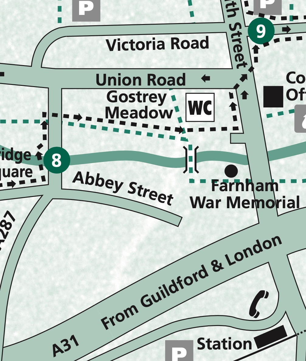
A good way to explore them is to download and follow the circular Farnham Heritage Trail published by the town council. You can also pick up a copy at the town council offices in South Street. The trail starts at the bottom of Castle Street but the cheapest (although not by much) car parks are down by the riverside so I parked there and picked up the trail at point 8. If you arrive by train then point 8 or 9 are the closest to the station too.
 
Map extract p8-9
 
 War memorial, Gostrey Meadow, Farnham.
 
An open space through which flows the River Wey and contains a children’s play area, a handy public convenience, and the town’s war memorial. On your left with the weather vane is the former Church House (now The Vineyard Church) which was built in 1909. Past the memorial emerge into South Street, cross over and turn left passing the town council offices and the Methodist Church to arrive at the Liberal Club. This was the architect Edwin Lutyens’ first public work to be built, there’s an information plaque on the building giving more details. It’s also point 9 on the trail map.
 
 The Victoria Garden, Brightwells Rd. Farnham.
 
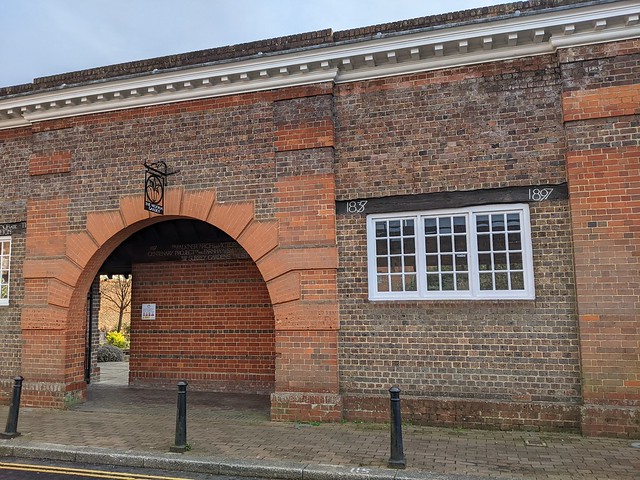
Down the side of the Liberal Club in what is either Brightwells Road or Falkner Court depending which map you look at is a large arch leading into Victoria Garden. This garden was formerly an open air swimming baths built in 1897, as attested by the lettering on the wooden lintels above the windows. Go trough the arch and in the garden you will find a wooden sign from the swimming baths advertising that bathing was mixed and at the far end a statue of a small boy in swimming trunks who looks bloody frozen! Returning to South Street and turning right will bring you to the main crossroads in the town centre. On the far side is a milestone showing the distances to London (38 miles), Bagshot (12 miles), and Alton (9 Miles). Behind the milestone is a wooden hoarding over which can be seen the top of a pile of rubble. This is the remains of the 1960s Brutalist Woolmead House complex  of shops and flats. Condemned as “ugly” and by the developer as “lacking the quality associated with Farnham and the adjoining conservation area and lacking civic presence” it was demolished in the winter of 2018/2019. Supposedly to be redeveloped but still in 2022 just a wasteland spreading dust across the town centre. Strangely there’s no reference to Woolmead House in the trail leaflet. Not all heritage is equal.
 
Heading West from the crossroads along The Borough on the left is the entrance to the courtyard of the Bush Hotel, at 500 years old it’s the town's oldest hostelry and a former coaching inn. It’s point 11 o the trail map.
 
 Courtyard of the Bush Hotel, The Borough, Farnham.
 
Further along The Borough is Borelli Yard, named for local businessman and councillor Charles Borelli whose family’s clockmakers shop was nearby in The Borough and held a Royal Warrant from Queen Victoria. This is point 12 in the trail leaflet says that the date 1610 can be seen by looking up under the archway but I was obviously not looking in the right place.
 
Borelli and local architect Harold Faulkner acted in the early 20th century to restore many of Farnham’s old buildings and had much influence over planning in the town. Looking at some of the development currently underway in the town centre I think there’s a chance both are now spinning in their graves. In Borelli Yard there is a bronze sculpture by local artist Ben Franklin called ‘Matriarch’, which I’m sure that the artist understood and a panel on the wall giving information about a medieval tile kiln which was excavated here in the 1980s.
 
Returning to The Borough and crossing the road to the corner of Castle Street brings you to point 1, the official start of the Heritage Trail. I wouldn’t have started it here as previously mentioned point 8 or 9 would be more logical for visitors but I suppose the trail was devised by locals and Castle Street is regarded as one of the town’s highlights. 
 
 Castle Street, Farnham.
 
In the middle of the road at the bottom of Castle Street between 1566 and 1866 stood the Market House and jail, see plaque on the wall of the adjacent bank. There are still market buildings here albeit not in the middle of the road and as far as I know people are not incarcerated in them now.
 
Castle Street is broad and with many historic buildings many older than they appear having gained Georgian facades. A row of Almshouses on the right were built in 1619 according to the plaque outside for “The habitation and relief of eight poor honest old impotent persons”. I assume that last is i the sense of powerless rather than unable to get it up.
 
 Almshouses, Castle Street, Farnham.
 
Carrying on past the Nelson Arms (shouldn’t that be ‘Arm”?) pub to the end of Castle Street where it becomes Castle Hill a long set of steps leads up to Farnham Castle, formerly a bishop’s palace and now "An award winning venue for Weddings, Private Hire, Meetings and Events, overlooking the beautiful, historic town of Farnham”, according to its web site.
 
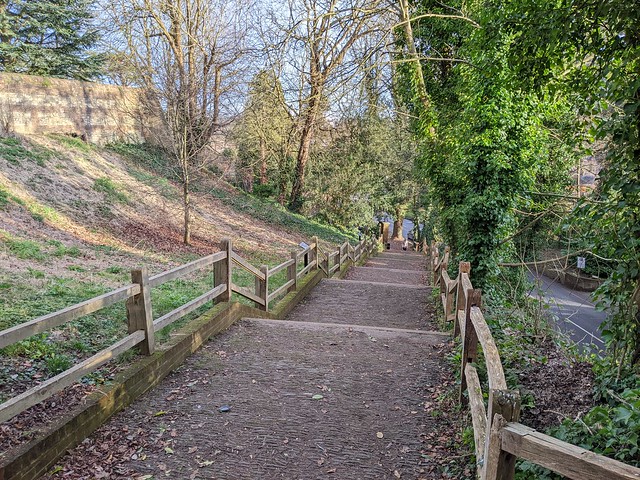
 Blind Bishop's Steps, Castle Hill, Farnham.
 
The steps are set out in blocks of seven steps set seven paces apart, built to enable Bishop Richard Fox to walk unaided to and from the town. Successively Bishop of Exeter, Bath and Wells, Durham, and Winchester, Fox gained political power under Henry VII. With the rise of Cardinal Wolsey under Henry VIII Fox's political career waned and he returned to his episcopal duties. In the last ten years of his life his sight failed, hence the special arrangement of the steps.
 
Back down the hill and across Castle Street and turn right into the alleyway called Long Garden Walk opposite the large Plane trees planted in 1897 to celebrate Queen Victoria’s Diamond Jubilee. Long Garden Walk leads to the Hop Blossom pub and rope was once made here in lengths stretching to the far side of Castle Street. It strikes me that must have interfered somewhat with traffic on one of the main roads in and out of the town centre.
 
 The Hop Blossom, Long Garden Walk, Farnham.
 
At the end of Long Garden Walk outside the supermarket is Lion & Lamb Yard. Turn left here into this shopping area the first part of which dates from the 1980s but looks older apart from the barn on the left formerly a vehicle repair garage and now an (empty at the time of writing) retail unit. At the bottom of the yard is an old water pump and the former Lion & Lamb Hotel building whence the yard derives its name.
 
 Water pump, Lion & Lamb Way, Farnham.
 
Pass through the arch and turn right into West Street and walk past the Post Office, one of the few modernist buildings and not getting any attention in the trail leaflet, note the multi-coloured concrete frieze on the ground floor. Look up Malthouse Yard at the unusual building (and many Private Property signs) the yard was once owned by a hop garden tallyman.
 
 Malthouse Yard, Farnham.
 
The lane running north alongside the timber-framed 98-99 West Street - most Farnham town centre streets number consecutively rather than odds and evens on opposite sides - is Timber Close.
 
 Timber Close, Farnham.
 
Now mostly lined with modern buildings it is believed to be the site of an early prefabricated construction site where in 1395, the hammer-beam roof of Westminster Hall, in London, was constructed and then taken, piece by piece, to London and erected there where it can still be seen today.  Continuing across The Hart to a small green space called College Gardens a plaque set in the grass records that this was  the site of the Senior Department of the Royal Military College from 1814 to 1820 when it moved to Sandhurst, later becoming the Staff College. Across the road at number 38 is the Museum of Farnham in a Grade 1 listed building which due to lack of time had to wait until another day. I headed back towards the centre of town passing number 28, Vernon House.
 
 Vernon House, West Street, Farnham.
 
A ceramic roundel on the wall here records that 'CHARLES I STAYED HERE ON THE NIGHT OF 20 DECEMBER 1648’. From here he was taken to London to face trial and execution. In thanks for his hospitality he gave his host, Sir Henry Vernon, his blue silk morning cap decorated with gold and silver thread. A little over a year later he had nothing on which to wear a cap anyway.
 
Onward past the Bishop’s Table Hotel at 27, West Street, reputed to be haunted, and 25, the large Victorian building, the Farnham Adult Learning Centre. in the past this building has been Farnham Grammar School, Farnham Girls’ Grammar School and Farnham School of Art, now elsewhere in the town. At 24, West Street is Harold Falkner’s house, the aforementioned associate of Charles Borelli.
 
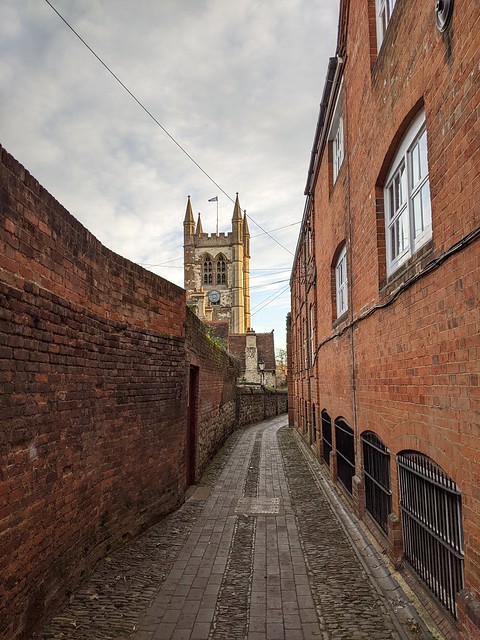
Turn right into Church Passage. According to the leaflet "this passage is also known as Streaky Bacon Lane. Look at the setts beneath your feet for the reason!" Didn't look like bacon to me. Perhaps its name owes more to the former bacon factory that occupied the building on the right. Decide for yourself.
 
 Church Passage, Farnham.
 
I did spot an interesting cast iron cover among the setts though I’m not sure what it covers, possibly a coal hole although those are normally circular. (My job means I now notice things like this almost out of habit, spending much time looking for telephone network infrastructure. This is probably a bit sad.)
 
 A little bit of Chelsea in Surrey, Church Passage, Farnham.
 
Church Passage leads to St. Andrew’s Parish Church, one of Surrey’s largest and the oldest parts of which date from the 12th century. It has been modified, restored, and changed in nearly every century since and is Grade II listed.
 
 St. Andrews Church, Farnham.
 
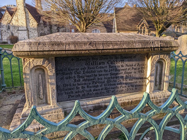
Near the church door is the tomb of William Cobbett, which records a series of journeys by horseback through the countryside of Southeast England and the English Midlands. Cobbett was born into poverty in 1763, yet rose to become an MP, an advocate of political reform and an author whose most well known work is Rural Rides, which records a series of journeys by horseback through the countryside of Southeast England and the English Midlands.
 
 William Cobbett's tomb, St. Andrews Church, Farnham.
 
Out through the churchyard gates and turn left past the row of cottages in Middle Church Lane, often used for period scenes by television companies and left into the even more picturesque Lower Church Lane complete with central gutter, thankfully no longer used as an open sewer as it was in Tudor times.
 
 Lower Church Lane, Farnham.
 
Just before the end of the lane turning right into Wagon Yard car park. The wagons from which it takes its name would have carried goods including wheat and must have been a major transport site if what the man told Daniel Defoe was true, that he had "once counted 1,100 teams of horses, all drawing wagons or carts, loaded with wheat, in Farnham on this piece of ground”. Must have resembled the post-Brexit lorry parks in Kent 300 years later. On the other side of the car park and the River Wey is the cultural and arts centre Farnham Maltings, 
 
 Farnham Maltings.
 
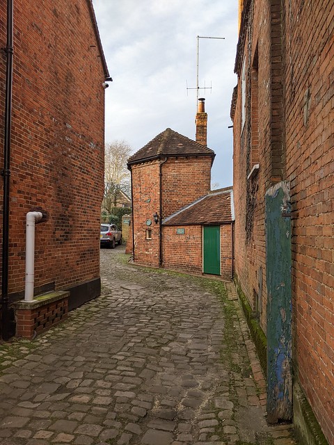
This was a tannery and then a malting house for brewer’s malt until purchased in the 1960s from Courage Brewery by Farnham residents to save it from being demolished. On the corner of the Maltings building, point 7 on the leaflet map, turn left into Red Lion Lane which contains some brewery related “ghost signs” and one of Farnham’s oldest buildings dating from the 1500s but when I passed all but invisible behind builders’ hoardings.
 
 Red Lion Lane, Farnham.
 
At the end of the lane across the road is William Cobbett’s birthplace, an inn then called the Jolly Farmer but now bearing his name because that’s what they do for renowned MPs. There probably aren’t many jolly farmers around here anyway.
 
 The William Cobbett, Bridge Square, Farnham.
 
Following the road around to the left and over Longbridge brought me back to where I started at point 8, Gostrey Meadow. Following this link will take you to more photos taken on my walk.
 
If you lost a small red plastic tractor in Gostrey Meadow speak up, otherwise it can remain decorating my mantlepiece :-)