Wednesday 2nd February 2022
Farnham is a market town in the very western end of the county of Surrey, very close to the border with Hampshire, across which lies Aldershot. It’s about 36 miles southwest of London, from which it can be reached by train from London Waterloo or by road via the A3 and A31. Having been here since the 7th Century when the Saxons named it Fearnhamme (fern/bracken + water meadows) the town has a long history and a good collection of old buildings to look at and many interesting nooks and crannies.
A good way to explore them is to download and follow the circular Farnham Heritage Trail published by the town council. You can also pick up a copy at the town council offices in South Street. The trail starts at the bottom of Castle Street but the cheapest (although not by much) car parks are down by the riverside so I parked there and picked up the trail at point 8. If you arrive by train then point 8 or 9 are the closest to the station too.
An open space through which flows the River Wey and contains a children’s play area, a handy public convenience, and the town’s war memorial. On your left with the weather vane is the former Church House (now The Vineyard Church) which was built in 1909. Past the memorial emerge into South Street, cross over and turn left passing the town council offices and the Methodist Church to arrive at the Liberal Club. This was the architect Edwin Lutyens’ first public work to be built, there’s an information plaque on the building giving more details. It’s also point 9 on the trail map.
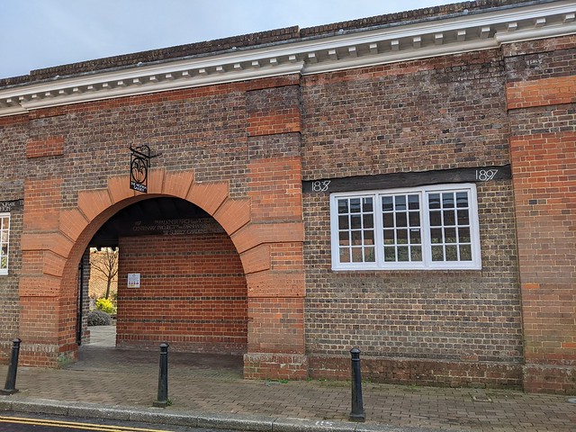
Down the side of the Liberal Club in what is either Brightwells Road or Falkner Court depending which map you look at is a large arch leading into Victoria Garden. This garden was formerly an open air swimming baths built in 1897, as attested by the lettering on the wooden lintels above the windows. Go trough the arch and in the garden you will find a wooden sign from the swimming baths advertising that bathing was mixed and at the far end a statue of a small boy in swimming trunks who looks bloody frozen! Returning to South Street and turning right will bring you to the main crossroads in the town centre. On the far side is a milestone showing the distances to London (38 miles), Bagshot (12 miles), and Alton (9 Miles). Behind the milestone is a wooden hoarding over which can be seen the top of a pile of rubble. This is the remains of the 1960s Brutalist Woolmead House complex of shops and flats. Condemned as “ugly” and by the developer as “lacking the quality associated with Farnham and the adjoining conservation area and lacking civic presence” it was demolished in the winter of 2018/2019. Supposedly to be redeveloped but still in 2022 just a wasteland spreading dust across the town centre. Strangely there’s no reference to Woolmead House in the trail leaflet. Not all heritage is equal.
Heading West from the crossroads along The Borough on the left is the entrance to the courtyard of the Bush Hotel, at 500 years old it’s the town's oldest hostelry and a former coaching inn. It’s point 11 o the trail map.
Further along The Borough is Borelli Yard, named for local businessman and councillor Charles Borelli whose family’s clockmakers shop was nearby in The Borough and held a Royal Warrant from Queen Victoria. This is point 12 in the trail leaflet says that the date 1610 can be seen by looking up under the archway but I was obviously not looking in the right place.
Borelli and local architect Harold Faulkner acted in the early 20th century to restore many of Farnham’s old buildings and had much influence over planning in the town. Looking at some of the development currently underway in the town centre I think there’s a chance both are now spinning in their graves. In Borelli Yard there is a bronze sculpture by local artist Ben Franklin called ‘Matriarch’, which I’m sure that the artist understood and a panel on the wall giving information about a medieval tile kiln which was excavated here in the 1980s.
Returning to The Borough and crossing the road to the corner of Castle Street brings you to point 1, the official start of the Heritage Trail. I wouldn’t have started it here as previously mentioned point 8 or 9 would be more logical for visitors but I suppose the trail was devised by locals and Castle Street is regarded as one of the town’s highlights.
In the middle of the road at the bottom of Castle Street between 1566 and 1866 stood the Market House and jail, see plaque on the wall of the adjacent bank. There are still market buildings here albeit not in the middle of the road and as far as I know people are not incarcerated in them now.
Castle Street is broad and with many historic buildings many older than they appear having gained Georgian facades. A row of Almshouses on the right were built in 1619 according to the plaque outside for “The habitation and relief of eight poor honest old impotent persons”. I assume that last is i the sense of powerless rather than unable to get it up.
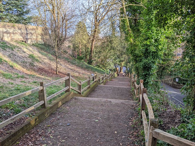
Carrying on past the Nelson Arms (shouldn’t that be ‘Arm”?) pub to the end of Castle Street where it becomes Castle Hill a long set of steps leads up to Farnham Castle, formerly a bishop’s palace and now "An award winning venue for Weddings, Private Hire, Meetings and Events, overlooking the beautiful, historic town of Farnham”, according to its web site.
The steps are set out in blocks of seven steps set seven paces apart, built to enable Bishop Richard Fox to walk unaided to and from the town. Successively Bishop of Exeter, Bath and Wells, Durham, and Winchester, Fox gained political power under Henry VII. With the rise of Cardinal Wolsey under Henry VIII Fox's political career waned and he returned to his episcopal duties. In the last ten years of his life his sight failed, hence the special arrangement of the steps.
Back down the hill and across Castle Street and turn right into the alleyway called Long Garden Walk opposite the large Plane trees planted in 1897 to celebrate Queen Victoria’s Diamond Jubilee. Long Garden Walk leads to the Hop Blossom pub and rope was once made here in lengths stretching to the far side of Castle Street. It strikes me that must have interfered somewhat with traffic on one of the main roads in and out of the town centre.
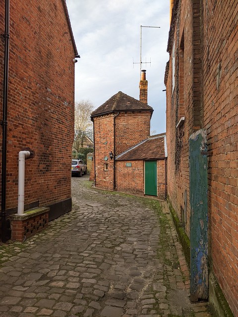
At the end of Long Garden Walk outside the supermarket is Lion & Lamb Yard. Turn left here into this shopping area the first part of which dates from the 1980s but looks older apart from the barn on the left formerly a vehicle repair garage and now an (empty at the time of writing) retail unit. At the bottom of the yard is an old water pump and the former Lion & Lamb Hotel building whence the yard derives its name.
Pass through the arch and turn right into West Street and walk past the Post Office, one of the few modernist buildings and not getting any attention in the trail leaflet, note the multi-coloured concrete frieze on the ground floor. Look up Malthouse Yard at the unusual building (and many Private Property signs) the yard was once owned by a hop garden tallyman.
The lane running north alongside the timber-framed 98-99 West Street - most Farnham town centre streets number consecutively rather than odds and evens on opposite sides - is Timber Close.
Now mostly lined with modern buildings it is believed to be the site of an early prefabricated construction site where in 1395, the hammer-beam roof of Westminster Hall, in London, was constructed and then taken, piece by piece, to London and erected there where it can still be seen today. Continuing across The Hart to a small green space called College Gardens a plaque set in the grass records that this was the site of the Senior Department of the Royal Military College from 1814 to 1820 when it moved to Sandhurst, later becoming the Staff College. Across the road at number 38 is the Museum of Farnham in a Grade 1 listed building which due to lack of time had to wait until another day. I headed back towards the centre of town passing number 28, Vernon House.
A ceramic roundel on the wall here records that 'CHARLES I STAYED HERE ON THE NIGHT OF 20 DECEMBER 1648’. From here he was taken to London to face trial and execution. In thanks for his hospitality he gave his host, Sir Henry Vernon, his blue silk morning cap decorated with gold and silver thread. A little over a year later he had nothing on which to wear a cap anyway.
Onward past the Bishop’s Table Hotel at 27, West Street, reputed to be haunted, and 25, the large Victorian building, the Farnham Adult Learning Centre. in the past this building has been Farnham Grammar School, Farnham Girls’ Grammar School and Farnham School of Art, now elsewhere in the town. At 24, West Street is Harold Falkner’s house, the aforementioned associate of Charles Borelli.
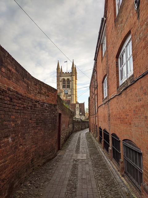
Turn right into Church Passage. According to the leaflet "this passage is also known as Streaky Bacon Lane. Look at the setts beneath your feet for the reason!" Didn't look like bacon to me. Perhaps its name owes more to the former bacon factory that occupied the building on the right. Decide for yourself.
I did spot an interesting cast iron cover among the setts though I’m not sure what it covers, possibly a coal hole although those are normally circular. (My job means I now notice things like this almost out of habit, spending much time looking for telephone network infrastructure. This is probably a bit sad.)
Church Passage leads to St. Andrew’s Parish Church, one of Surrey’s largest and the oldest parts of which date from the 12th century. It has been modified, restored, and changed in nearly every century since and is Grade II listed.
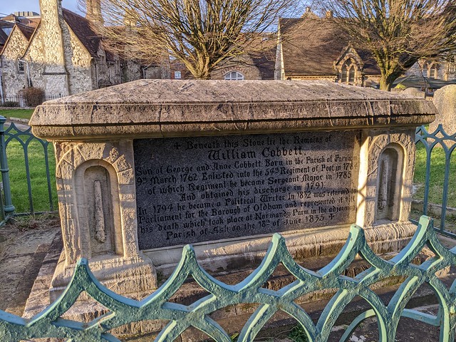
Near the church door is the tomb of William Cobbett, which records a series of journeys by horseback through the countryside of Southeast England and the English Midlands. Cobbett was born into poverty in 1763, yet rose to become an MP, an advocate of political reform and an author whose most well known work is Rural Rides, which records a series of journeys by horseback through the countryside of Southeast England and the English Midlands.
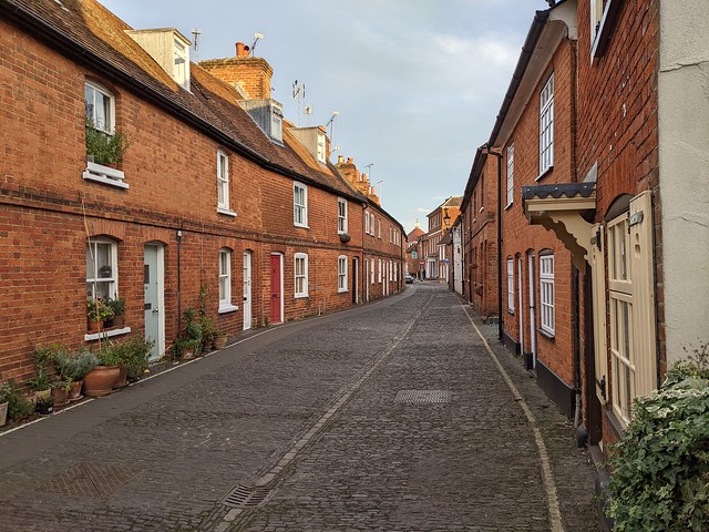
Out through the churchyard gates and turn left past the row of cottages in Middle Church Lane, often used for period scenes by television companies and left into the even more picturesque Lower Church Lane complete with central gutter, thankfully no longer used as an open sewer as it was in Tudor times.
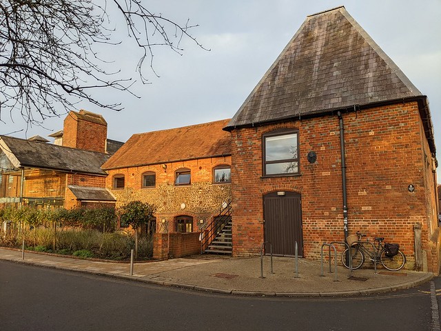
Just before the end of the lane turning right into Wagon Yard car park. The wagons from which it takes its name would have carried goods including wheat and must have been a major transport site if what the man told Daniel Defoe was true, that he had "once counted 1,100 teams of horses, all drawing wagons or carts, loaded with wheat, in Farnham on this piece of ground”. Must have resembled the post-Brexit lorry parks in Kent 300 years later. On the other side of the car park and the River Wey is the cultural and arts centre Farnham Maltings,
This was a tannery and then a malting house for brewer’s malt until purchased in the 1960s from Courage Brewery by Farnham residents to save it from being demolished. On the corner of the Maltings building, point 7 on the leaflet map, turn left into Red Lion Lane which contains some brewery related “ghost signs” and one of Farnham’s oldest buildings dating from the 1500s but when I passed all but invisible behind builders’ hoardings.
At the end of the lane across the road is William Cobbett’s birthplace, an inn then called the Jolly Farmer but now bearing his name because that’s what they do for renowned MPs. There probably aren’t many jolly farmers around here anyway.
Following the road around to the left and over Longbridge brought me back to where I started at point 8, Gostrey Meadow. Following this link will take you to more photos taken on my walk.
If you lost a small red plastic tractor in Gostrey Meadow speak up, otherwise it can remain decorating my mantlepiece :-)











No comments:
Post a Comment