Showing posts with label Surrey. Show all posts

Saturday, 5 October 2024

London Loop Section 5

Hamsey Green to Coulsdon South
 
This six and a half mile section is largely across level ground but with some steep slopes where it crosses a couple of valleys. It was actually quite a pleasant ramble, not too long, mostly on firm surfaces, no overgrown paths, and with a smattering of points of interest along the way. I got a bus from South Croydon station to the section start at Hamsey Green which isn’t as rural as the name suggests, then walked up Tithepit Shaw Lane for about 400 yards and at the Loop signpost out onto the Sanderstead to Whyteleafe Countryside area.
 
 London Loop Section 5, Hamsey Green
 
 This was mostly level open country with intermittent bands of trees but eventually reached Riddlesdown and dropped steeply into the valley and joining an old Roman road, Riddlesdown Road, now a trackway which crosses the East Grinstead railway line before reaching the A22 Godstone Rd. Crossing the A22 I passed through a small commercial area then crossed over the Purley & Caterham railway line on a pedestrian bridge and climbed up the other side of the valley along residential streets to a bench at the top of New Barn Lane which has a good view back across the valley.
 
 London Loop Section 5, Riddlesdown from Hawkhurst Wood
 
 This would have been a good spot to stop and eat my packed lunch except for the guy in the adjacent garden cutting concrete blocks with a petrol disc cutter so instead I carried on up the 83 steps through Hawkhurst Wood and on to Kenley Common, where I was disappointed not to find a bench.
 
I took a short diversion onto the former RAF Kenley airfield and watched some gliders being launched using a winch and a long rope. In the 1980s I went gliding at Lasham Airfield in Hampshire and we were given the option of winch launching or for a small extra fee being towed up by a powered aircraft. We all chose the latter since that way you started off higher up and got a longer flight. Seeing the steep angle the glides were launched at here at Kenley I’m doubly sure that was the right choice!
 
 London Loop Section 5, RAF Kenley
 
 I left the airfield and walked down Golf Rd. - unusually that’s the nearest section 5 gets to a golf course - and to the edge of Couldson Common as the route makes its way around the west side of RAF Kenley. They don’t seem to do convenient benches in this part of Surrey so I eventually ate my sandwiches perched on a handy boundary marker stone near the Norman Fisher Observatory with its two small white domes for astronomical telescopes.
 
 London Loop Section 5, Norman Fisher Observatory, Kenley
 
 The gliders from Kenley passed very low over my lunch spot. It’s surprising how much noise a glider makes when it passes low over your head but without any forewarning sound so I never managed to get what would have made great a photo 😞
 
From the observatory I carried on along narrow lanes and on to Couldson Common proper, passing The Fox pub and the southernmost point on the London LOOP before getting to Happy Valley. This is not the same Happy Valley as that featured in the BBC TV Series which is much further north. I doubt this one gets it’s name for the same reason (The name "Happy Valley" is what local police in the Calder Valley call the area because of its drug problem) but who knows 😀
 
 London Loop Section 5, Happy Valley, Coulsdon
 
 In the above photo the London LOOP crosses the valley by dropping down on the path to the left then climbing steeply up to the trees on the far side before turning right to meet the path that goes straight on here. I don’t know why this pointless dog-leg is included but I followed it anyway while thinking that the direct path was probably easier. Whichever path you take you enter the sinister-sounding Devil’s Den Woods and climb steadily to emerge on Farthing Downs near the car park and Public Toilets. Just to prove that the age of miracles is not past the latter were actually open!
 
 London Loop Section 5, Farthing Down
 
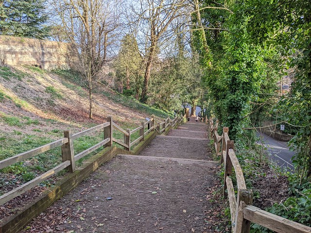
 From here the route runs along the length of Farthing Downs parallel to but separate from the road with far-reaching views to both sides. It was pretty quiet and peaceful on a Thursday afternoon in October but I’ll bet it’s not like that on a Summer weekend! From the high points of the ridge you can see central Croydon’s high-rise buildings, the radio masts at Crystal Palace, and the towers of the City of London. Including of course the distinctive spike of The Shard because 14 miles isn’t far enough away to avoid seeing this 21st century Orthanc. 
 
 London Loop Section 5, Farthing Down, view of the city towers
 
 From the end of Farthing Downs it’s not far through the streets to Coulsdon South station, the end of Section 5 and the start of Section 6 which I completed back in August. I caught a bus back to South Croydon to catch a train to Redhill where I had a long wait because of course GWR cancelled my intended train home. Plus ca change 🙄
 
 London Loop Section 5, Coulsdon South station
 
 As ever there are more photos in my London LOOP Section 5 Flickr Album
 
 London Loop Section 5


Tuesday, 27 August 2024

London Loop Section 6

Coulsdon South to Banstead Downs
 
In spite of GWR’s best efforts (cancel trains, don’t put the trains on the departure boards, change the stops the trains stop at, reinstate trains but on no account tell the passengers what is happening and don’t answer the phone!) I managed to get to Coulsdon South station at about twenty to eleven in the morning on Bank Holiday Monday 26th August ready to tackle Section 6 of the London Loop.
 
 London Loop Section 6, Coulsdon South Station
 
 The sun even came out, on a Bank Holiday! My walk started by passing under the railway and road bridges and then climbing through residential streets on what seemed an ever upward trek without an apparent top. On the way I passed over the Tattenham Corner Line as a Southern train passed under the bridge which was good timing.
 
 London Loop Section 6, crossing the Tattenham Corner Line
 
 I continued to climb, passing into the London Borough of Sutton before leaving the roadside verge down a sunken bridleway which had a half-hidden cast iron boundary marker for the former Carshalton Urban District Council part way down the hill. The bridleway climbed to a small rise near some paddocks with a comprehensive selection of “No” signs and CCTV cameras. This spot afforded some distant views of London's towers, cranes, and the Wembley Stadium arch just about visible through the haze. A few yards further on I spotted the two radio masts of Crytal Palace over the treetops and the Woodcote Smallholdings, built for soldiers returning from the Great War.
 
 London Loop Section 6, view over Little Woodcote to Crystal Palace masts
 
 The Loop turns south west through the open space of Carshalton Road Pastures before crossing Carshalton Road and turning north to cross the famous Mayfield Lavender Fields.
The path runs through the middle of the lavender fields which the farm makes a good deal from not only growing the plants but by charging people to come and look at them. By this time of year the blooms are well past their best though. At the far side of the field I waited for a couple to cross the stile who were stopped in their tracks by a sign saying there was a £5 entry charge. Nice try, it’s a public right of way. I wonder how many they catch with that? There’s no sign at the other side of the field where I came in. Here’s a photo because they also have a sign up claiming that you need their permission to take photos too.
 
 London Loop Section 6, Mayfield Lavender Fields
 
 I crossed Carshalton Road into the rather more welcoming and much more attractive space of Oaks Park. The park was laid out in the 1770s by the Earl of Derby as the gardens of his house there. The park has been much modified since as was the house before it was demolished in the 1950s leaving only some of the outbuildings and stables. The Oaks estate lent its name to the horse race started by the 12th Earl of Derby in 1779 and run annually at the Derby meeting at nearby Epsom Racecourse. According to legend, as recounted on an information board in the park, Lord Derby and Lord Bunbury tossed a coin to decide which would get to name another race, Derby won the toss else we might have had the Epsom Bunbury, and by extension the Kentucky Bunbury races. It’s a very pleasant park with a number of separate spaces, ideal to stop and eat your picnic lunch whilst walking section 6 of the Loop. So I did.
 
 London Loop Section 6, Oaks Park, lunchtime.
 
 Fortified with cheese and ham sandwiches I resumed my walk along a wiggly path through the trees out onto a track, Fairlawn Road and then left onto a narrower path called Freedown Lane which passed a new development site and led up past HM Prison Highdown, glimpsed through the trees lining the path. Lining the other side of the path were many patches of brambles so my now empty sandwich box was soon filled with blackberries instead. The crumble will be worth the pricked fingers ðŸ˜€

At the end of Freetown lane I crossed Sutton Lane onto Banstead Down. The rest of Section 6 runs across the down and its huge golf course. I had expected this to be busy with it being a Bank Holiday Monday but it was almost empty. Perhaps the members of Banstead Downs Golf Club mainly play on “work” days?
 
 London Loop Section 6, Banstead Downs Golf Course
 
 Running through the middle of the course and across the Loop is the most substantial obstacle on this section, the “Mad Mile” of the A217 Brighton Road, a fast dual carriageway without a controlled pedestrian crossing of a footbridge. I had to wait for several minutes before a gap in the speeding traffic long enough to get across occurred. There appears to be no suitable alternative route to avoid taking your life in your hands else I’m sure the Loop would take it.
 
 London Loop Section 6, crossing the A217 Brighton Road at the "Mad Mile"
 
 Once across the road there’s just one more fairway to cross - also deserted at the time - before reaching the end of Section 6 in the woods at a fingerpost that marks the start of Section 7 and it also points the way to Banstead Station for those calling it a day here.
 
 London Loop Section 6, Banstead Downs, end of Section 6.
 
It was 1320 and I wasn’t stopping yet, planning to complete Section 7 to Ewell from where I had a ticket to get the train home. I pressed on to further “adventures”.
 
 
 London Loop Section 6
 

Sunday, 10 April 2022

Gunpowder Mills at Chilworth

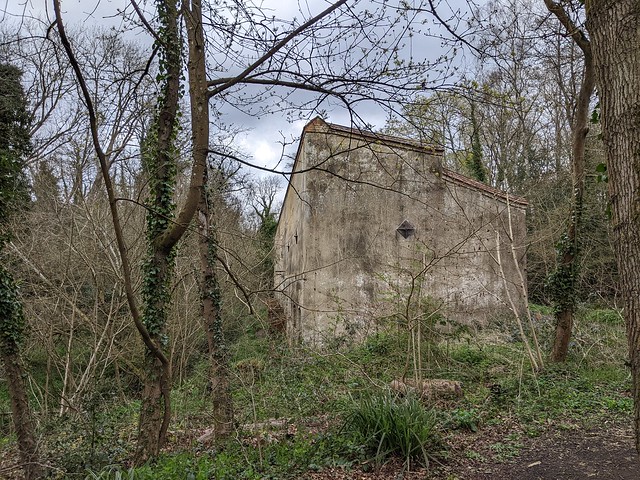
I have walked in the hills above Chilworth and driven through the village countless times but until I spotted it on the map while looking for somewhere to go for a ramble on my day off I was unaware of the existence of the former Gunpowder Mills. What looks like a patch of ordinary woodland contains the remains of the Middle Works, part of a much larger industrial site that produced explosives from the mid 17th century until the end of the Great War. The ruins of many structures can be found among the trees and it’s all just sitting there free to wander around. You can even pick up a Heritage Trail guide on site provided by Guildford Borough Council, or download it before you go (PDF file, 3MB).
 
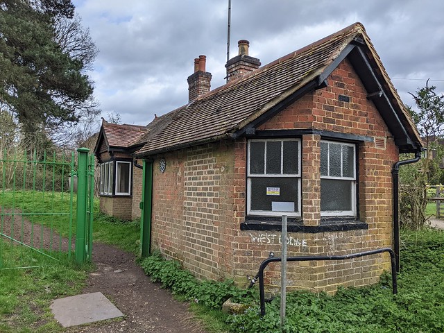
The West Lodge stands at the site entrance in Blacksmith Lane. This was where the workers would check in and be checked for sources of ignition, e.g. matches, pipes, etc.
 
 Chilworth Gunpowder Mills, West Lodge.
West Lodge
 
Oddly it doesn’t seem that checks included footwear as in 1901 an explosion occurred in the Corning House, where pressed powder was broken up and sorted into grain sizes. A spark from a hob-nailed boot caused the explosion which resulted in the death of six men. Seems strange to me that hob-nailed boots were permitted on site. They did wear brimless hats however to keep the powder out of their hair since that could result in an unfortunate incident when they got home and sat down in front of the fire!
 
 Chilworth Gunpowder Mills corning house.
Remains of the Corning House
 
 
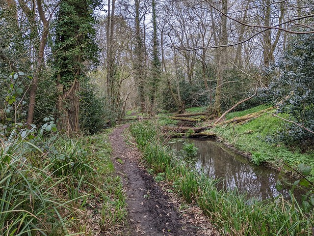
The Middle Works were built in the 1650s along with the New Cut, a 5-8m wide water channel used to transport materials in punts around the site. The finished product would be taken by waggon to the Wey Navigation and then to magazines on the Thames.
 
 Chilworth Gunpowder Mills, New Cut 1656.
The New Cut, 1656.
 
 
Many of the paths giving access to the site today follow the network of man-hauled tramways built on the site which also had a spur built to the railway line at Chilworth, crossing the New Cut on a swing bridge.This tramway was of metric gauge, the first such known in the UK. Nobody tell the Brexiteers, they wouldn’t like it. Narrow gauge wooden wagons (for obvious reasons) brought in coal for use on site. 
 
 Chilworth Gunpowder Mills swing bridge.
Tramway swing bridge over the New Cut, branch to Chilworth station.
 
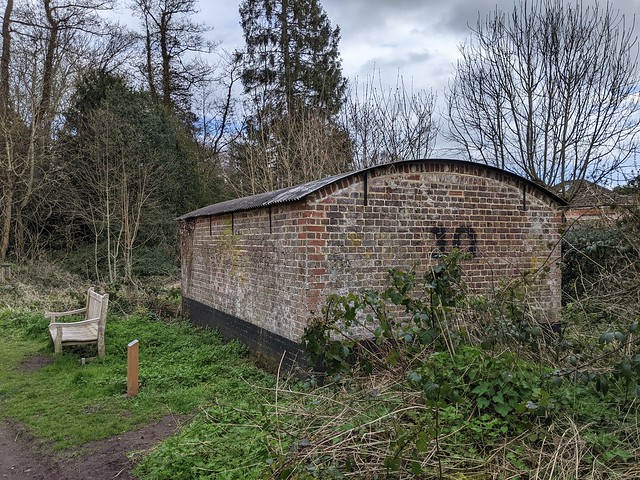
There are two buildings on site which are apparently intact. These are the Expense Magazines, used to store materials between production stages and located next to wharves on the New Cut. Judging by the big steel gates across their doors they're still in use for storage although presumably not for gunpowder!
 
 Chilworth Gunpowder Mills, expense magazine.
Expense Magazine
 
 
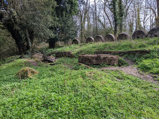
The earlier steam Incorporating Mills where the mixture of saltpetre, charcoal, and sulphur was ground between mill stones like those used to grind grain into flour, are in a very ruinous state. Two bed stones and the engine bed and part of the boiler house chimney remain. Above next to the path is a row of worn out millstones sat on edge which would have been banked up with earth to form a blast wall.
 
 Chilworth Gunpowder Mills, steam incorporating mills.
Steam Incorporating Mill remains.
 
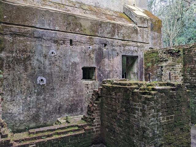
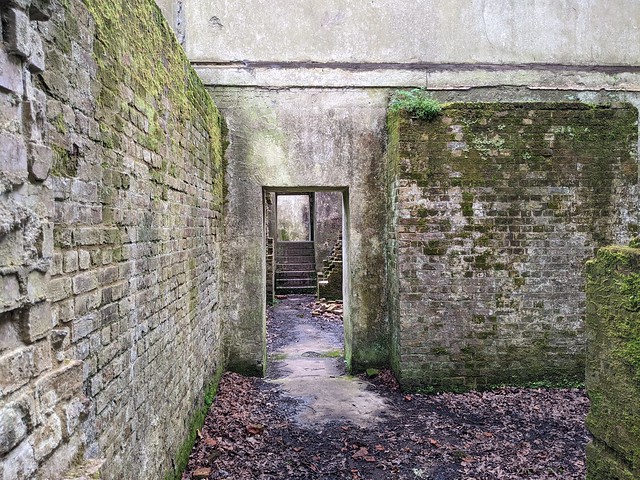
The largest and most impressive structures remaining on the site are to be found towards the eastern end, next to the main tramway/path and the New Cut. These are the 1880s Steam Incorporating Mills. The tall blast proof walls remain and you can walk down the stairs into the gear rooms which would have been below a wooden floor at ground level.
 
 Chilworth Gunpowder Mills, 1880s Steam Incorporating Mills.
Tall blast walls, 1880s Incorporating Mills.
 
 Chilworth Gunpowder Mills, 1880s Steam Incorporating Mills.
Underfloor gear rooms, 1880s Incorporating Mills
 
 Chilworth Gunpowder Mills, 1880s Steam Incorporating Mills.
Underfloor gear rooms, 1880s Incorporating Mills
 
Across the minor road at the eastern end of Middle Works is the Upper Works and an iron gate exists that was the entrance to the Smokeless Powder Factory. The Upper Works lies on private land with no access to the public however from the footpath leading to Mill Lane you can see the remains of the Afmiralty Cordite Factory further up-stream on the Tillingbourne, the river that provided water to, and runs through, the factory complex.
 
 Cordite Factory, Chilworth.
Admiralty Cordite Factory, Upper Works.
 
I do seem to have taken quite a lot of photos while wandering around the works, too many to include here but they can all be seen in this Flickr Album if you are interested.
 
The photos in the album aren’t in the west to east order that I’ve written this blog post since I started in the middle of the site having walked down from St. Martha’s Church, high on the downs above. That’s worth a visit too if only for the far reaching views.
 
 
Getting there: You could park up at St. Martha’s Hill car park in Guildford Lane and walk down as I did, it’s a fairly long climb back up so if you’re not feeling energetic park in Chilworth and access via Blackthorn Lane or Vera’s Path which is the route of the tramway spur to Chilworth Station, which is served by GWR trains between Redhill and Reading. Buses from Guildford, Redhill, and Godalming also stop outside the railway station.

Thursday, 3 February 2022

Farnham, Surrey.


Wednesday 2nd February 2022

Farnham is a market town in the very western end of the county of Surrey, very close to the border with Hampshire, across which lies Aldershot. It’s about 36 miles southwest of London, from which it can be reached by train from London Waterloo or by road via the A3 and A31. Having been here since the 7th Century when the Saxons named it Fearnhamme (fern/bracken + water meadows) the town has a long history and a good collection of old buildings to look at and many interesting nooks and crannies.
 
A good way to explore them is to download and follow the circular Farnham Heritage Trail published by the town council. You can also pick up a copy at the town council offices in South Street. The trail starts at the bottom of Castle Street but the cheapest (although not by much) car parks are down by the riverside so I parked there and picked up the trail at point 8. If you arrive by train then point 8 or 9 are the closest to the station too.
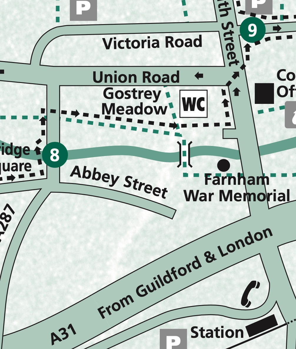
 
Map extract p8-9
 
 War memorial, Gostrey Meadow, Farnham.
 
An open space through which flows the River Wey and contains a children’s play area, a handy public convenience, and the town’s war memorial. On your left with the weather vane is the former Church House (now The Vineyard Church) which was built in 1909. Past the memorial emerge into South Street, cross over and turn left passing the town council offices and the Methodist Church to arrive at the Liberal Club. This was the architect Edwin Lutyens’ first public work to be built, there’s an information plaque on the building giving more details. It’s also point 9 on the trail map.
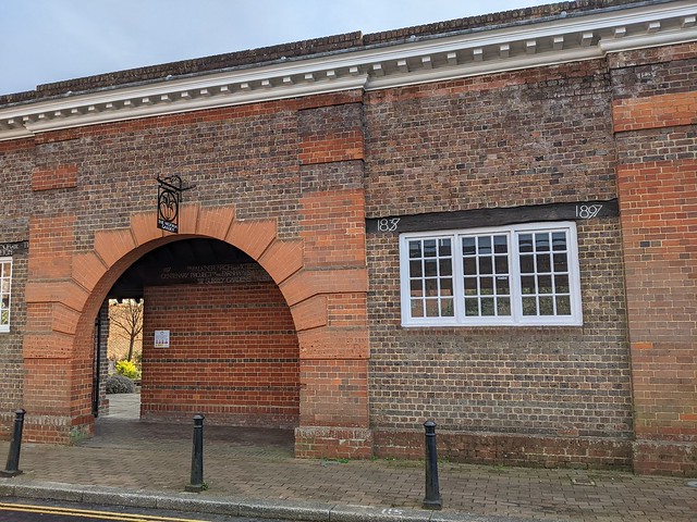
 
 The Victoria Garden, Brightwells Rd. Farnham.
 
Down the side of the Liberal Club in what is either Brightwells Road or Falkner Court depending which map you look at is a large arch leading into Victoria Garden. This garden was formerly an open air swimming baths built in 1897, as attested by the lettering on the wooden lintels above the windows. Go trough the arch and in the garden you will find a wooden sign from the swimming baths advertising that bathing was mixed and at the far end a statue of a small boy in swimming trunks who looks bloody frozen! Returning to South Street and turning right will bring you to the main crossroads in the town centre. On the far side is a milestone showing the distances to London (38 miles), Bagshot (12 miles), and Alton (9 Miles). Behind the milestone is a wooden hoarding over which can be seen the top of a pile of rubble. This is the remains of the 1960s Brutalist Woolmead House complex  of shops and flats. Condemned as “ugly” and by the developer as “lacking the quality associated with Farnham and the adjoining conservation area and lacking civic presence” it was demolished in the winter of 2018/2019. Supposedly to be redeveloped but still in 2022 just a wasteland spreading dust across the town centre. Strangely there’s no reference to Woolmead House in the trail leaflet. Not all heritage is equal.
 
Heading West from the crossroads along The Borough on the left is the entrance to the courtyard of the Bush Hotel, at 500 years old it’s the town's oldest hostelry and a former coaching inn. It’s point 11 o the trail map.
 
 Courtyard of the Bush Hotel, The Borough, Farnham.
 
Further along The Borough is Borelli Yard, named for local businessman and councillor Charles Borelli whose family’s clockmakers shop was nearby in The Borough and held a Royal Warrant from Queen Victoria. This is point 12 in the trail leaflet says that the date 1610 can be seen by looking up under the archway but I was obviously not looking in the right place.
 
Borelli and local architect Harold Faulkner acted in the early 20th century to restore many of Farnham’s old buildings and had much influence over planning in the town. Looking at some of the development currently underway in the town centre I think there’s a chance both are now spinning in their graves. In Borelli Yard there is a bronze sculpture by local artist Ben Franklin called ‘Matriarch’, which I’m sure that the artist understood and a panel on the wall giving information about a medieval tile kiln which was excavated here in the 1980s.
 
Returning to The Borough and crossing the road to the corner of Castle Street brings you to point 1, the official start of the Heritage Trail. I wouldn’t have started it here as previously mentioned point 8 or 9 would be more logical for visitors but I suppose the trail was devised by locals and Castle Street is regarded as one of the town’s highlights. 
 
 Castle Street, Farnham.
 
In the middle of the road at the bottom of Castle Street between 1566 and 1866 stood the Market House and jail, see plaque on the wall of the adjacent bank. There are still market buildings here albeit not in the middle of the road and as far as I know people are not incarcerated in them now.
 
Castle Street is broad and with many historic buildings many older than they appear having gained Georgian facades. A row of Almshouses on the right were built in 1619 according to the plaque outside for “The habitation and relief of eight poor honest old impotent persons”. I assume that last is i the sense of powerless rather than unable to get it up.
 
 Almshouses, Castle Street, Farnham.
 
Carrying on past the Nelson Arms (shouldn’t that be ‘Arm”?) pub to the end of Castle Street where it becomes Castle Hill a long set of steps leads up to Farnham Castle, formerly a bishop’s palace and now "An award winning venue for Weddings, Private Hire, Meetings and Events, overlooking the beautiful, historic town of Farnham”, according to its web site.
 
 Blind Bishop's Steps, Castle Hill, Farnham.
 
The steps are set out in blocks of seven steps set seven paces apart, built to enable Bishop Richard Fox to walk unaided to and from the town. Successively Bishop of Exeter, Bath and Wells, Durham, and Winchester, Fox gained political power under Henry VII. With the rise of Cardinal Wolsey under Henry VIII Fox's political career waned and he returned to his episcopal duties. In the last ten years of his life his sight failed, hence the special arrangement of the steps.
 
Back down the hill and across Castle Street and turn right into the alleyway called Long Garden Walk opposite the large Plane trees planted in 1897 to celebrate Queen Victoria’s Diamond Jubilee. Long Garden Walk leads to the Hop Blossom pub and rope was once made here in lengths stretching to the far side of Castle Street. It strikes me that must have interfered somewhat with traffic on one of the main roads in and out of the town centre.
 
 The Hop Blossom, Long Garden Walk, Farnham.
 
At the end of Long Garden Walk outside the supermarket is Lion & Lamb Yard. Turn left here into this shopping area the first part of which dates from the 1980s but looks older apart from the barn on the left formerly a vehicle repair garage and now an (empty at the time of writing) retail unit. At the bottom of the yard is an old water pump and the former Lion & Lamb Hotel building whence the yard derives its name.
 
 Water pump, Lion & Lamb Way, Farnham.
 
Pass through the arch and turn right into West Street and walk past the Post Office, one of the few modernist buildings and not getting any attention in the trail leaflet, note the multi-coloured concrete frieze on the ground floor. Look up Malthouse Yard at the unusual building (and many Private Property signs) the yard was once owned by a hop garden tallyman.
 
 Malthouse Yard, Farnham.
 
The lane running north alongside the timber-framed 98-99 West Street - most Farnham town centre streets number consecutively rather than odds and evens on opposite sides - is Timber Close.
 
 Timber Close, Farnham.
 
Now mostly lined with modern buildings it is believed to be the site of an early prefabricated construction site where in 1395, the hammer-beam roof of Westminster Hall, in London, was constructed and then taken, piece by piece, to London and erected there where it can still be seen today.  Continuing across The Hart to a small green space called College Gardens a plaque set in the grass records that this was  the site of the Senior Department of the Royal Military College from 1814 to 1820 when it moved to Sandhurst, later becoming the Staff College. Across the road at number 38 is the Museum of Farnham in a Grade 1 listed building which due to lack of time had to wait until another day. I headed back towards the centre of town passing number 28, Vernon House.
 
 Vernon House, West Street, Farnham.
 
A ceramic roundel on the wall here records that 'CHARLES I STAYED HERE ON THE NIGHT OF 20 DECEMBER 1648’. From here he was taken to London to face trial and execution. In thanks for his hospitality he gave his host, Sir Henry Vernon, his blue silk morning cap decorated with gold and silver thread. A little over a year later he had nothing on which to wear a cap anyway.
 
Onward past the Bishop’s Table Hotel at 27, West Street, reputed to be haunted, and 25, the large Victorian building, the Farnham Adult Learning Centre. in the past this building has been Farnham Grammar School, Farnham Girls’ Grammar School and Farnham School of Art, now elsewhere in the town. At 24, West Street is Harold Falkner’s house, the aforementioned associate of Charles Borelli.
 
Turn right into Church Passage. According to the leaflet "this passage is also known as Streaky Bacon Lane. Look at the setts beneath your feet for the reason!" Didn't look like bacon to me. Perhaps its name owes more to the former bacon factory that occupied the building on the right. Decide for yourself.
 
 Church Passage, Farnham.
 
I did spot an interesting cast iron cover among the setts though I’m not sure what it covers, possibly a coal hole although those are normally circular. (My job means I now notice things like this almost out of habit, spending much time looking for telephone network infrastructure. This is probably a bit sad.)
 
 A little bit of Chelsea in Surrey, Church Passage, Farnham.
 
Church Passage leads to St. Andrew’s Parish Church, one of Surrey’s largest and the oldest parts of which date from the 12th century. It has been modified, restored, and changed in nearly every century since and is Grade II listed.
 
 St. Andrews Church, Farnham.
 
Near the church door is the tomb of William Cobbett, which records a series of journeys by horseback through the countryside of Southeast England and the English Midlands. Cobbett was born into poverty in 1763, yet rose to become an MP, an advocate of political reform and an author whose most well known work is Rural Rides, which records a series of journeys by horseback through the countryside of Southeast England and the English Midlands.
 
 William Cobbett's tomb, St. Andrews Church, Farnham.
 
Out through the churchyard gates and turn left past the row of cottages in Middle Church Lane, often used for period scenes by television companies and left into the even more picturesque Lower Church Lane complete with central gutter, thankfully no longer used as an open sewer as it was in Tudor times.
 
 Lower Church Lane, Farnham.
 
Just before the end of the lane turning right into Wagon Yard car park. The wagons from which it takes its name would have carried goods including wheat and must have been a major transport site if what the man told Daniel Defoe was true, that he had "once counted 1,100 teams of horses, all drawing wagons or carts, loaded with wheat, in Farnham on this piece of ground”. Must have resembled the post-Brexit lorry parks in Kent 300 years later. On the other side of the car park and the River Wey is the cultural and arts centre Farnham Maltings, 
 
 Farnham Maltings.
 
This was a tannery and then a malting house for brewer’s malt until purchased in the 1960s from Courage Brewery by Farnham residents to save it from being demolished. On the corner of the Maltings building, point 7 on the leaflet map, turn left into Red Lion Lane which contains some brewery related “ghost signs” and one of Farnham’s oldest buildings dating from the 1500s but when I passed all but invisible behind builders’ hoardings.
 
 Red Lion Lane, Farnham.
 
At the end of the lane across the road is William Cobbett’s birthplace, an inn then called the Jolly Farmer but now bearing his name because that’s what they do for renowned MPs. There probably aren’t many jolly farmers around here anyway.
 
 The William Cobbett, Bridge Square, Farnham.
 
Following the road around to the left and over Longbridge brought me back to where I started at point 8, Gostrey Meadow. Following this link will take you to more photos taken on my walk.
 
If you lost a small red plastic tractor in Gostrey Meadow speak up, otherwise it can remain decorating my mantlepiece :-)

Sunday, 16 August 2020

Three Richmond Bridges at night.

 Saturday 15th August 2020

A little nocturnal exploration of three bridges that cross the River Thames close together at Richmond, South West of London.

Richmond Lock & Footbridges

This interesting structure was what drew me to Richmond on a dull, damp post-lockdown Saturday evening when I had nothing better to do. So I parked by the river in Ranelagh Drive and went for a little walk.

Designed by F.G.M. Stoney (careful how you search for him!), Grade II listed, and opened in 1894 it combines a low-tide barrage with a lock at one end with a pair of footbridges. 


The footbridges support the suspended sluice gates which are used to maintain a navigable depth of water in the River Thames upstream when the tide goes out. Until some time in the second world war there was a 1d toll charged to pedestrians when crossing the bridge. Now it's free but the four disused toll-booths, one at each end of each bridge remain in situ. The bridge closes at night at 2130hrs in the summer or 1930hrs in the winter so I had about 15 minutes to cross it and take some photos which was ample. 

Richmond Lock is the furthest lock downstream on the River Thames and falls under the jurisdiction of the Port of London Authority. 

For about two hours either side of high tide the sluice gates are raised up into the footbridge structure and boats can pass through under the bridge arches. At other times they need to go through the lock for which there's a charge - currently £7 and only payable by card because of You Know What.


From the footbridge walkway you can see upstream to the other two bridges.

Twickenham Bridge

Despite lying between Richmond Lock and Richmond Railway Bridge this road bridge comprising three reinforced concrete arches is named Twickenham Bridge because it carries the road to the town of Twickenham, home of the world's largest Rugby stadium.

They couldn't call it Richmond Bridge of course because an 18th century arched bridge linking the two halves of Richmond already existed. Which I didn't go to on this visit. Twickenham Bridge was built in 1933 as part of the Chertsey Arterial Road - now the A316 which links southwestern suburban London to the M3 motorway at Sunbury - it was opened by Edward, Prince of Wales, (later King Edward VIII until he abdicated to marry Wallis Simpson, and was thereafter Duke of Windsor and an alleged Nazi sympathizer).

The bridge is Grade II listed, largely because of its Art Deco bronze lamp standards and balustrades. In 1992 the first Gatso speed camera in the UK was installed on Twickenham Bridge. 

Richmond Railway Bridge

Close to Twickenham Bridge the London Waterloo to Reading railway line crosses the River Thames approaching through the Old Deer Park on a viaduct.

Richmond Railway Bridge designed by Joseph Locke originally opened in 1848 when the line was extended from Richmond to Windsor. It was rebuilt in 1908 by the L&SWR chief engineer J W Jacomb-Hood replacing the 100ft iron girders with a steel truss design on the original piers and abutments as there were concerns over the integrity of the original structure. The main girders and decking were replaced again in 1984.


The Grade II listed bridge now carries multitudes of commuters (well not so much at the moment because of You Know What) on South Western Railway services.
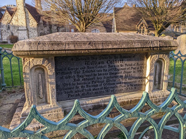
I crossed back over the river and returned to the car past the night anglers and other characters lurking in the shadows just in time to get out of the returning rain.


This Flickr Album contains some more photos

The Bridges of Richmond