Showing posts with label Railway. Show all posts

Monday, 16 January 2023

Hanwell

Hanwell is a town in the London borough of Ealing. It lies on the River Brent which forms its boundary with Southall to the west. The earliest known reference is as Hanwelle in CE 959. Apparently the name Hanwell possibly derives from a stream or spring where there are cocks - the chicken sort that is. There is enough of interest in and around Hanwell for a January afternoon’s walkabout.
 
Hanwell Station
The Great Western Railway came to Hanwell in 1838 and built a station on the north side of the town. Now run by Transport for London as part of the Elizabeth Line trains run between Heathrow Airport and Abbey Wood, meaning that coming in from the west I had to change at Hayes & Harington. The station has been modernised to provide step free access but also much restored into its GWR station colour scheme which looks great.
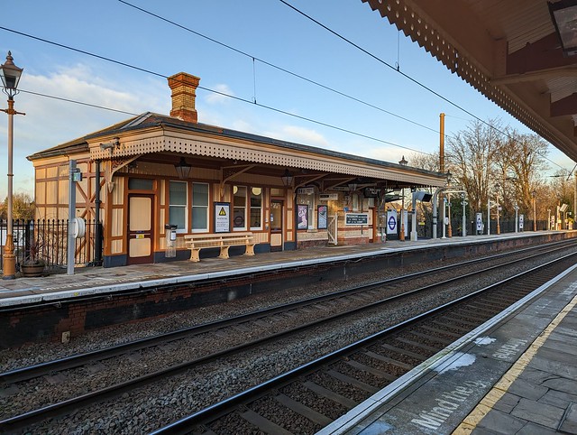
 
 Hanwell Station, Elizabeth Line.
 
There are even some restored signs on the platform showing ‘Hanwell & Elthorne’, the name by which the station was known between 1896 and 1974.
 
 Hanwell Station, Elizabeth Line.
 
The Wharncliffe Viaduct
For the GWR to get west from Hanwell to Southhall it needed to cross the valley of the River Brent. To achieve this Isambard Kingdom Brunel designed his first major engineering construction project, the Wharncliff Viaduct. Built in brick with hollow piers it rises 66 feet (20m) above the valley and is 890 ft (270m) long with 8 arches. It was built in 1836-1837 ready for the opening of the GWR main line.
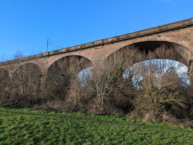
 
 The Wharncliffe Viaduct, Hanwell.
 
On the central pier on the south side is a carving of the coat of arms of James Stuart Wortley Mackenzie, Lord Wharncliffe, who was chairman of the parliamentary committee that steered the passage of the GWR Bill through Parliament. If you have money and influence you’re allowed to tag railway bridges.
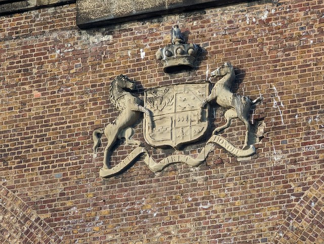
 
 The Wharncliffe Viaduct, Hanwell.
 
Hanwell Flight of Locks
Lying just across the boundary in Southhall but named after Hanwell because it’s much closer are the six locks on the Grand Union Canal. These raise the canal about 53 feet (16m). The flight has a clever system of side ponds to conserve water by holding water let out of a lock to refill the one below. The flight runs alongside the former Middlesex County Lunatic Asylum (now a housing development and a psychiatric hospital) and low down in the high brick boundary wall are four small red doors. These are to enable the fire brigade to run hoses out to take water from the canal in the event of a fire in the asylum.
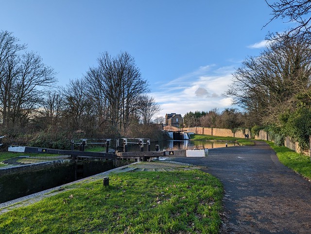
 
 Hanwell Flight of locks on the Grand Union Canal.
 
The Three Bridges
A little further west along the canal from the Hanwell Flight is another local landmark and another I K Brunel creation. The Three Bridges were originally known as Windmill Bridge and enable the crossing over of the canal by Windmill Lane and the crossing under the canal by the Great Western and Brentford railway at the same point.
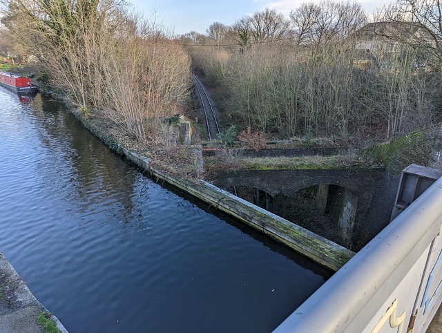
 
 Three Bridges, Hanwell.
 
Technically there are only two bridges, road over canal and canal over railway which is hidden in a deep cutting. Although as shown in the photo above there is another bridge-like structure across the railway between the bridge abutments. It’s also very hard to get a decent photo of all three unless you’re standing on the railway. The Three Bridges project was Brunel’s last to be completed before his death in September 1859, so Hanwell can claim a “first and last”.
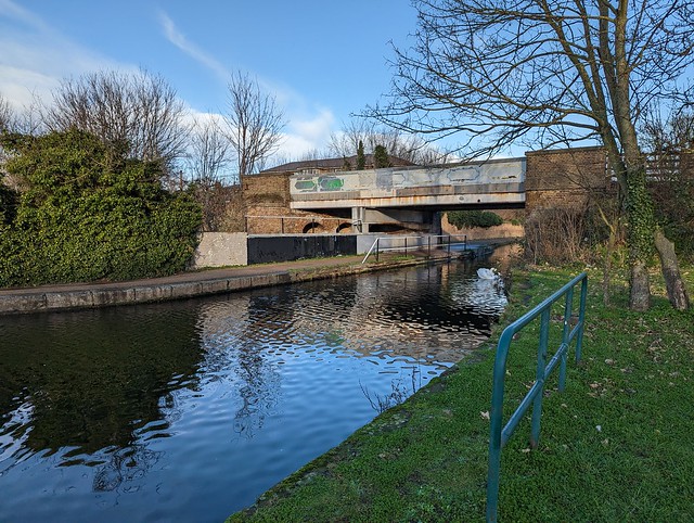
 
 Three Bridges, Hanwell.
 
Hanwell Clock Tower
Returning to the town centre there’s a nice and rather unusual modernist clock tower. This was built in 1937 to commemorate the coronations of King George VI and Queen Elizabeth (later known as the Queen Mother). Since then the design has occasionally sparked controversy, particularly from a local estate agent whose views were seen as arrogant and insulting. An estate agent being a dick, who’d have imagined that.
 
 Hanwell Clock Tower
 
It has survived though through bouts of neglect and threats of demolition and then restoration, the latest in 2002 to mark the late Queen Elizabeth II’s Golden Jubilee. Even the aforementioned estate agent relented in the end and accepted the clock tower as part of Hanwell’s streetscape. It tells the right time too, at least when I was there. 
 
City of Westminster Cemetery, Hanwell.
The dead centre of town is actually to the eastern side of Hanwell town centre. In the 1840s the cemeteries in the middle of London were full to overflowing, some messily so, and alternative sites for interment needed to be found outside the city. In 1853 the St. George's Hanover Square Burial Board purchased 12 acres in Hanwell for a new burial ground. A Victorian Gothic revival style church was built, designed by Robert Jerrard and the first interment took place in 1854. In 1883 another 11 acres of land was added.
 
 City of Westminster - Hanwell Cemetery
 
The cemetery suffered bomb damage during World War 2 and repairs were carried out to the chapel afterwards including a new stained glass window on the south side. There are quite a lot of impressive Victorian and later memorials and mausolea to be seen and a few notable burials to be found if you have more time than I had. There are some public toilets too but these were closed due to “antisocial behaviour”. In 1987, the cemetery was subject to some Tory shithousery when it was one of three that Shirley Porter's Westminster City Council controversially sold to land developers for 15p. However, like East Finchley and Mill Hill, it was reacquired by the new City of Westminster in 1990, and renamed at that point as their Hanwell Cemetery. 
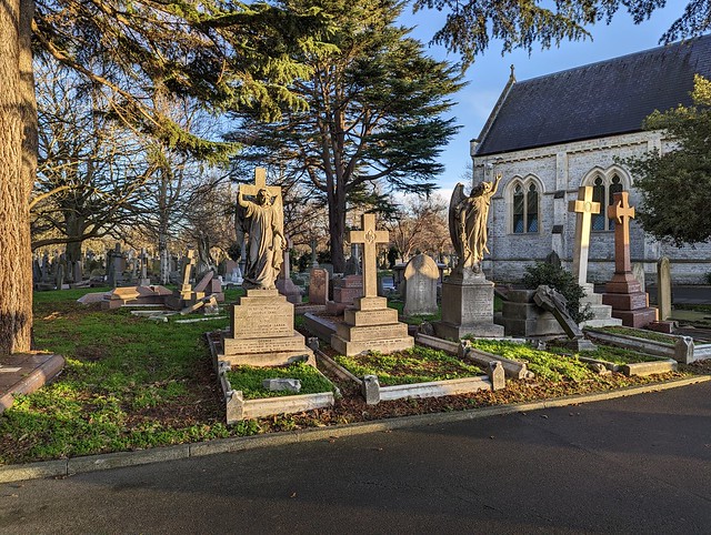
 
 City of Westminster - Hanwell Cemetery
 
North of the Uxbridge Road there is another large cemetery, the Royal Borough of Kensington and Chelsea Cemetery, Hanwell but since they close at 4p.m. in the winter there was no time to visit that one.
 
My afternoon exploring Hanwell done I walked back to the railway station and caught a #PurpleTrain back to the west.
 
All my Hanwell photos are here in this Flickr Album.

Sunday, 16 August 2020

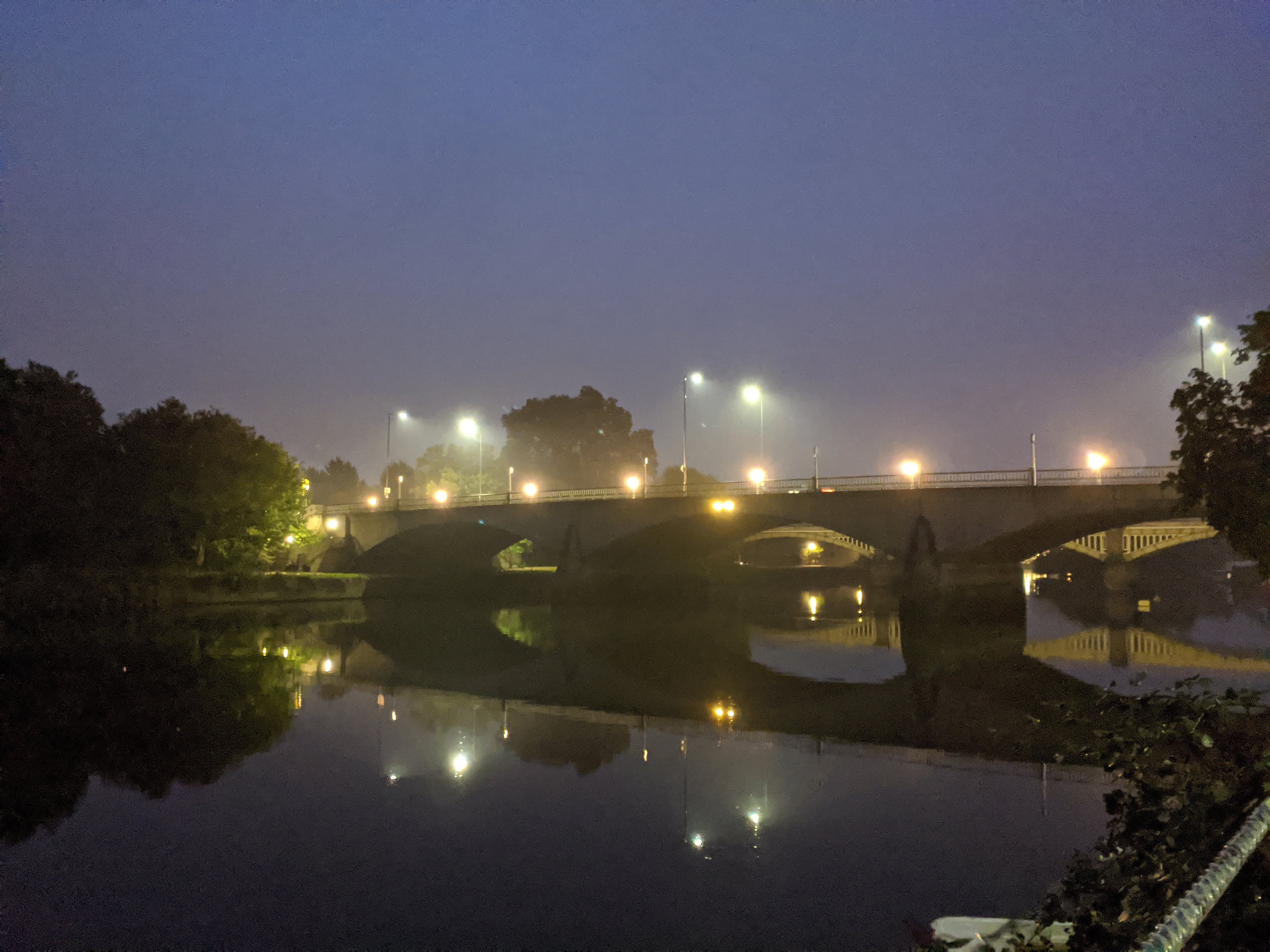
Three Richmond Bridges at night.

 Saturday 15th August 2020

A little nocturnal exploration of three bridges that cross the River Thames close together at Richmond, South West of London.

Richmond Lock & Footbridges

This interesting structure was what drew me to Richmond on a dull, damp post-lockdown Saturday evening when I had nothing better to do. So I parked by the river in Ranelagh Drive and went for a little walk.

Designed by F.G.M. Stoney (careful how you search for him!), Grade II listed, and opened in 1894 it combines a low-tide barrage with a lock at one end with a pair of footbridges. 


The footbridges support the suspended sluice gates which are used to maintain a navigable depth of water in the River Thames upstream when the tide goes out. Until some time in the second world war there was a 1d toll charged to pedestrians when crossing the bridge. Now it's free but the four disused toll-booths, one at each end of each bridge remain in situ. The bridge closes at night at 2130hrs in the summer or 1930hrs in the winter so I had about 15 minutes to cross it and take some photos which was ample. 

Richmond Lock is the furthest lock downstream on the River Thames and falls under the jurisdiction of the Port of London Authority. 

For about two hours either side of high tide the sluice gates are raised up into the footbridge structure and boats can pass through under the bridge arches. At other times they need to go through the lock for which there's a charge - currently £7 and only payable by card because of You Know What.


From the footbridge walkway you can see upstream to the other two bridges.

Twickenham Bridge

Despite lying between Richmond Lock and Richmond Railway Bridge this road bridge comprising three reinforced concrete arches is named Twickenham Bridge because it carries the road to the town of Twickenham, home of the world's largest Rugby stadium.

They couldn't call it Richmond Bridge of course because an 18th century arched bridge linking the two halves of Richmond already existed. Which I didn't go to on this visit. Twickenham Bridge was built in 1933 as part of the Chertsey Arterial Road - now the A316 which links southwestern suburban London to the M3 motorway at Sunbury - it was opened by Edward, Prince of Wales, (later King Edward VIII until he abdicated to marry Wallis Simpson, and was thereafter Duke of Windsor and an alleged Nazi sympathizer).

The bridge is Grade II listed, largely because of its Art Deco bronze lamp standards and balustrades. In 1992 the first Gatso speed camera in the UK was installed on Twickenham Bridge. 

Richmond Railway Bridge

Close to Twickenham Bridge the London Waterloo to Reading railway line crosses the River Thames approaching through the Old Deer Park on a viaduct.

Richmond Railway Bridge designed by Joseph Locke originally opened in 1848 when the line was extended from Richmond to Windsor. It was rebuilt in 1908 by the L&SWR chief engineer J W Jacomb-Hood replacing the 100ft iron girders with a steel truss design on the original piers and abutments as there were concerns over the integrity of the original structure. The main girders and decking were replaced again in 1984.


The Grade II listed bridge now carries multitudes of commuters (well not so much at the moment because of You Know What) on South Western Railway services.

I crossed back over the river and returned to the car past the night anglers and other characters lurking in the shadows just in time to get out of the returning rain.


This Flickr Album contains some more photos

The Bridges of Richmond

Friday, 3 April 2020

Hidden London - Moorgate Station

4th March 2020

In a previous era when we were able to leave home without the risk of catching the plague, having our shopping examined by the police, or being abused by self-appointed guardians of society on Twitter, I paid a visit to the disused parts of Moorgate Underground station by means of a Hidden London Tour by the London Transport Museum. Was it really only a month ago? For anyone old enough to remember 1975 Moorgate is synonymous with one terrible thing but there's more to the station than that.


Moorgate Station - Metropolitan Line

 Moorgate station in the City of London opened in 1865 as the terminus of the first extension of the Metropolitan Railway, intended to bring the line closer to the financial heart of the city. A year later extra platforms were added for the Metropolitan Widened Lines, a.k.a City Widened Lines, which gave more capacity in peak times. In 1868 these lines were extended to King's Cross and used by the Great Northern, London Chatham & Dover, and Midland Railways for services to that station. The Metropolitan Railway altered their terminal platforms in 1875 when they extended the line to Liverpool Street and Moorgate became a through station.


Moorgate Station - Northern Line

 Moving forward 25 years a second Moorgate Station was built when the City & South London Railway (now part of the Northern Line) arrived in 1900. This tube station on the other side of the road also incorporated a fancy 6 storey office building which became the company headquarters. Four lifts took passengers to the platforms deep below the ticket hall. In 1904 the Great Northern & City Railway joined the C&SLR at Moorgate, bringing main line trains through larger than normal tube tunnels from Finsbury Park direct to the city, relieving congestion at King's Cross. This meant there were two separate Moorgate stations (actually both called Moorgate Street at the time) and passengers wishing to change lines had to come up to the surface and cross the road. 


Old signage in subway tunnel

 Since this was a pain in the neck the three railway companies built a passenger subway to link the stations. This opened in 1912 and contained ticket offices for the three underground lines and mainline trains running over the City Widened Lines.

These subway tunnels form the first part of the Hidden London tour, (Were you wondering when I'd get to that?) where the guides explained much of the above history in the now very grubby tunnels after descending the spiral staircase - no lifts any more. As always the presentation given was excellent, pitched at the right level for "tube nerds" and "normal" visitors both.


Greathead Shield

The next section of the tour took us to Moorgate's "unique selling point" as far as station tours go. The Great Northern & City had always intended to extend it's line to Lothbury, further into the heart of the city and so a Greathead Shield was installed at the southern end of the tunnel ready to excavate the new line southwards. This required supporting money from the Great Northern Railway but they pulled out of the project and the tunnel went no further. The GN&C, heavily reliant on peak hour traffic was bought by the Metropolitan Railway in 1913. The Greathead Shield however was left in place and over 100 years later it's still there. After  being strongly warned against taking photos of the trains - the shield is located just beyond the live platform, ducking through a narrow service tunnel, and waiting until the platform is empty a raised walkway takes us to something you really won't see anywhere else on the network. (Though if you've walked through the pedestrian tunnel between the DLR and Waterloo & City at Bank station you'll have passed through the remains of a Greathead shield left in place after the line was completed and rediscovered when the DLR was built, look for the red metal ring partly embedded in the tunnel walls.)


Moorgate "catacombs"

During the Blitz the Metropolitan station at Moorgate was very heavily damaged being a subsurface station with open platforms not a deep tube. (So this is one Hidden London station tour where "used as an air raid shelter" isn't a theme.) Temporary repairs were carried out post-war pending the area's redevelopment. That redevelopment was part of the Barbican and entailed re-aligning the Metropolitan tracks between Barbican station and Moorgate. Between 1962 & 1967 a steel and concrete raft was built over the Metropolitan platforms and Moorgate Underground station actually became an underground station. Three seven storey office blocks were then built above. As part of the Thameslink project the City Widened Lines platforms were closed in 2009. Sometimes humorously referred to as the Moorgate Catacombs these are intended to be re-used as storage sidings for the Hammersmith & City and Circle line trains in 2020. The tour takes us through the working platforms and into the construction site to the end of the Widened Lines platforms where on the day I went we were lucky that the builders had left the lights on, affording a good view down the lines under the Barbican.


Metropolitan Railway "Diamond & Bar"

Moorgate station will be joined to Liverpool Street by the platforms of the new Crossrail* station - whenever that eventually opens, adding another chapter to the history and complexity of a station which I hitherto had rarely thought about except in connection with that terrible accident on 28th February 1975 when a train from Drayton Park failed to stop at the terminal platform, hitting the tunnel end wall at about 35mph and resulting in the deaths of 43 people. This was the Underground's worst peacetime accident but was the catalyst for the introduction of the automatic safety system, sometimes called the Moorgate System, that will stop a train entering a station too fast and that has been adopted on railways across the world.


(*Cross/Eliz/Purple/rail/train/Line 😉 )


Sunday, 19 January 2020

Clifton Rocks Railway

Sunday 12th January 2020
While looking at the map around Clifton Suspension Bridge something else of interest sprang off the page. In Sion Hill a little south of the suspension bridge was marked “Clifton Rocks Railway”. Searching the web revealed a disused funicular railway. In a tunnel. I had to go and have a look obviously.
The former top station is next to the Avon Gorge Hotel and is where there is most to see from the street. There were two entrances for passengers which lead down to the ticket hall and platforms below street level and you can look down through the iron railings into this area. A gap in the old awning of glass and iron pavement lights allows you to throw donations into a dustbin with a bell in. These donations go to the Clifton Rocks Railway Trust which has been formed by a group of volunteers to restore the Railway. Not as a working railway unfortunately as subsequent re-use of the tunnels since the railway closed in 1934 make that an impractical proposition.
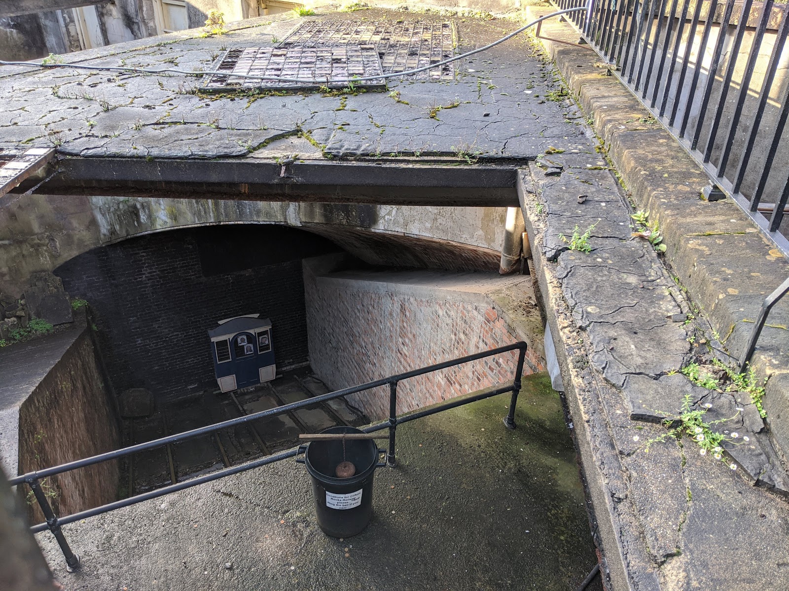
The railway opened in 1893 it had taken two years to build and cost £30,000 -twice as long and three times as much as originally planned. (Sound familiar?)
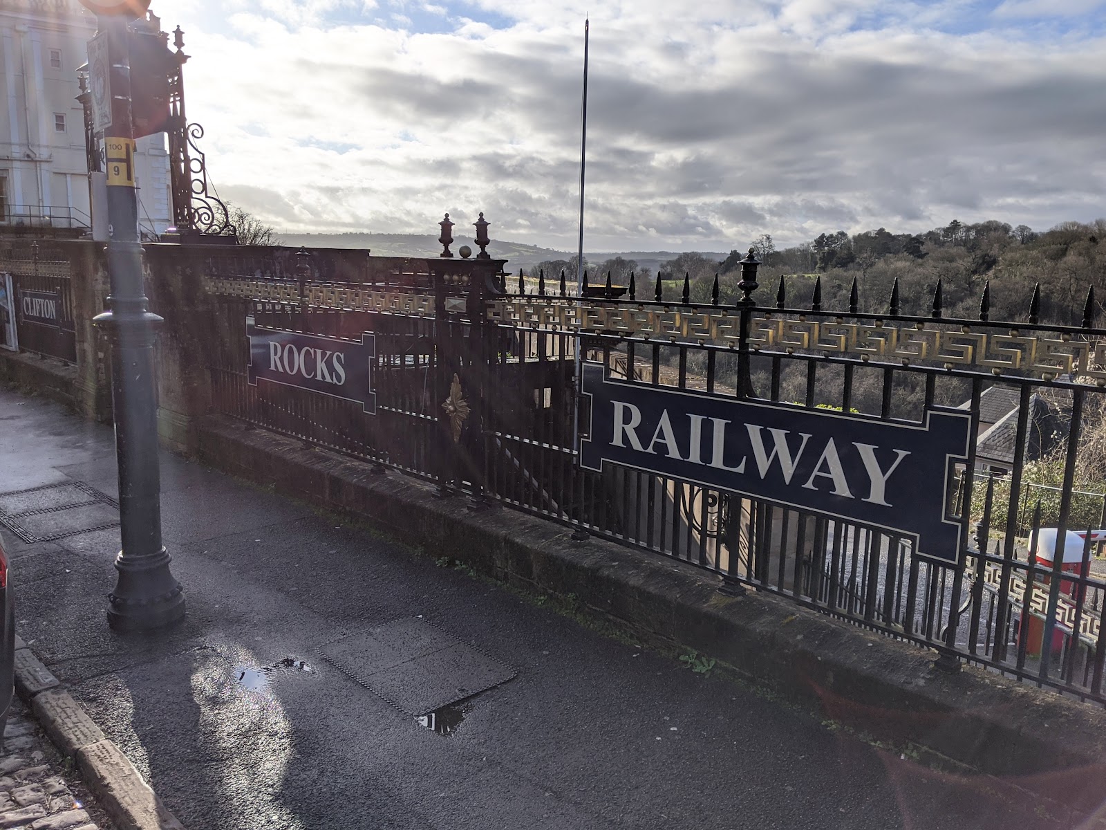
The tunnel is 500 feet long rising 240 feet at a gradient of 1:2.2. Semi-elliptical and lined with bricks it is 27 feet 6 inches wide andv18 feet high with two pairs of tracks allowing operation of four cars, in pairs connected by steel cables.
The cars were raised and lowered by means of adding or removing water from tanks under the car floors to balance the weight of car, passengers, and water tank so that the upper car going down pulled the lower car up the incline.
The railway was very popular on opening but that didn’t last and in 1908 it went into receivership, being purchased by the Bristol Tramway and Carriage Co.
In 1922 The Portway road (now the A4 Hotwell Road) was widened. This required the closure and demolition of the Bristol Port and Pier Railway from Sneyd Park junction up to and including the Hotwells terminus, leaving the Rocks Railway somewhat isolated. Also having a major road placed only inches from the bottom station made, and still makes, access difficult.
That rather heralded or at least hastened the end for the operation of the Clifton Rocks Railway and in 1934 it ceased operations.
This wasn’t the end of the line for the tunnel though. Well it was the end of the line as a railway obviously but five years later the tunnel, like so many others, got a new use.
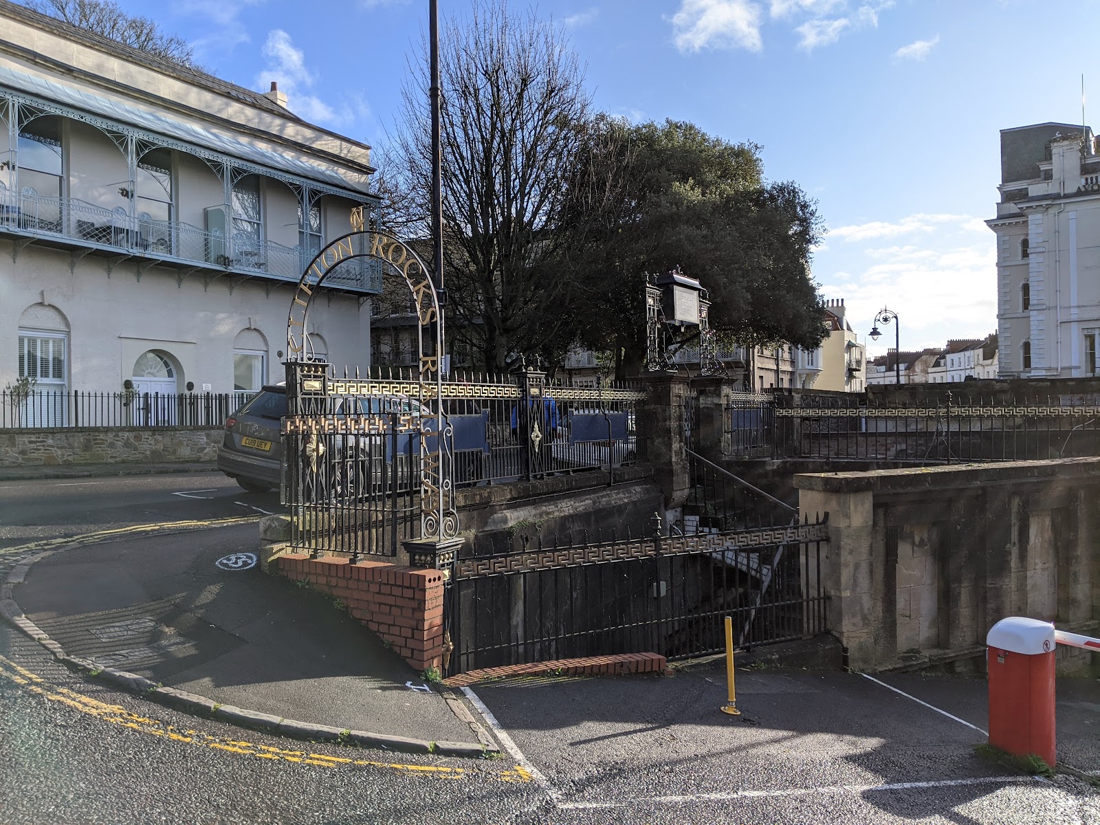
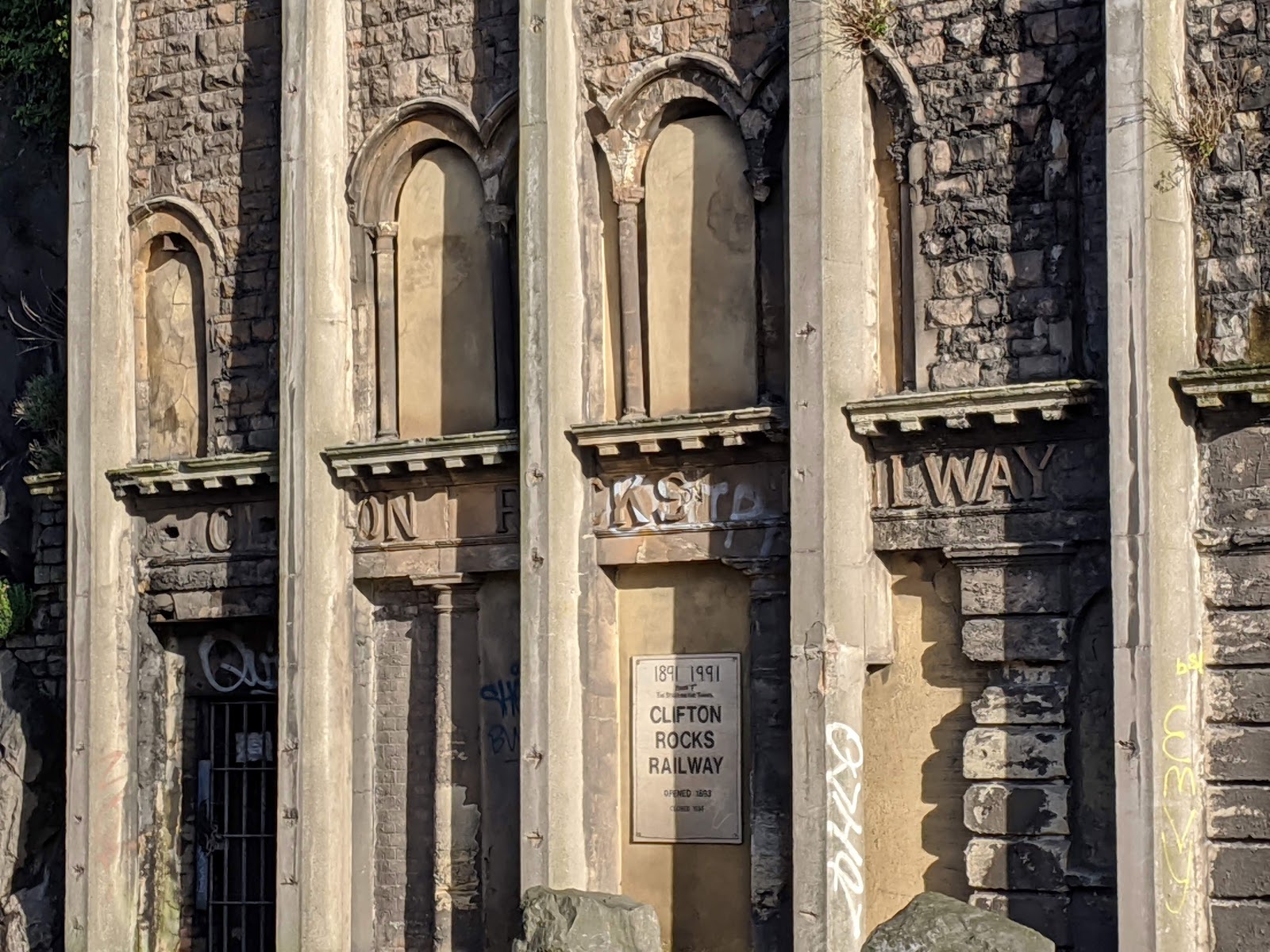
At the outbreak of the Second World War the Ministry of Works and Buildings leased the tunnel from the Tramways Company. In March, 1940. British Overseas Airways built an office suite and used part of the upper tunnel for storage. The ARP (Air Raid Precaution) Committee established air raid shelter number 1898.
In 1941 the four cars which had remained at the bottom of the tunnel since the railway closed were removed and the BBC moved in. They built a complex in the tunnel of four main chambers and three smaller rooms in the bottom station. From the top these contained transmitters, a studio for creating programmes, a recording room to record programmes which also contained enough recorded material for several weeks’ broadcasting, and a control room where eighty GPO land lines to other BBC sites could be switched. 
The three small rooms contained generators, ventilation plant, and of course a canteen because you can’t fight against Lord Haw-Haw without plenty of tea.
In the event the main BBC Bristol studios were never put out of action by the German bombing so the emergency studio at Clifton was never needed but the useful control room alone made the tunnel conversion worthwhile. The BBC continued to make use of the site until 1960 when advances in radio technology rendered it redundant.
In the late 1950s it became apparent that the facia of the bottom station was beginning to part company with the cliff face, a four inch wide crack having appeared between it and the rock face.As a result a series of tied buttresses were constructed along the face of the tunnel in Hotwell Road. These steel sections encased in concrete were anchored to the cliff using inclined anchors connecting the top of the assembly down into the rock behind. This has rather defaced the original facia of the bottom station.
The information above is just a brief summary of that supplied by Richard Hope-Hawkins on the excellent Cliff Rocks Railway website which is well worth visiting if you want to know more. You can also book tours via that site when they are running. I do hope they manage to open the site properly as a tourist attraction, given its proximity to the suspension bridge it surely has great potential.