Showing posts with label Disused Railway. Show all posts

Sunday, 11 October 2020

Lydney

 Monday 7th September 2020

Lydney Harbour

Day three on holiday and I'm looking for local history. Nearby in Lydney the map shows an ancient monument, Lydney Harbour which as well as a harbour has a canal and disused railway. Out into the wet and windy morning I went.
Lydney Harbour tidal basin
The harbour at Lydney wasn't quite what I'd imagine a harbour to look like (if I hadn't already checked the map) being long and narrow and looking more like a lock.

It lies at the end of a 1 mile canal and gives access to the tidal River Severn. The gates of the tidal basin shown here appear to be stuck open so that it is filling up with silt from the river. They're spending a couple of million on the site to upgrade the tourist facilities (hence the digger and wire fencing) so hopefully that will include fixing the gates. Parking is currently free though after the refurbishment who knows.


Between the tidal basin and the canal is a lock and the canal serves as a marina for small craft.

A bit of history: The canal opened in 1813 and the outer harbour was completed in 1821. Coal and iron ore from the Forest of Dean was shipped out, brought down by a tramway which was in 1868 converted to a broad gauge railway although in 1872 that was converted to standard gauge. 
As can be seen from the early 20th century map below there were extensive sidings serving the harbour.

Reproduced with the permission of the National Library of Scotland

Lydney Harbour former railway
Parts of the track bed can be seen and walked along and there are markers pointing out wrecks on the river shore and "sighting stones" core drilled through pointing at distant landmarks.

Also a circle of standing stones, not ancient but dating from the refurbishment of the harbour around 2006 - apparently it works as a compass, something I failed to notice at the time.


I walked along the track bed on the west side of the
Lydney Harbour marina

inner harbour then crossed the swing bridge and back up the east side to the lock and harbour entrance.

There are a lot of boats moored here, I'm not sure if they can get out onto the Severn until the tide gate is repaired? The Environment Agency page doesn't mention it.

The last coal was shipped from the harbour in 1960 but imported wood was still being brought in by barge from Avonmouth. In 1977 the harbour closed and began to fall into disrepair, scheduled as an ancient monument in the 1980s with the swing bridge Grade II listed the harbour re-opened after a two-year project of restoration and enhancement in 2005.

Lydney Harbour lock
There are still a few old buildings around the lock and harbour and if you look closely on the west side the remains of the coal tip shown on the above map where coal was offloaded from the trains to the barges.

The old mortuary building was inaccessible due to the ongoing building works - I gather it's going to be made into public toilets which will be dead convenient. Sorry.

Crossing back over via the lock gates I went out to the rather windy harbour entrance where I could see up and down the Severn. 


Severn Bridges
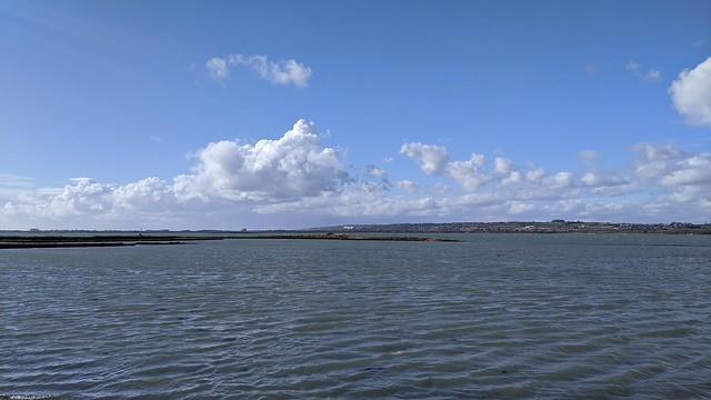
On a clear day you'd get a really good view of the Severn road bridges downstream, this wasn't a clear day and with occasional showers as well but the bridges were just about visible anyway. The view of the Berkeley Nuclear Power Station on the far side of the river was much clearer.

A short but heavier shower sent me from my perch on a bollard on the harbour wall back to the car.

So Lydney Harbour was interesting with quite a bit to look out for, let's hope they don't spoil it.


Lydney Junction

I parked in the railway station car park so that I could walk into Lydney town centre, between the two
lies Lydney Junction station, the southern terminus of the Dean Forest Railway. Crossing over the tracks at the level crossing this very shiny Brush Type 2 diesel locomotive was hard to miss. Newly overhauled I think.

I'd have liked to take a ride on the DFR but when I tried to book for the Wednesday trip discovered that it was not possible to book only one ticket. No doubt trying to maximise their income under COVID-19 restrictions which I can sort of understand during the busy summer period but mid week after the schools had (finally) returned? I doubt that the train was going to be full. I note that this restriction remains in place even now in mid October. Alienating potential customers could be a policy that comes back to bite them in the arse.

Lydney Town

I can tell you that the walk from Lydney railway station to the town centre isn't very interesting, apart from trying to get across the A48 without being mown down by traffic at the roundabout. That the River Lyd near the boating lake smells quite unpleasant, although that might be the treatment works, and that on this particular post-lockdown Monday a lot of Lydney was still shut. At least it was some exercise.


Tuesday, 3 March 2020

Hayling Billy

Sunday March 1st 2020
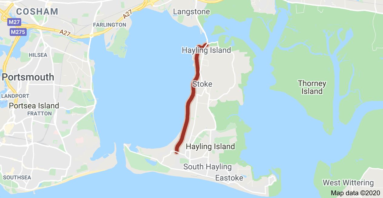
Hayling Island, east of Portsmouth doesn’t have a railway but it used to have one. A four and a half mile long single track branch line ran from Havant on the mainland, to Langston Station on the north east corner of Langstone Harbour (the railway never used the ‘e’), across a wooden swing bridge onto Hayling Island then via North Hayling station down the western shore of the island to the terminus at Hayling Island station near the popular beaches on the island’s south coast. 
What became known as the “Hayling Billy” was opened by the London, Brighton and South Coast Railway (LBSCR) for goods on 19 January 1865, and for passengers on 16 July 1867. The delay for passenger operation being a result of problems with the quality of the line’s construction meaning the Board of Trade inspector initially refused to certify the line as fit to carry passengers. Because of the weight restriction on the bridge over Langstone Harbour it was worked, from late Victorian times to closure in 1963 by small LB&SCR A1/A1X Class locomotives.
Remains of the railway bridge 
Heavily used in the summer by holidaymakers visiting the beaches of Hayling Island in the winter the trains were mostly empty.Nevertheless the line was able to run at a small profit. By 1962 however the bridge across Langstone Harbour needed replacement and British Railways decided this was not a reasonable investment. The decision was taken to close the line and the last scheduled passenger train ran on the evening of 2 November 1963. With hindsight this was probably a poor decision. Anyone who has sat in the interminable summer traffic queues getting on and off the island over the single road bridge would probably consider that keeping the railway would have been worth the required investment. Too late now, the bridge was dismantled and the track lifted in spring 1966.
Restored signal post
So you can’t ride on a train on Hayling island but you can walk the route (the part on the island at least) so that’s what I did on a dry but very windy Sunday afternoon. The island section is now a combined footpath, bridleway and cycleway. It has recently become part of route 2 of the National Cycle Network and called the Hayling Billy Trail. Just after the road bridge on the right is a small, busy car park with a tight entrance which serves as the trail starting point. Fortunately there was one space left.
A path from the car park leads to the south end of the bridge to the mainland, the remains of which are visible looking back towards the site of Langston Station. Here also is a restored semaphore signal post reinforcing that this is a disused railway line. You then back-track and follow the course of the line south.

Site of North Hayling Station
You can as I did take the detour via the former oyster beds which returns to the trackbed at the site North Hayling Station, nothing of which is now apparent. Here there was a sign saying that the next section was currently unsuitable for cycles due to drainage problems and indeed there was a fair sized part of the track that was flooded but as everyone knows cyclists cannot read - or choose not to. Walkers could pick their way around the flood on the raised bank on the seaward side. 
The route hugs the water side so there are good views across Langstone Harbour to Southsea and Portsmouth with the Spinnaker Tower being clearly visible. This also means it’s exposed to the elements which today meant a strong southwesterly wind. There isn’t much obvious in the way of railway “remains” though. The trail ends in West Town about 750 metres from the sea front where Station Road runs into Sinah Lane. Hayling Island Station was demolished but the former goods shed survives as part of the Station Theatre and is quite clearly a bit of railway architecture.
Former goods shed, Hayling Island station
If I could have worked out if, when, and from where the buses ran I’d have ridden back but instead I walked under a darkening sky that shortly unloaded a squall of horizontal rain and hail. This eventually passed and I was treated to an impressive rainbow. Which ws a little compensation for still being rather damp when I got back to the car park. At least the nearby petrol station has a Costa - a proper one with a counter and attractive baristas rather than a self service machine. It also has cheap fuel which is against the usual trend of anything on an island being more expensive. I filled up with flat white and unleaded before heading home.


Here's a Flickr Album of photos from Hayling Island
Hayling Island

Sunday, 19 January 2020

Clifton Rocks Railway

Sunday 12th January 2020
While looking at the map around Clifton Suspension Bridge something else of interest sprang off the page. In Sion Hill a little south of the suspension bridge was marked “Clifton Rocks Railway”. Searching the web revealed a disused funicular railway. In a tunnel. I had to go and have a look obviously.
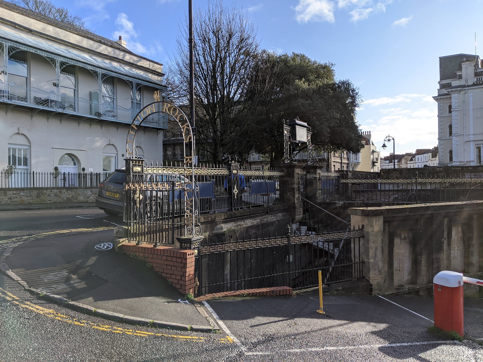
The former top station is next to the Avon Gorge Hotel and is where there is most to see from the street. There were two entrances for passengers which lead down to the ticket hall and platforms below street level and you can look down through the iron railings into this area. A gap in the old awning of glass and iron pavement lights allows you to throw donations into a dustbin with a bell in. These donations go to the Clifton Rocks Railway Trust which has been formed by a group of volunteers to restore the Railway. Not as a working railway unfortunately as subsequent re-use of the tunnels since the railway closed in 1934 make that an impractical proposition.
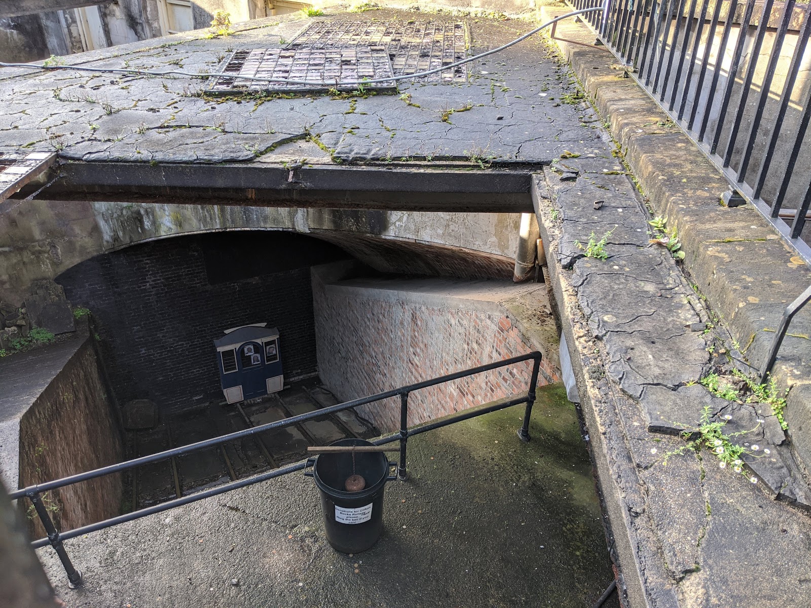
The railway opened in 1893 it had taken two years to build and cost £30,000 -twice as long and three times as much as originally planned. (Sound familiar?)
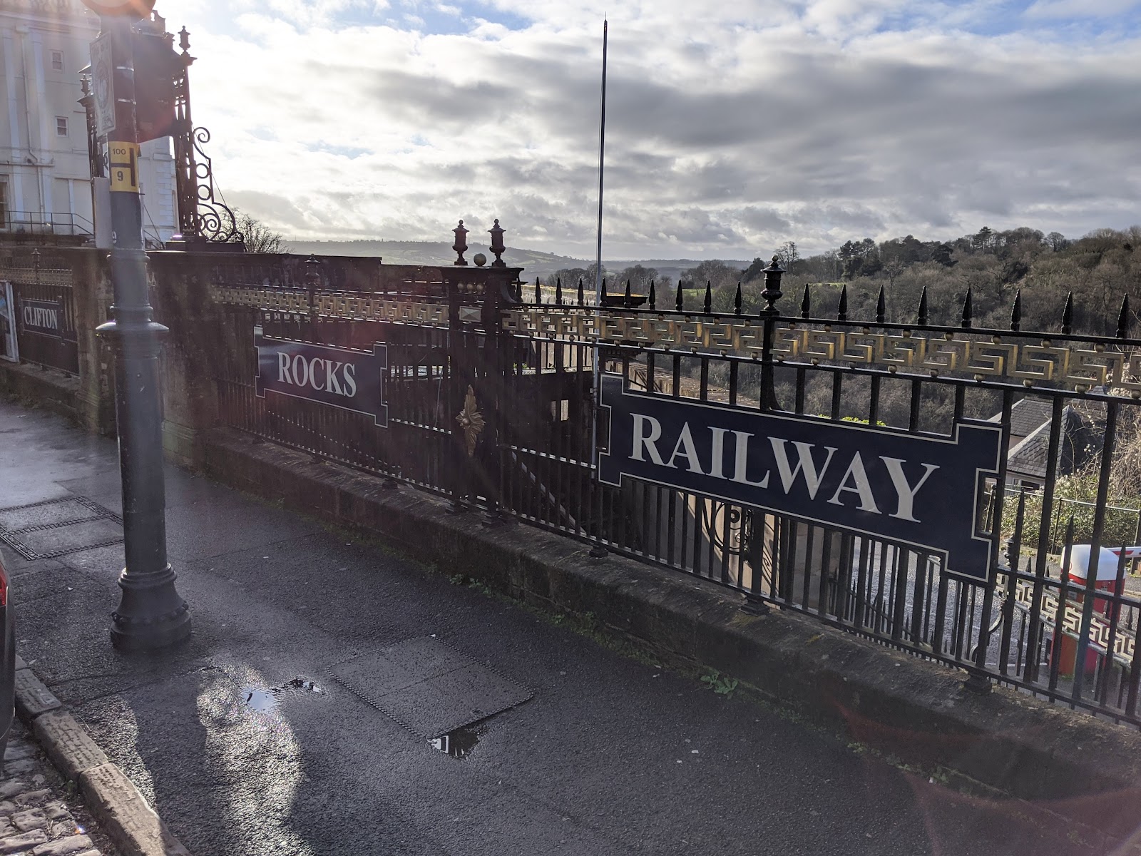
The tunnel is 500 feet long rising 240 feet at a gradient of 1:2.2. Semi-elliptical and lined with bricks it is 27 feet 6 inches wide andv18 feet high with two pairs of tracks allowing operation of four cars, in pairs connected by steel cables.
The cars were raised and lowered by means of adding or removing water from tanks under the car floors to balance the weight of car, passengers, and water tank so that the upper car going down pulled the lower car up the incline.
The railway was very popular on opening but that didn’t last and in 1908 it went into receivership, being purchased by the Bristol Tramway and Carriage Co.
In 1922 The Portway road (now the A4 Hotwell Road) was widened. This required the closure and demolition of the Bristol Port and Pier Railway from Sneyd Park junction up to and including the Hotwells terminus, leaving the Rocks Railway somewhat isolated. Also having a major road placed only inches from the bottom station made, and still makes, access difficult.
That rather heralded or at least hastened the end for the operation of the Clifton Rocks Railway and in 1934 it ceased operations.
This wasn’t the end of the line for the tunnel though. Well it was the end of the line as a railway obviously but five years later the tunnel, like so many others, got a new use.
At the outbreak of the Second World War the Ministry of Works and Buildings leased the tunnel from the Tramways Company. In March, 1940. British Overseas Airways built an office suite and used part of the upper tunnel for storage. The ARP (Air Raid Precaution) Committee established air raid shelter number 1898.
In 1941 the four cars which had remained at the bottom of the tunnel since the railway closed were removed and the BBC moved in. They built a complex in the tunnel of four main chambers and three smaller rooms in the bottom station. From the top these contained transmitters, a studio for creating programmes, a recording room to record programmes which also contained enough recorded material for several weeks’ broadcasting, and a control room where eighty GPO land lines to other BBC sites could be switched. 
The three small rooms contained generators, ventilation plant, and of course a canteen because you can’t fight against Lord Haw-Haw without plenty of tea.
In the event the main BBC Bristol studios were never put out of action by the German bombing so the emergency studio at Clifton was never needed but the useful control room alone made the tunnel conversion worthwhile. The BBC continued to make use of the site until 1960 when advances in radio technology rendered it redundant.
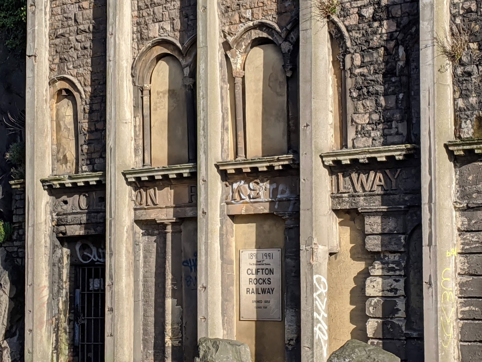
In the late 1950s it became apparent that the facia of the bottom station was beginning to part company with the cliff face, a four inch wide crack having appeared between it and the rock face.As a result a series of tied buttresses were constructed along the face of the tunnel in Hotwell Road. These steel sections encased in concrete were anchored to the cliff using inclined anchors connecting the top of the assembly down into the rock behind. This has rather defaced the original facia of the bottom station.
The information above is just a brief summary of that supplied by Richard Hope-Hawkins on the excellent Cliff Rocks Railway website which is well worth visiting if you want to know more. You can also book tours via that site when they are running. I do hope they manage to open the site properly as a tourist attraction, given its proximity to the suspension bridge it surely has great potential.

Wednesday, 8 January 2020

Walking on a disused railway viaduct.

Saturday 4th January 2020
Viaduct Way, Winchester.
About 2.6 miles, around an hour, mostly flat and good surface.
The main event of this little walk is the Hockley Viaduct, which was built in the late 1880s by the London and South Western Railway(LSWR) to provide a link over the River Itchen and water meadows, from the Didcot, Newbury and Southampton Railway(DN&SR), to the LSWR's main line. The DN&SR was originally intended to continue down the east side of the Itchen to Southampton, but had run out of money at Winchester. The viaduct crossed the valley to link the DN&SR to the LSWR, which still runs down the west side of the valley.


I started off at the South Winchester Park and Ride Car Park, exiting up the ramp onto Otterbourne Road and walking down to the roundabout and then crossing Hockley Link to pick up National Cycle Route 23 by the railway bridge (Sheep Wash bridge) over the South West main line.

It might be quicker to come out of the main car park entrance but this way you get a really good view of the viaduct that you’ll shortly be crossing.

Beyond the viaduct you can see the M3 motorway where it enters its cutting through Twyford Down. Was it really 28 years ago that Group 4 Security and the Dongas Tribe were fighting over that hill?

I followed the path around to the left until it met the road again and found the start of the Viaduct Way (or end of if you’re following the official guide).
The railway viaduct is not very far from the start/end of the path.

The viaduct was last used by the railway on 2 April 1966. The line it carried closed as a result of the Beeching plan but the whole structure remains standing and is open to walkers and cyclists. Since 2013 following restoration it forms part of the National Cycle Network Route 23.
Though fortunately on a cloudy January afternoon it was mercifully free of lycra-clad lunatics!
There are plaques giving info on the viaduct’s history on the walls along a number of artworks by Nicola Henshaw that reflect the history of Hockley Viaduct and mark the restoration of Viaduct Way.
The other and most obvious thing on the viaduct is this lattice signal post and semaphore signal arm, provided by the Friends of Hockley Viaduct.
I carried on across the viaduct meeting only one or two people - dog walkers and a runner.
There are good views and even the noise fro the M3 which runs parallel to the old railway wasn’t overly intrusive.
Near the northern end the viaduct crosses high over the River Itchen, along will some minor field flooding.
At the end of the viaduct the path bears left and passes under a bridge to run alongside the Itchen Navigation, a 10.4-mile disused canal system
that provided a trade route from Winchester to the sea at Southampton. Completed in 1710 it was known as a navigation because it was an improved river, with the main river channel being supplemented with cuts and locks used to bypass the difficult sections.
It was nver a hugely busy canal and the opening of the London and Southampton Railway in 1840 sealed its fate, and the navigation ceased to operate in 1869.
The remains of St Catherine’s Mill and Lock can be seen on the left of the path, with plenty of water rushing through the sluice this afternoon.
On the right of the path the bulk of St. catherine’s Hill rises 220 feet to a summit with a hill fort. 
Once cut off from the city by the old A33 Winchester Bypass road with the completion of the M3 that was removed and the area replanted as open grassland. 
It seemed to be very popular with local residents and grazing cattle alike and from here on the Viaduct Way was much busier.
Onward alongside the Itchen Navigation until it reached the car park at Garner Rd. where the way turns right, under a bridge beneath the Handlebar Cafe, few of whose customers appeared to have come by bike, and around to the left crossing Garnier Rd. on the old railway bridge.
Along here there are good views through the trees down to the Itchen on the left and not-such-good views fortunately screened by the trees to the right. Car park, household waste site, industrial estates.
Then on the left two hardy tennis players making use of the Kingsgate Lawn Tennis Club courts. I’m no expert (massive understatement!) but I think the ball’s supposed to go over the net.
After the tenns club the way joins Domum Rd. at the end of which I bore right onto Wharf Hill, then crossed over and turned left behind Seagram’s Mill to once again find the Itchen.

The river was flowing high and fast under the mill as it has been wet for weeks.
The last thing you’d want to do would be to fall in because it almost surely would be. Fortunately the river bank is walled and fenced off, the only thing going in the drink being a couple of angler’s bait. I didn’t see anything coming out mind you.
I crossed the river and turned right following it upstream towards the city centre.
On the left of the path are the Pilgrim’s School playing fields, Wolvesey Castle, and the Bishop of Winchester’s palace and Diocesan offices. Not that you can see any of that because of the old high stone wall they’ve built to separate themselves from hoi polloi like us.
A few hundred feet away on the other side of the river is the site of the DN&SR’s Winchester Cheesehill station, later renamed Winchester Chesil, which is a shame as the earlier name is much better. More of a shame still is that it’s now been replaced by the Chesil Multi-storey Car Park.

The way ends at the City Bridge. From there you could cross over the road to National Trust City Mill, which is good or turn left to the city centre which is stuffed with historical buildings. Abbey, Guildhall, Great Hall, and Cathedral (we know a song about that don’t we boys and girls) are the biggest but there’s a lot of ‘old’ in Winchester to look at.

It was also stuffed with January Sales shoppers so I grabbed a coffee and a sandwich then caught the bus back to the park and ride from the stop overlooked by King Alfred.


I’m not the only people I know to have walked the Viaduct Way recently and I may have been influenced by these two who made a video about it.
But I did it in the opposite direction

Here's the usual Flickr Album:
Viaduct Way
Ye Olde Flickr Album