Showing posts with label Underground. Show all posts

Tuesday, 6 August 2024

Hidden Holborn

1st August
 
I went on another Hidden London tour, Holborn - The Secret Platforms, run by the London Transport Museum. This was I’m pretty sure the second day of running tours at Holborn tube station but the guides were already well into the swing of things and as usual it was all well organised and very interesting. Our group was met outside and after safety briefing, ticket and ID checks led through the ticket barriers and through a door into a swelteringly hot small space for the initial introduction by our enthusiastic lead guide Becky. this lasted only a few minutes but it was still a relief to move on to the slightly cooler spiral staircase and go down the 193 steps (I didn’t count them but I reckon that’s about the equivalent of a 15 storey building 😉 ) with walls still covered in original tiles in a white, brown, and blue combination unique to Holborn.
 
 Holborn - The Secret Platforms
 
 After briefly emerging onto the eastbound Piccadilly Line platform we passed through another private door onto the disused platforms that formerly served the branch line to Aldwych. The first of which, that used to be the terminating platform, is now a row of disused offices and other spaces e.g. toilets. One of the rooms bore a sign for the “Central Line Model Railway Club”, sadly no longer used.
 
 Holborn - The Secret Platforms
 
 At the far end of the platform we were able to get to down the the tunnel towards Aldwych, with the tunnel lights switched on else we’d have just been looking into a black hole. We had a shuffle round to take photos and a quick plug for the Hidden London Aldwych tour (I’ve already done that one back in 2018) before returning to the office/platform area.
 
 Holborn - The Secret Platforms
 
 Before the station got too busy the disused platforms at Holborn were often used for filming. These days Aldwych or Charing Cross disused platforms tend to be used as they’re easier for film crews to access. We got a little film show here to remind us of some of the music videos filmed at Holborn and just how awful Superman 4 was, particularly the low-budget special effects!
 
Another short walk via tunnels and stairs took us past more original coloured tiles and a large fragment of early Piccadilly Line map to the other disused platform. This is the through platform, still connected to the tunnel in the photo above and to the live Piccadilly line to the north of the station so if you look down the tunnel in that direction and are patient you can get a view of the eastbound trains leaving the adjacent open platform. This platform has been used by TfL to test new platform decor so has some rather confusing signage.
 
 Holborn - The Secret Platforms
 
 Holborn - The Secret Platforms
 
The tour ended here with the customary round of applause for our four guides. It didn’t seem like about 90 minutes had passed which is the sign of a good tour and I even got used to the “Holl-born” pronunciation being used throughout, it’s always been “Ho-b’n” to me 😀. We returned to the ticket hall, thankfully not via the 193 stairs but taking time to appreciate the very long escalators instead. 
 
I took a lot more photos: Flickr Album
 
 Holborn - The Secret Platforms
 
I’ve only given a brief outline of the tour here, there’s a lot more to discover by actually going there and yes, it’s not a cheap day out but it is worth it so if you fancy doing it yourself bookings are being taken for Wednesday, Thursday, Friday, Saturday, and Sunday between now and November 10th with more dates to come in March 2025.

Monday, 8 January 2024

Walking from Roding Valley to Hainault

5th January 2024

This was the first day of 2024 on which there seemed to be a low risk of getting seriously wet. Wanting to relieve the winter cabin fever I took a long ride on the Piccadilly and Central Lines to a station I’d never been to before. It’s a station that most people haven’t been to either as Roding Valley is the least used tube station with only 259,271 entries and exits according to the latest official figures, 2022 at the time of writing. (Station Usage Data" (XLSX). Usage Statistics for London Stations, 2022. Transport for London. 4 October 2023.) So I’ve added 1 to whatever the 2023 figure turns out to be.
 
 Roding Valley, least used tube station.
 
 Served by the Central Line Woodford to Hainault shuttle there’s not a lot at Roding Valley station - not even a ticket barrier just Oyster/Contactless validators which must affect the accuracy of those entry and exit figures a little. I arrived from Woodford a little before half past midday a little disappointed not to have ridden on the newly refurbished train with its new moquette which is supposed to be running on the shuttle service. 
 
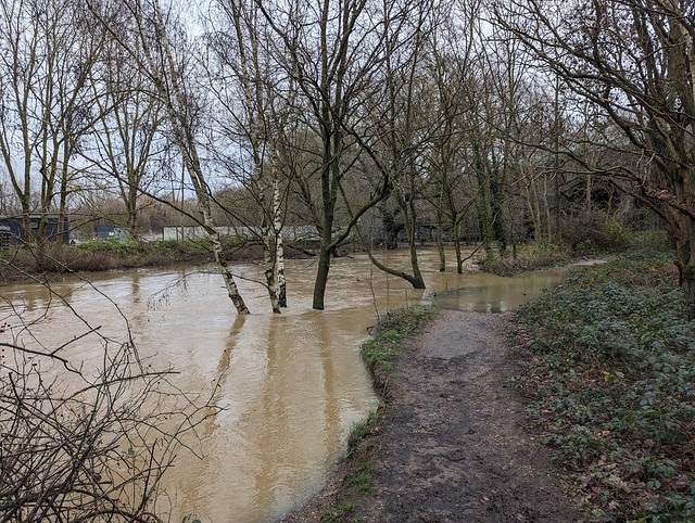
My “plan” was to take a short walk to either Grange Hill or Hainault and then head back into London again. I’d plotted a route on my phone which took me via Loughton Rugby Club, a short way along the River Roding under the Central Line to a bridge over the river and along Luxborough Lane to cross over the M11. Having crossed the edge of the rugby field I found that the Roding had other ideas.
 
 The River Roding in flood at the confluence of the Chigwell Brook.
 
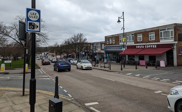
 There was about six or seven feet of the path flooded to “needs wellies” depth so I retraced my steps and found an alternative route via Ray Park, crossing over the river and under the M11 at Woodford Bridge, pausing for coffee at Costa on Chigwell Road. 
 
 ULEZ land, Woodford Bridge
 
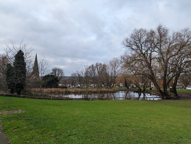
 Suitably caffeinated and having taken advantage of the other facilities I carried on past St. Paul’s Church and across the green by the pond then continued along Manor Road towards Grange Hill. A fairly busy road but with broad pavements and more importantly dry underfoot.
 
 Pond, Manor Road, Woodford Bridge
 
 Manor Road is peak Chigwell, isn’t it? Lined with very large detached properties behind big, often ornate gates mostly electrically powered. The front “gardens” nearly all paved over and accommodating a range of exotic or just large cars, many sporting personalised registration numbers (or twat-plates as I can’t help thinking of them). Visible alarm systems and CCTV adorn most of the houses. Every so often they’d got the builders in, refurbishing or extending the houses and blocking the footway with vans or skips. OK **** we’ll just walk in the busy road then shall we? Crossing the A23 the houses become more standard suburban fare and have suburban streets behind rather tan the golf course. On the opposite side of the road St. Winifred’s Church looks oddly utilitarian but is in parts at least older than it looks.
 
 St. Winifred's Church, Chigwell.
 
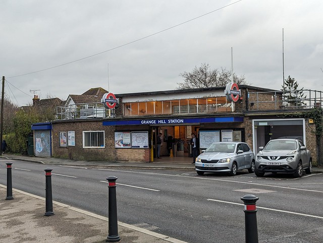
 I carried on along this less ostentatious part of Manor Road to Grange Hill Station. I could have got back on the Central Line here but Hainault is only a little further and I’d have needed to change trains there anyway. In fact the walk would have been shorter had I gone to Hainault directly but then I’d have missed the opportunity to make the obvious  low flying sausage joke
 
 Grange Hill Station
 
 So I passed by the station and turned down Long Green continuing along the alleyway at the end parallel to the railway. Rather unexpectedly there’s a World War II pillbox fortification here and a line of concrete tank obstacles along the edge of the line.
 
 WWII pillbox and tank obstables, Hainault.
 
 The alleyway emerges into Robina Close amongst blocks of flats and then via Clinton Crescent to New North Road where I turned right to Hainault Station entrance under the railway bridge.
 
 Hainault Stationentrance
 
 Hainault has some unusual tiled station name boards on the platforms which I thought reminiscent of a mid 20th century domestic fireplace particularly with the spaces intended for posters being mostly empty.
 
 Hainault Station tiled sign
 
 From the platforms the footbridge you can see the entrance to the Central Line Hainault Depot just north of the station. There are three platforms, one seems to be for the Woodford shuttle and the other two for trains towards London. Checking the next departures on both the TFL Go app and Google Maps showed completely different platform numbers to those actually being used so I followed everyone else onto the train at platform 3 that said it was bound for Ealing Broadway even though both apps said it was leaving from platform 1!
 
 Hainault Station
 
Roding valley ticked off I went to Gants Hill next but that’s another story. 


Thursday, 23 February 2023

Deep in the Bush

Wednesday 22nd February 2023

I had a personal tour of Shepherd’s Bush Underground station today.
 
 Shepherd's Bush Underground Station
 
I wasn’t expecting it to be a personal tour but I’d managed to book the 14:35 Hidden London Shepherd’s Bush tour and no one else had. So it was just me, the Hidden London guide, and the safety man that set off down to the platforms and then through locked doors to the parts of the station you don’t get to see as a passenger.
 
These include disused passenger tunnels from the several extensions and reconfigurations of the station, tunnels dug for ventilation, and former lift shafts whose function has been replaced by escalators.
 
 Hidden London, Shepherd's Bush, ventillation tunnel.
 
 As with the other Hidden London station tours I’ve been on it’s all atmospheric and grubby but underneath the dirt and later added behind-the-scenes infrastructure there’s a lot of original Central London Railway features.
 
 Hidden London, Shepherd's Bush, disused passenger tunnel and lift exits.
 
 Including these built in tiled poster cases at the end of one of the disused passenger tunnels.
 
 Hidden London, Shepherd's Bush, tiled poster frames in a former passenger tunnel.
 
Not having another 15 guests on the tour meant this time I could get pictures without other people in them for a change. My guide whose name rather embarrassingly has escaped my mind was keen and knowledgeable so I got the full show and as there was only two of us we were able to go into spaces where a full tour group would be unmanageable.
 
One of the other fun things about these tours is that you get to look out on the platforms from hidden spaces, to the amusement of the two young ladies who looked across the track to see two people waving and grinning from behind a ventilation grille.
 
 Hidden London, Shepherd's Bush, "Hello on the platform!", view through a ventillation grille.
 
 More photos in this Flickr Album
 
I can recommend this Hidden London tour, although I can’t guarantee that you’ll get the personalised version :-)


Friday, 3 April 2020

Hidden London - Moorgate Station

4th March 2020

In a previous era when we were able to leave home without the risk of catching the plague, having our shopping examined by the police, or being abused by self-appointed guardians of society on Twitter, I paid a visit to the disused parts of Moorgate Underground station by means of a Hidden London Tour by the London Transport Museum. Was it really only a month ago? For anyone old enough to remember 1975 Moorgate is synonymous with one terrible thing but there's more to the station than that.


Moorgate Station - Metropolitan Line

 Moorgate station in the City of London opened in 1865 as the terminus of the first extension of the Metropolitan Railway, intended to bring the line closer to the financial heart of the city. A year later extra platforms were added for the Metropolitan Widened Lines, a.k.a City Widened Lines, which gave more capacity in peak times. In 1868 these lines were extended to King's Cross and used by the Great Northern, London Chatham & Dover, and Midland Railways for services to that station. The Metropolitan Railway altered their terminal platforms in 1875 when they extended the line to Liverpool Street and Moorgate became a through station.


Moorgate Station - Northern Line

 Moving forward 25 years a second Moorgate Station was built when the City & South London Railway (now part of the Northern Line) arrived in 1900. This tube station on the other side of the road also incorporated a fancy 6 storey office building which became the company headquarters. Four lifts took passengers to the platforms deep below the ticket hall. In 1904 the Great Northern & City Railway joined the C&SLR at Moorgate, bringing main line trains through larger than normal tube tunnels from Finsbury Park direct to the city, relieving congestion at King's Cross. This meant there were two separate Moorgate stations (actually both called Moorgate Street at the time) and passengers wishing to change lines had to come up to the surface and cross the road. 


Old signage in subway tunnel

 Since this was a pain in the neck the three railway companies built a passenger subway to link the stations. This opened in 1912 and contained ticket offices for the three underground lines and mainline trains running over the City Widened Lines.

These subway tunnels form the first part of the Hidden London tour, (Were you wondering when I'd get to that?) where the guides explained much of the above history in the now very grubby tunnels after descending the spiral staircase - no lifts any more. As always the presentation given was excellent, pitched at the right level for "tube nerds" and "normal" visitors both.


Greathead Shield

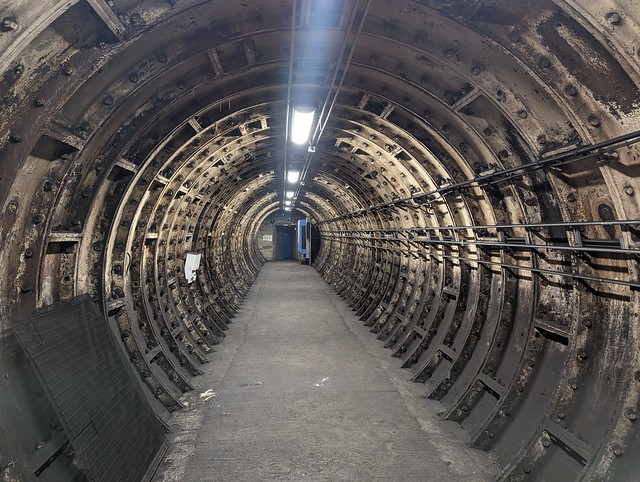
The next section of the tour took us to Moorgate's "unique selling point" as far as station tours go. The Great Northern & City had always intended to extend it's line to Lothbury, further into the heart of the city and so a Greathead Shield was installed at the southern end of the tunnel ready to excavate the new line southwards. This required supporting money from the Great Northern Railway but they pulled out of the project and the tunnel went no further. The GN&C, heavily reliant on peak hour traffic was bought by the Metropolitan Railway in 1913. The Greathead Shield however was left in place and over 100 years later it's still there. After  being strongly warned against taking photos of the trains - the shield is located just beyond the live platform, ducking through a narrow service tunnel, and waiting until the platform is empty a raised walkway takes us to something you really won't see anywhere else on the network. (Though if you've walked through the pedestrian tunnel between the DLR and Waterloo & City at Bank station you'll have passed through the remains of a Greathead shield left in place after the line was completed and rediscovered when the DLR was built, look for the red metal ring partly embedded in the tunnel walls.)


Moorgate "catacombs"

During the Blitz the Metropolitan station at Moorgate was very heavily damaged being a subsurface station with open platforms not a deep tube. (So this is one Hidden London station tour where "used as an air raid shelter" isn't a theme.) Temporary repairs were carried out post-war pending the area's redevelopment. That redevelopment was part of the Barbican and entailed re-aligning the Metropolitan tracks between Barbican station and Moorgate. Between 1962 & 1967 a steel and concrete raft was built over the Metropolitan platforms and Moorgate Underground station actually became an underground station. Three seven storey office blocks were then built above. As part of the Thameslink project the City Widened Lines platforms were closed in 2009. Sometimes humorously referred to as the Moorgate Catacombs these are intended to be re-used as storage sidings for the Hammersmith & City and Circle line trains in 2020. The tour takes us through the working platforms and into the construction site to the end of the Widened Lines platforms where on the day I went we were lucky that the builders had left the lights on, affording a good view down the lines under the Barbican.


Metropolitan Railway "Diamond & Bar"

Moorgate station will be joined to Liverpool Street by the platforms of the new Crossrail* station - whenever that eventually opens, adding another chapter to the history and complexity of a station which I hitherto had rarely thought about except in connection with that terrible accident on 28th February 1975 when a train from Drayton Park failed to stop at the terminal platform, hitting the tunnel end wall at about 35mph and resulting in the deaths of 43 people. This was the Underground's worst peacetime accident but was the catalyst for the introduction of the automatic safety system, sometimes called the Moorgate System, that will stop a train entering a station too fast and that has been adopted on railways across the world.


(*Cross/Eliz/Purple/rail/train/Line 😉 )


Sunday, 19 January 2020

Clifton Rocks Railway

Sunday 12th January 2020
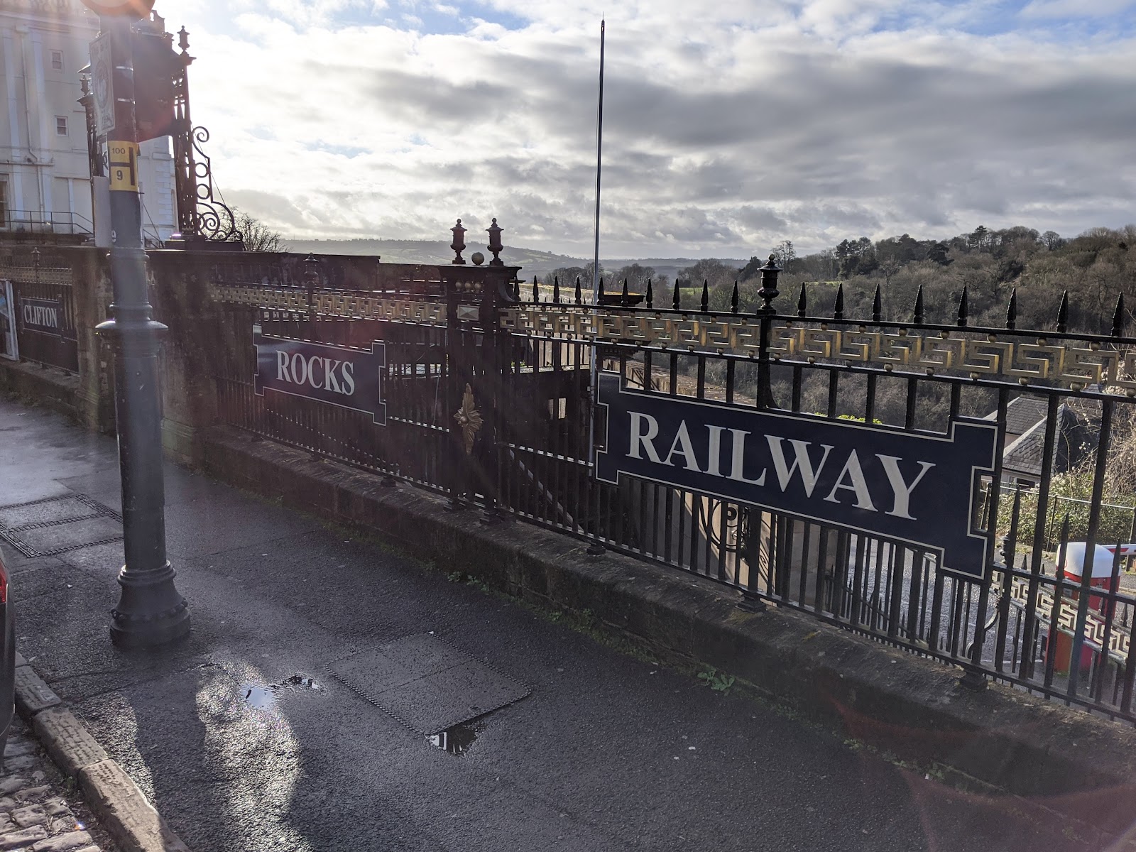
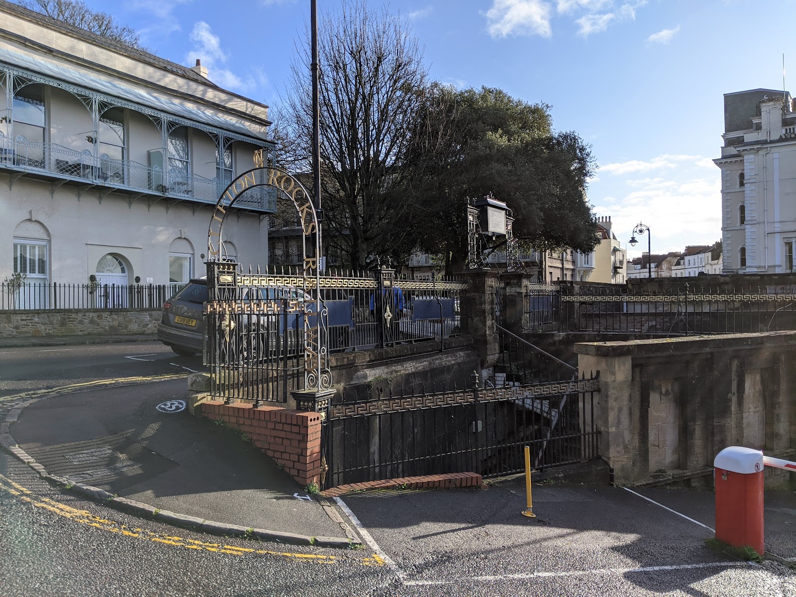
While looking at the map around Clifton Suspension Bridge something else of interest sprang off the page. In Sion Hill a little south of the suspension bridge was marked “Clifton Rocks Railway”. Searching the web revealed a disused funicular railway. In a tunnel. I had to go and have a look obviously.
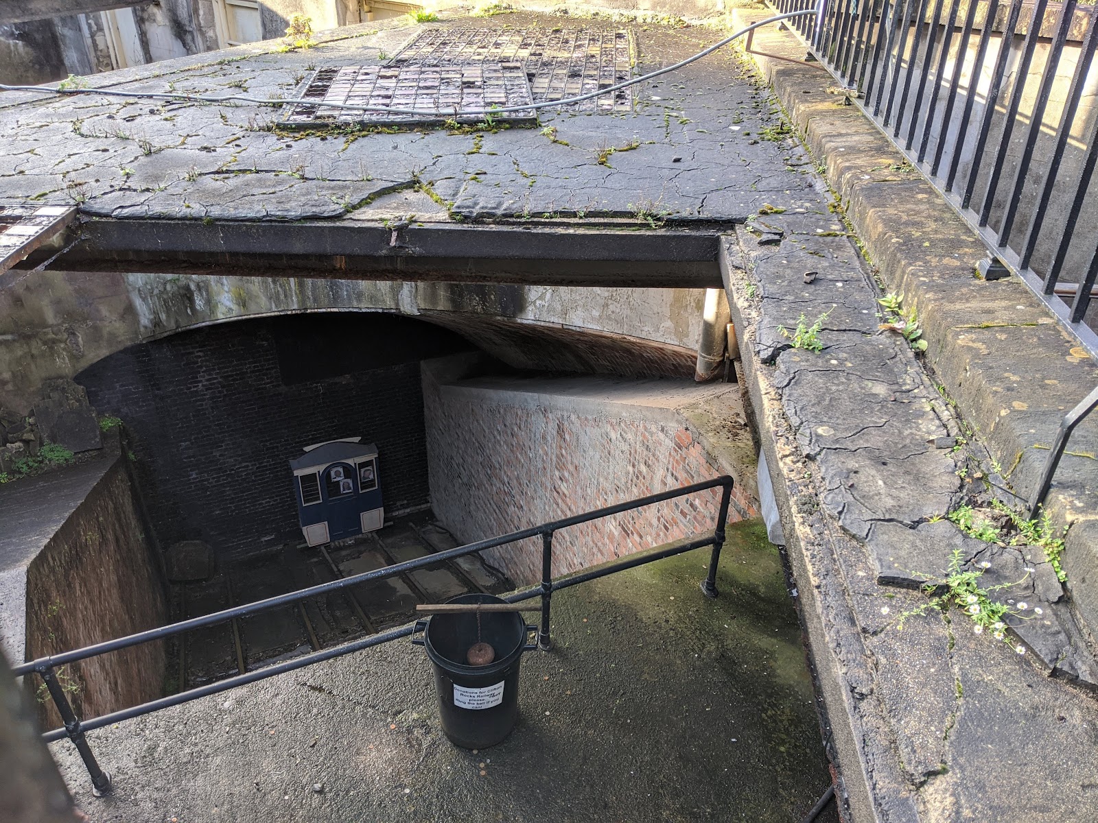
The former top station is next to the Avon Gorge Hotel and is where there is most to see from the street. There were two entrances for passengers which lead down to the ticket hall and platforms below street level and you can look down through the iron railings into this area. A gap in the old awning of glass and iron pavement lights allows you to throw donations into a dustbin with a bell in. These donations go to the Clifton Rocks Railway Trust which has been formed by a group of volunteers to restore the Railway. Not as a working railway unfortunately as subsequent re-use of the tunnels since the railway closed in 1934 make that an impractical proposition.
The railway opened in 1893 it had taken two years to build and cost £30,000 -twice as long and three times as much as originally planned. (Sound familiar?)
The tunnel is 500 feet long rising 240 feet at a gradient of 1:2.2. Semi-elliptical and lined with bricks it is 27 feet 6 inches wide andv18 feet high with two pairs of tracks allowing operation of four cars, in pairs connected by steel cables.
The cars were raised and lowered by means of adding or removing water from tanks under the car floors to balance the weight of car, passengers, and water tank so that the upper car going down pulled the lower car up the incline.
The railway was very popular on opening but that didn’t last and in 1908 it went into receivership, being purchased by the Bristol Tramway and Carriage Co.
In 1922 The Portway road (now the A4 Hotwell Road) was widened. This required the closure and demolition of the Bristol Port and Pier Railway from Sneyd Park junction up to and including the Hotwells terminus, leaving the Rocks Railway somewhat isolated. Also having a major road placed only inches from the bottom station made, and still makes, access difficult.
That rather heralded or at least hastened the end for the operation of the Clifton Rocks Railway and in 1934 it ceased operations.
This wasn’t the end of the line for the tunnel though. Well it was the end of the line as a railway obviously but five years later the tunnel, like so many others, got a new use.
At the outbreak of the Second World War the Ministry of Works and Buildings leased the tunnel from the Tramways Company. In March, 1940. British Overseas Airways built an office suite and used part of the upper tunnel for storage. The ARP (Air Raid Precaution) Committee established air raid shelter number 1898.
In 1941 the four cars which had remained at the bottom of the tunnel since the railway closed were removed and the BBC moved in. They built a complex in the tunnel of four main chambers and three smaller rooms in the bottom station. From the top these contained transmitters, a studio for creating programmes, a recording room to record programmes which also contained enough recorded material for several weeks’ broadcasting, and a control room where eighty GPO land lines to other BBC sites could be switched. 
The three small rooms contained generators, ventilation plant, and of course a canteen because you can’t fight against Lord Haw-Haw without plenty of tea.
In the event the main BBC Bristol studios were never put out of action by the German bombing so the emergency studio at Clifton was never needed but the useful control room alone made the tunnel conversion worthwhile. The BBC continued to make use of the site until 1960 when advances in radio technology rendered it redundant.
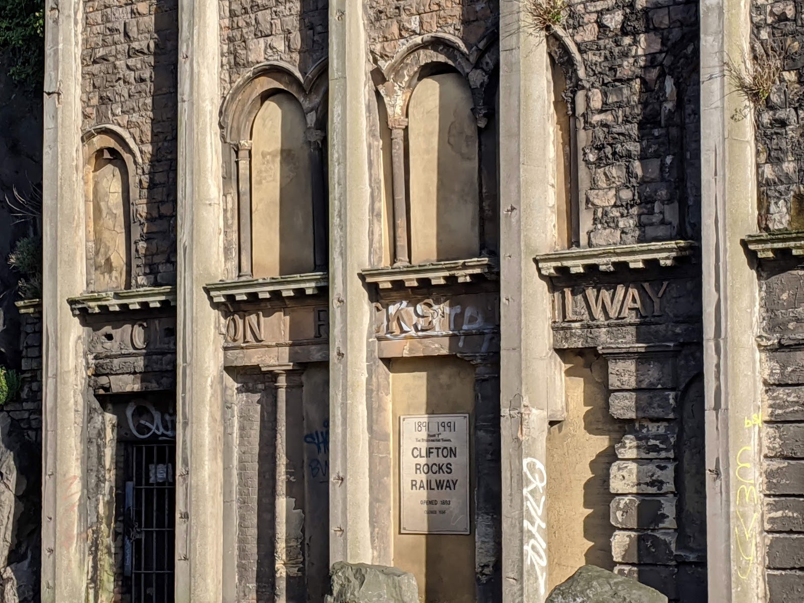
In the late 1950s it became apparent that the facia of the bottom station was beginning to part company with the cliff face, a four inch wide crack having appeared between it and the rock face.As a result a series of tied buttresses were constructed along the face of the tunnel in Hotwell Road. These steel sections encased in concrete were anchored to the cliff using inclined anchors connecting the top of the assembly down into the rock behind. This has rather defaced the original facia of the bottom station.
The information above is just a brief summary of that supplied by Richard Hope-Hawkins on the excellent Cliff Rocks Railway website which is well worth visiting if you want to know more. You can also book tours via that site when they are running. I do hope they manage to open the site properly as a tourist attraction, given its proximity to the suspension bridge it surely has great potential.

Sunday, 29 December 2019

An Urban Ramble, Art Deco Factories and Charles Holden stations.

Osterley Station to Acton Town Station

4.9 miles, about 1h 40m. Mostly level but with three flights of steps.

In theory urban walking means not getting muddy but that probably depends on the weather and time of year. My shoes will need to be cleaned.


This gentle urban ramble links five Piccadilly Line stations, three of which were designed by Charles Holden and two of which look like they were but in fact weren't. It also passes along part of the Brentford "Golden Mile" of Art Deco style factories.

Osterley station is the starting point for this walk.


Starting in the station car park, exit up the ramp and turn left. If you want a better photo you'll have to run across the Great West Road but in spite of the trees the concrete illuminated obelisk on top of Stanley Heaps' 1934 station building stands out. This is one of the not-Holden stations but in the same modern European style that Holden employed elsewhere.
Walk East along the A4 Great West Rd towards Thornbury Road. If you want to take a look at the former Osterley & Spring Grove station, which is now a book shop then head north up Thornbury Rd. and then come back to rejoin this walk.

Sticking up between the pre-war semis on the far side of the road is the St. Francis of Assisi church which opened in 1934 and was designed by Ernest C. Shearman, who also designed a number of similar churches in the London area.
More about its history can be found on the church's own web site.


Gillette Corner marks the western end of the Golden Mile beyond which the land belonged to the Church Commissioners, who would allow no factories to be built.

The Gillette Factory, designed by Sir Banister Flight Fletcher in 1936–1937. Gillette stopped using this factory in April 2006, moving production to Poland. The building was sold in 2013 for conversion into a mixed use complex with a hotel and residential apartments. It has also been used as a filming location.


The Coty Cosmetics Factory, 941 Gt. West Rd., designed by Wallis, Gilbert and Partners opened in 1932. The building now operates as BMI Syon Clinic. The factory was used for the manufacture of Coty soaps, lipsticks, scents and creams until 1979.


Only the boundary fences an gateways remain of the Firestone Tyre Company factory. Built 1928, designed by Wallis, Gilbert and Partners.The building frontage was demolished in an act of corporate vandalism by contractors working for Trafalgar House Plc. during a public holiday in August 1980, shortly before a preservation order was due to be served on it to retain the Art Deco architecture. What a bunch of bastards ☹️ The Art Deco gatehouse was demolished in 2004 to make way for increased parking facilities. The remaining gates, railings, and piers are in a Jazz Modern style and are Grade II listed.

The Pyrene Fire Extinguisher Company, 981 Gt. West Rd., built between 1929 and 1930, designed by Wallis, Gilbert & Partners. Pyrene established the concept of major fire demonstrations with the construction of a large demonstration ground alongside the Brentford factory, to simulate an oil storage depot. Now called Westlink House and available to let if you fancy it.

The Currys Factory and head office, 991 Gt. West Rd., built in 1936 as the distribution centre for Curry's chain of shops a wide variety of goods including bicycles, toys, radios and gramophones. Curry's started as a bicycle makers but are now much better known as an electrical retailer - Currys PC World. Now Grade II listed, the front office building was restored by Foster & Partners between 1997 and 2000 for JCDecaux.


Just before the A4 crosses the River Brent take the stairs on the left down to the Capital Ring walk and continue along the riverbank and over the river via the footbridge to enter Boston Manor Park.

Continue diagonally across the open area following the worn and at the time I was there rather muddy path that passes under the M4 motorway.
There is a rather unsettling rattling from the motorway bridge above as vehicles pass overhead.
The park was created in 1924 from part of the historic estate of the 17th-century stately home Boston Manor.

 The manor house itself was swathed in scaffolding and plastic sheeting but the lake was busy with gulls, and the gullible feeding them.

Exit the park at the other side of the lake onto Boston Manor Road and turn left. Continue past the suburban semis, some of which have heavy iron chains that appear to hold up their porches but are almost certainly only decorative. Eventually you reach Boston Manor Station.

Originally opened in 1883 by the District Railway, Boston Manor station was reconstructed in 1932 to a design by by architect Charles Holden, the Art Deco styled structure features a tall tower which acts as a landmark of the area and is Grade II listed. If you cross the road in front of the booking hall and (if you're tall enough) look over the bridge parapet you get a good view of Northfields Train Depot, the other side of which is our next destination, Northfields station. Head back down Boston Manor Rd. on the opposite side to the station and turn left through the iron gates into Blondin Park.

 Continue past the allotments on your left and into the open space of the park. The land was acquired by the Municipal Borough of Ealing in 1928 and opened as a public park called Northfields Recreation Ground. In 1957 it was renamed Blondin Park after Charles Blondin the famous French tightrope walker, who lived locally in Niagara House. Exit the park into Blondin Avenue and at the end of the street turn left and walk up the road to Northfields Station.

The current Northfields station opened in 1932 replacing that of around 1911. Located on the east side of Northfields Avenue, the new station was designed by Charles Holden in a modern European style using brick, reinforced concrete and glass. Like the stations at Sudbury Town, Sudbury Hill, Acton Town and Oakwood that Holden also designed, Northfields station features a tall block-like ticket hall rising above a low horizontal structure that contains station offices and shops. The brick walls of the ticket hall are punctuated with panels of clerestory windows and the structure is capped with a flat concrete slab roof. Our next stop is not far away. Turn left out of Northfields station and left into Bramley road. Continue straight ahead into Airedale Road and at the end of the street turn left. Soon you will come to South Ealing Station.

The platforms of Northfields and South Ealing are only 300m apart. For the story of why they're so close see here.
South Ealing isn't a Charles Holden design but does have a little tower in his style even though the building only dates from 1988. Since our next stop is a bit further away this is a good place to stop for a coffee in one of the cafes in the parade of shops either side of the station. Once refreshed cross the road and walk south, turning left into Sunderland Road. Continue into Maple Grove and when you come to the open grass area of Village Park Recreation Ground take the path diagonally across it and walk up Almond Ave. Turn right into Elderberry Rd. passing the huge Ealing Electricity Substation on your left and being glad you don't live in one of the houses opposite. At the end of the road turn left onto Popes Lane and cross the road.

Follow Popes Lane for about half a mile. It's not the most interesting road to walk along being mostly semi detached houses on the right and sports grounds on the left. I've not been able to determine which Pope gave it its name either.
Eventually however it will bring you to Gunnersbury Park.


I've covered Gunnersbury Park in more detail in a previous posting. It's worth diverting into the park for a look around before continuing this walk, and both refreshment and relief may be obtained therein subject to opening hours. If you've more time to linger then a visit to the museum in the large mansion will well repay your time spent inside.

Onward to the final leg. Turn right out of Gunnersbury Park onto Pope's Lane (or if you didn't go in, then carry on along Pope's Lane) and cross over the A406 Gunnersbury Avenue dual-carriageway into Gunnersbury Lane.

About five minutes further walking brings you to our last stop, Acton Town Station, on your right.
Acton Town station was opened as Mill Hill Park on 1 July 1879 by the District Railway (now the District line).It remained as a terminus until on 1 May 1883 and 23 June 1903 the DR opened two branches from Acton Town to Hounslow Town and Park Royal & Twyford Abbey respectively. On 4 July 1932 the Piccadilly line was extended to Acton Town and now it serves both Piccadilly Line and District Line trains. The original brick-built station was built in 1879 and in February 1910 the station building was reconstructed. In 1931 and 1932 the station was rebuilt again in preparation for transferring the Uxbridge branch service from the District line to the Piccadilly line. The new station was designed by Charles Holden in a modern European geometric style using brick, reinforced concrete and glass. Similar to other Holden designed stations, Acton Town features a tall block-like ticket hall rising above a low horizontal structure housing the station offices and shops. The ticket hall has a projecting London Underground roundel sign over a canopy, the brick walls of the ticket hall are punctuated with panels of clerestory windows and the structure is capped with a flat concrete slab roof. It was given Grade II listing in 1994.

From Acton Town you can either get the tube back to Osterley or... well the world's your lobster really ☺️


More photos, a Flickr Album:

Urban Ramble. Osterley to Acton Town