18th May 2021
My pre-booked leave coincided with the date the government let us go and stay away from home so I booked an Air BnB in Bolster Moor near Huddersfield in the hope of getting a little gentle hill walking in, weather permitting. In the event the Tuesday was the best day with the rest of the week descending into what can only be described as bloody wet. Lucky then that Tuesday was the day I picked for a walk up to the monument on Stoodley Pike, starting from and ending at the little car park at the Yorkshire Water facility by Withens Clough Reservoir.
The road up to the car park is narrow and rough, with enough potholes that I was a little surprised to meet a guy in an Aston Martin coming the other way. Not the ideal vehicle for that sort of road! There’s a height barrier at the car park entrance set at 6 feet, OK driving in but had to remember to duck walking out.
The advantage of starting from Withens Clough is that the climb up to Stoodley Pike is less steep than from the north, following the Calderdale Way along the edge of the reservoir and then at the signpost turning right up onto the moorland with the sheep.

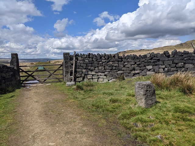
At which point the weather turned Yorkshire enough to require putting on a waterproof coat before continuing upwards to a gate with a carved medieval stone marker nearby, the Te Deum Stone, this is a boundary stone or maybe coffin rest from when coffins were carried over packhorse trails from villages that did not have their own burial grounds. And I was able to look that up online as I passed because it also has a pretty good 4G signal!
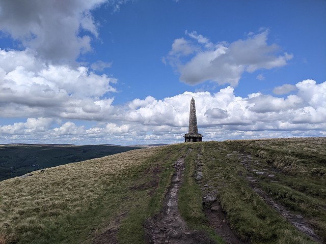
Through the gate I turned right up a slightly steeper and rather squelchy path towards the top of the ridge, my first sight of Stoodley Pike monument, and some spectacular views down to Todmorden and Makinholes below.
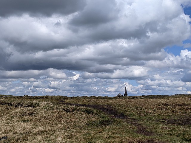

After a brief sit down on a convenient rock to take photos I carried on along the ridge to the monument, meeting other humans for the first time on the walk, not many though, some walking their dogs and others just getting out onto the hills. I imagine that it can get crowded in the main holiday period, the paths worn into the ground between the rocks and bogs would seem to bear witness to its popularity.
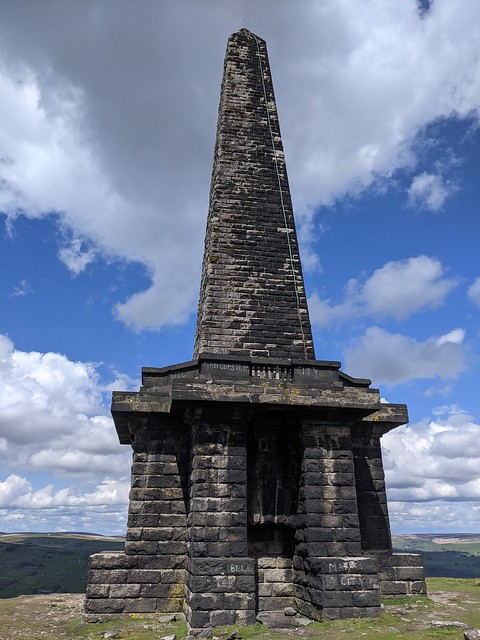
It’s a big bit of stonework which being 1300 feet up affords great views and can be seen from a long way off. The 121ft tall structure here is a replacement, completed in 1856, of a monument built in 1815 to commemorate the defeat of Napoleon. That fell down in 1854 after decades of Yorkshire weather and then being struck by lightning. The inscription on the monument tells the tale:
A PEACE MONUMENT
ERECTED BY PUBLIC SUBSCRIPTION
COMMENCED IN 1814 TO COMMEMORATE
THE SURRENDER OF PARIS TO THE ALLIES
AND FINISHED AFTER THE BATTLE OF
WATERLOO WHEN PEACE WAS ESTABLISHED IN 1815.
BY A STRANGE COINCIDENCE
THE PIKE FELL ON THE DAY THE RUSSIAN
AMBASSADOR LEFT LONDON BEFORE THE
DECLARATION OF WAR WITH RUSSIA IN 1854.
WAS REBUILT WHEN PEACE WAS RESTORED IN
1856
RESTORED AND LIGHTNING CONDUCTOR FIXED
1889
The “war with Russia” mentioned is the Crimean War October 1853 to February 1856.
Target achieved. Break out the flask of coffee.
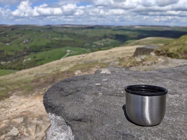
Having sat for a while watching the comings and goings of the people (mostly over the precipitous side of the hill facing Mankinholes) and passing the time of day with other walkers I planned a route back down to the car initially following the Pennine Way east then turning south along a marked path to the west of Sunderland Plantation woods. The threat of more rain appeared to have gone away and the sun was pleasantly warm but now the risk of getting wet was from the bottom upwards, the path following streams and across bogs where the way was only discernible by looking for the yellow-topped wooden posts marking the route. I wouldn’t have wanted to go that way in bad weather.
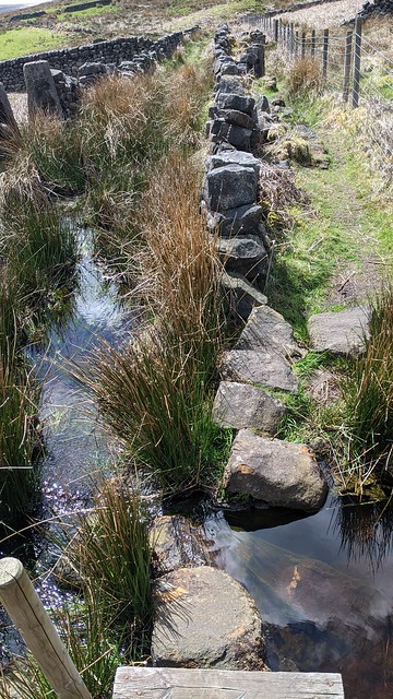
There’s a path here, believe it or not! Or a wall. Or a stream. Or maybe all three. Yes, it is as deep as it looks.

Having managed to negotiate the swamp without falling in I stopped by this stone gatepost and checked the way back to Withens Clough Reservoir. Apart from the sheep and the birds it was very quiet with not a soul in sight. Unless sheep have souls of course and even if they do you can’t see them so why we use that phrase? Emerging back onto the track beside the water via a gate in the drystone wall (confirming that I was on the path I thought I was on) and realising that it was only just after two o’clock I decided it would be good to walk around the far side of the reservoir and back across the dam to the car park.

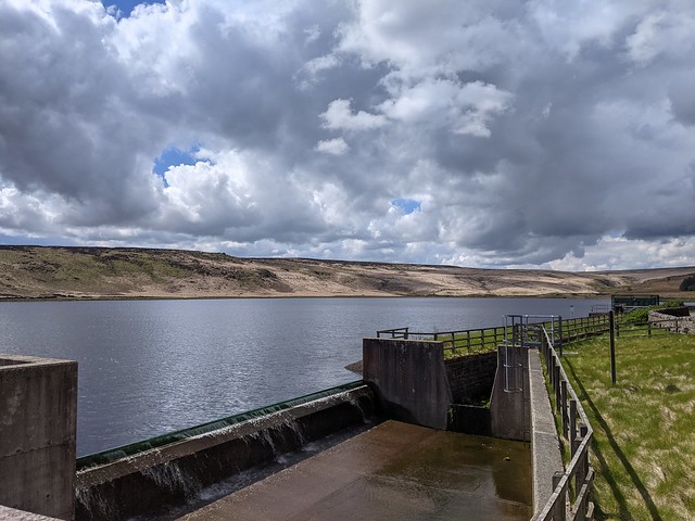
The Withens Clough reservoir was constructed by Morley Borough Corporation in the early 1890s and it served the town via a 20 mile pipeline and intermediate service reservoirs in the borough boundaries. The path on the far side is partly on a narrow raised bank with the reservoir lapping at on side and a deep water-filled ditch on the other. Inevitably I was going to meet someone coming the other way walking seven assorted dogs on leads. She certainly had her hands full and it was fortunate we passed at a point where the path was at its widest. Once around the reservoir is obviously a regular professional dog walkers route and when I next saw her in the car park she loaded them all into a van and scraped (literally) out under the height barrier making a noise to set your teeth on edge.
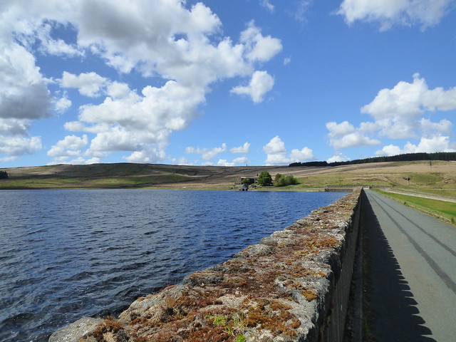
Withens Clough dam. Turn right at the far end back down to the car park.
It was a nice walk, moderately challenging, wouldn’t want to do it in bad weather though, such as any of the following three days.
Route statistics:
Distance walked 5.1 miles (8.2km).
Up 586m.
Down 596m.
Max height above sea level 411m
Total time 1 hr 48m excluding stopping, sitting, taking photos or drinking coffee.
Start/finish at Withens Clough Car Park, Rudd Lane 53.7058064N, 2.0214075W
No comments:
Post a Comment