Monday 26th July 2021
We’d got back our “freedom” and the rain had let up for the day at least according to the forecast. Time to pick a random destination and get back on the rails.
The source of the River Thames lies in a remote meadow near the village of Kemble in Gloucestershire - which used to be in Wiltshire. At least the official source is, some argue that it’s actually at Seven Springs about 11 miles further north at the source of the river Churn because that flows into the Thames and is further from its mouth. That would make it the longest river in the UK but must be wrong otherwise surely the river that runs through Reading,Oxford (yes, I know, Isis), and London wouldn’t be called the Thames and the rowing regatta would be held at Henley-on-Churn. Also the former TV channel would have been Churn Television although you could argue that would have been more apt.
Anyway the source in Trewsbury Mead has an official memorial stone and a signpost and all that so ignore the pedants. It’s also conveniently not too far from a railway station (Kemble) and a pub so that’s where I went to find the start of the longest river in England. No, the Severn is partly in Wales so you can delete the comment you were about to write.
We now have a somewhat irregular service pattern on our railway line, introduced last year to go with the replacement trains that we haven’t got yet, which means that as far as I can make out the first off-peak service to Reading, to connect with the GWR main line, is at 1026. That would have got me to Kemble at 1140, plenty of time to walk to the source and then go and have a pub lunch. Unfortunately as well as being irregular the service is unreliable and that train was cancelled due to a points failure and the next was consequently about 20 minutes behind schedule arriving at Reading just in time to watch the 1153 to Kemble (the one an hour later than the one I should have been on) depart from platform 7. There is no 1253 train from Reading that stops at Kemble so I had to go to Swindon and wait for a train to Kemble that started there. Actual arrival at Kemble was 1341 a bit late for lunch (good job i’d bought a picnic on the way) but just qualifying for a 100% Delay Repay refund on my ticket. I’d have preferred to have been on time.
Kemble Station is small, with long platforms and a large water tower at one end of the down platform in traditional if faded GWR colours. Since this part of the line hasn’t been electrified it also still has its iron lattice footbridge linking the two platforms, not yet replaced in order to provide space for overhead wires such as has happened elsewhere. From the road bridge on the London side a spur of track can be seen leading off to the north. This is the remains of the Cirencester branch line, opened by the Cheltenham and Great Western Union Railway in 1841 and closed on 4th October 1965. This branch crossed the course of the River Thames north of Kemble at about where the A429 does now, making it then the highest/uppermost rail crossing on the river.
It’s about a mile and three quarters (2.8km) from Kemble Station to the source of the Thames, leaving the station north car park and turning left for a few yards then right onto a broad grass footpath and you are off the road for the rest of the walk except for crossing the A433.
| © OpenStreetMapcontributors |
A little way before getting to the A429 there’s a Thames Path sign pointing left over a wooden footbridge and shortly after you are following the River Thames. It might be a little difficult to spot unless there’s been a lot of rain though. On my visit it was visible only as a reed-filled ditch about 3 yards across.
Further along the path crosses a farm track which itself crosses the Thames on a sort of low bridge or culvert, so water must flow here in some quantity at times although it was bone dry today.
The Thames Path rises to cross the A433 Tetbury to Cirencester road near where it crosses the Thames, which it the highest road crossing on the river although in contrast with the lowest crossing it requires neither bridge nor tunnel to do so, the river being small enough to be culverted so it’s hard to work out where the actual crossing is.
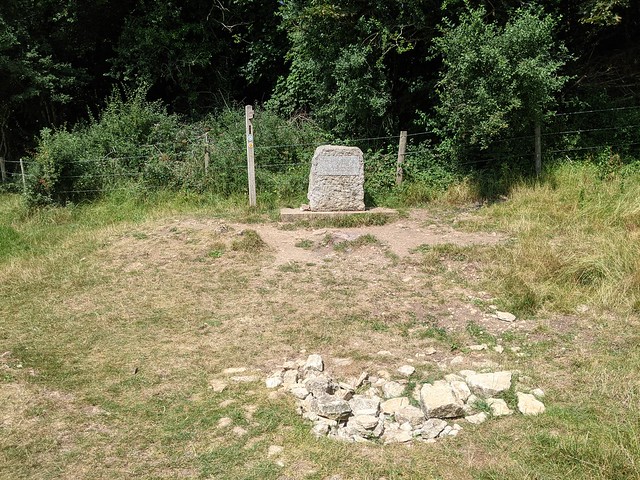
I followed the clearly marked path that climbed gently across the fields of Trewsbury Mead to the obscure corner the edge of the woods where the stone memorial and a pile of rocks in a shallow depression mark the official, accept-no-substitute Source Of The River Thames.
The inscription on the stone, unreadable due to wear and bright sunlight, reads
"The Conservators of the River Thames
1857 – 1974
This stone was placed here to mark the
Source of the River Thames".
1857 – 1974
This stone was placed here to mark the
Source of the River Thames".
Alongside the stone is the first (or last) Thames Path footpath sign, pointing the way down the 184 miles of the national trail to the barrier at Woolwich, which is definitely a lot noisier and busier than this end. I ate a solitary picnic against the only suitable tree that I could find to shelter under from the now quite hot sun, not even disturbed by the middle-aged couple walked down from the other direction, took their selfies, and returned the same way.
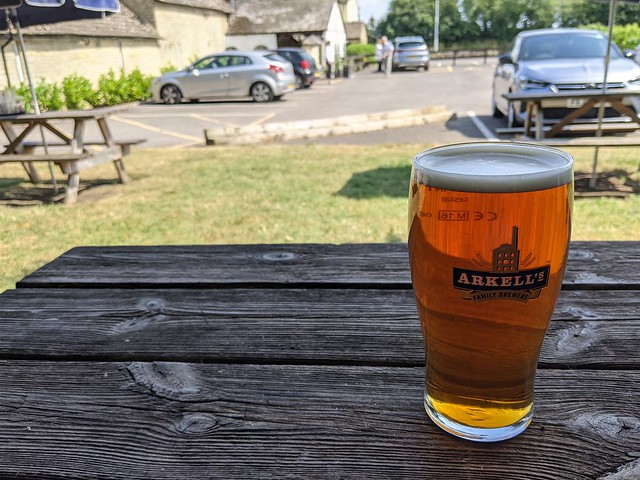
Then I returned along the Thames Path to the A433 and turned right along the road and under the railway to the Thames Head Inn. Because it would be rude not to really. It was the first time I’d set foot in a pub for over a year due to you-know-what but i remembered how it worked and enjoyed a nice pint of Hoperation IPA (ABV: 4.2%) sitting in the shade in the beer garden. I might have had another but had a train to catch from Kemble three quarters of a mile away down a country lane. A train which actually ran on time, as did the connection at Reading, making a better end to the day out than the beginning.


