Sunday, 26 May 2024

A week in t’North.

WARNING: Long rambling post or a long post with rambling.
 
A week in the Yorkshire Dales is always a welcome thing. It had been many years since I’d had one so I set about planning a holiday and finding somewhere to stay. I settled on Ingleton on the western edge of the Dales and this would be a road trip because going by train wouldn’t be practical. The village used to have two stations and still has an impressive viaduct but the last train called in 1954. At around 265 miles this would be the longest road trip I’d driven for a couple of years, I wasn’t looking forward to the drive but needs must. It wasn’t too onerous in the end. Apart from getting around Birmingham obviously.
 
Ingleton
 
My “cottage” for the week was actually a 3 bedroom semi about twice the size of my actual home, overkill maybe but the price was right. I had received key finding instructions which said “third rock on pile of earth by garden wall” but the owner met me on arrival and handed me the key personally. Once settled in I went for an early evening explore around the village to get my bearings. It didn’t take long, it’s not a big place. It does have all the things you need though, a Co-op shop, three pubs (one alas closed at the time), and a really good chippy (confirmed on the final night of my stay because that was Friday). There are a couple of restaurants too, though they and the pubs had somewhat odd opening times, being closed for days at a time. I had a nice pint in the Three Horseshoes though, sitting in the small garden out back. Much of Ingleton is picture postcard worthy.
 
 Ingleton Village
 
 And as mentioned, there’s that disused railway viaduct.
 
 Ingleton viaduct
 
 Ingleton Waterfalls Trail
 
The following day dawned bright and sunny and was forecast to remain that way so I kitted up for a walk and did what visitors have been doing here since 1885, that is joined the queue to get into Ingleton Waterfalls Trail, paid my admission fee (2d in 1885, £10 in 2024), and headed off with all the other Sunday walkers up the valley. The trail is about 4 miles long on mostly well surfaced paths and steps, with fences and barriers at the bits where you might end up falling for the rest of your life. It takes in several sets of waterfalls as it follows the River Twiss up Kingsdale to the 14m high Thornton Force, then up and over to Chapel-le-Dale to follow the River Doe back to Ingleton village. 
 
 Ingleton Waterfalls Trail, Pecca Falls.
 
 It was busy, although not so crowded that you couldn’t get good photos of the falls. I imagine it might be more of a challenge in the main holiday season. you can see where the admission charges get spent on maintaining the route, there are a lot of steps and surfaced paths to cope with the numbers of feet passing over them. The trail is a one-way route with a one-way gate where it crosses the River Doe out of the privately owned part of the valley. It was also very hot and many people were taking the opportunity to cool off in the pool at the foot of Thornton Force.
 
 Ingleton Waterfalls Trail, Thornton Force.
 
 My tracker on the phone says I walked a bit under five miles including to and from the house and it took about two hours since I really wasn’t rushing it. It’s a really nice walk and definitely worth the tenner. I’ll bet it’s utter hell in the school holidays though.
 
Ribblehead
 
Monday was cooler but the forecast was dry. I had been considering climbing Ingleborough but thought better of it, it’s big and scary viewed close up and I think my days of solo mountaineering have probably passed. So instead I plotted a little ramble around the Ribblehead Viaduct, somewhere I’ve visited several times but never really explored the surroundings. I parked up on Blea Moor Road a little east of Gauber Road and headed along the Three Peaks Walk to the east of the viaduct.
 
 Ribblehead Viaduct
 
 I climbed on up the hill to Blea Moor Signal box where a freight train was waiting in the siding as if posed for a photo.
 
 66774 waits at Blea Moor Signal Box headed south
 
 The signal box and the area surrounding it was a hive of activity, fenced off with scaffolding around the box and orange-clad workmen busy on site. Couldn’t get a decent photo from that side. Of the three cottages that stood nearby only number 3 remains and that in a state of dereliction. Too remote a spot for most people to make a home I guess with a convoluted access via an unmade track from the other side of the Settle-Carlisle Railway. Lovely spot in summer but it must be pretty bleak here in winter.
 
 No.3 Blea Moor Cottages (Nos. 1 & 2 now demolished)
 
 I retraced my steps a bit then passed under the railway onto the Dales High Way alongside Little Dale Beck, leaving behind the Three Peaks Walkers and heading west towards Winterscales Farm. Peace and quiet. Well apart from the sheep, the sound of water running over the stones in the beck, and the occasional distant motorbike. I stopped for a drink of water and watched the train leave the siding and head towards Ribblehead Viaduct.
 
 Little Dale Beck & Blea Moor Signal Box
 
 Then I carried on past the farm and onto the narrow lane Kirkby Gate. Where I made a new friend. Usually lambs head off to find mum when you walk by but this one walked straight up to me while I was taking a photo, sniffed my knees, and nonchalantly wandered off along the road the way I’d come.
 
 Sheep & Ingleborough from Kirkby Gate track Inquisitive little devil, isn't it?
 
 At the next farmyard I turned left down towards the bridge over Winterscales Beck and left through a gate to Gunnerfleet Farm where I took the path to the right back to Ribblehead Viaduct, getting a view of it from the other side which I’d not seen before - not that it looks particularly different, I’d just not been this side of it previously.
 
 Ribblehead Viaduct
 
 And then I passed under the viaduct to rejoin the Three Peaks Walk (and the walkers) back to the car. No photograph can give you a sense of the sheer bulk of the structure that standing under it gives you. It’s an incredible bit of engineering and history, the Wikipedia entry is worth a read if you’re unfamiliar with it.
 
 Ribblehead Viaduct
 
 Having completed my gentle four and a half mile ramble I celebrated with a 99 from the Yorkshire Ice Cream van parked by the road junction.
 
Then I went for a little circular drive back to Ingleton, stopping at Dent on the way. I stayed at Dent in 1994 on the campsite just outside the village. My abiding memories are that the farmer next to the site chose that particular day to get the muck-spreader out in the adjacent field and that a group with small tents decided to pitch them right close to the back of our old camper van so that we had to step over their guy lines to get in and out and right by the exhaust pipe too, they might have regretted their refusal to move when we came to leave. I do recall Dent being much livelier than it was today though, it was really quiet in the village - until several fast jets screamed low overhead anyway.
 
 Dent Village
 
 Morcambe & Heysham
 
To the seaside, by train from the tiny rural station at Wennington which has a free car park, albeit only seven spaces and is a short drive from Ingleton. Off peak day return £6.70 with a Railcard is probably cheaper than driving there and parking. It took less than an hour for the two carriage diesel to reach Morecambe Station having briefly encountered Carnforth along the way and reversed at Lancaster to take the branch to Heysham Port.
 
 Wennington Station, 158791 to Morecambe
 
 I walked east along the prom, pausing by the statue of the town’s most famous son, the comedian Eric. I obliged a group of ladies who wanted their photo taken with the statue, and did a selfie too. I’m not sure why since I’m not particularly a fan. Although Morecambe & Wise were rarely off the telly when I was a child I’ll venture the unpopular opinion that they weren’t as funny as everyone seems to remember and certainly don’t hold up well now. Anyway, the statue is the closest I’ll get to meeting either of them, although I did once work at Ernie Wise’s house when I was an apprentice telephone engineer. He wasn’t home. Maybe just as well since we accidentally let the dog out and set off the burglar alarm. Having reached the beach by the slipway where a few boats were moored I decided to turn around and walk back westwards instead and find a cup of tea.
 
 Morecambe
 
 That quest was fulfilled at the Stone Jetty Cafe, a former railway station on the pier and adjacent to the small lighthouse. Morecambe has a complicated history of railway station openings and closures but this one was Morecambe Harbour between 1848 and closure in 1904. Morecambe Promenade closed in 1994 and the building is now a pub. The current rather basic Morecambe station opened in 1994 but is located in the same place as Morecambe (Northumberland Street) which existed from 1848 to 1907. I said it was complicated.
 
 Morecambe Pier Light & Stone Jetty Cafe
 
 From the end of Stone Jetty (and indeed from most of the prom) you can see all the way across Morecambe Bay to the hills of the Lake District. I now had some time to kill before getting the train back at 1730 and on impulse decided to walk along the seafront to Heysham (having checked first that I could get a bus back to Morecambe Station) where the map showed some interesting archaeological features.
 
Heysham
 
After a level walk along the seafront I climbed up onto the sandstone headland adjacent to Heysham village. I wasn’t sure what was actually there having done no more research than glancing at the map on my phone. What’s there is the ruins of the 8th century St.Patrick’s Chapel, some graves hewn out of solid rock, and a spectacular view out across the sea to Cumbria. It’s all in the care of the National Trust as well so there are information boards etc. It was worth the walk.
 
 St. Patrick's Chapel, Heysham
 
The part of Heysham village around the newer St. Peter’s Church is quite picturesque too. I made my way up to the bus stop and returned to Morecambe in good time to get the train ‘home’.
 
It’s Grim Up North
 
Wednesday was a bit wet. As in getting on for 40mm of rain in 24hrs wet. The furthest I ventured out was to get some milk from the Co-op and that was far enough. I did finish reading Agatha Christie’s The Mystery of the Blue Train though.
 
Sizergh
 
Thursday’s forecast was a bit uncertain but looked at least a bit drier in the afternoon so I made use of my National Trust membership and drove up to Sizergh. This medieval house has been home to the Strickland family for over 800 years despite them being papists and picking the wrong side in several major disagreements over the centuries. Pretty standard National Trust fare, lots of nice old furniture, many portraits with unmistakeable family likenesses, usual tale of declining fortunes meaning transferring the property to the NT but the whiff of wealth and privilege remains. As do the Stricklands.
 
 Sizergh
 
 The gardens were nice to wander around especially as the rain had ceased but having walked round them the queue for the cafe was longer than I was prepared to stand so I decided it was time to move on elsewhere.
 
 Sizergh
 
 Aysgarth Falls
 
was the elsewhere I settled on. I’ve been there before but usually after a bit of a dry spell but after yesterday’s downpours I figured they’d not be short of water and I was right.
The Upper falls
 
 Aysgarth High Force , Aysgarth Falls
 
The Middle falls
 
 Aysgarth Middle Force, Aysgarth Falls
 
The Lower falls
 
 Aysgarth Lower Force, Aysgarth Falls
 
They were ideal for playing with long exposure mode as you can tell. After walking round the falls and back to the car park I sat on the tailgate of the car to change out of my boots and drink the coffee I’d got from the nearby cafe. There then followed an incident of minor upset. As I sat there with my coffee a middle-aged guy walked by with a cheery “‘Ow do Pops” as he passed. “Pops”?! Fortunately by the time the enormity of this remark registered with me he was out of earshot else he might have heard me mutter something about a “leaky punt” 😀
 
Water Sinks
 
I took a scenic route back to Ingleton, or at least partly scenic, the parts where I wasn’t driving through thick, low cloud of the “yes this is the one occasion a year when you actually need fog lights on” variety. In spite of which I managed to find the car park on Malham Moor between Malham Tarn and where Malham Water vanishes mysteriously into the ground. the stream was flowing strongly and I followed it the short distance across the moor to where it just disappears just the other side of a drystone wall with a slightly awkward set of steps embedded in it to allow you to get over to the actual sink point. Last time I was here I remember having to carry a greyhound over that wall who insisted on coming with me.
 
 Water Sinks,  Malham Moor
 
 The water reappears at Aire Head Springs south of Malham village (and not as used to be thought at Malham Cove) from where it makes its way eventually to the North Sea. I made my way back through the clouds to Ingleton.
 
Kirkby Lonsdale
 
Last day before the long trek home. Took it a bit easy, popped to Kirkby Lonsdale for a look round this small market town and had a short ramble along the River Lune to the Devil’s Bridge. Nice spot. Nothing like it’s more famous namesake in Ceredigion even though they share the same legend. Funny that, you’d have thought Old Nick might’ve learnt the first time 🙂
 
 Kirkby Lonsdale, Devil's Bridge.
 
 I wanted to walk out to Ruskin’s View as well but that’s been closed since 2021 because the path and viewpoint are subsiding into the River Lune valley below so you’ll have to make do with a picture by some bloke called J M W Turner instead. I’ve no idea if it’s changed much.
 
Ruskin’s View Kirkby Lonsdale, painting by JMW Turner.
 
 Anyway my other reason to go to Kirkby Lonsdale was to do some shopping at Booth’s (it’s like Waitrose but for Northern people) so that I wouldn’t have to go out as soon as I got home the next day. Suitably reprovisioned I went back to Ingleton and started packing up. It was Fryday so I had a chippy tea from the excellent Ingleton Chippy which I can heartily recommend. Proper chips and reasonably priced too, particularly compared to down here in t’south.
 
The next morning I was on the road at ten to nine, it was still a bloody long drive, getting around Birmingham was still shite, and six hours later having stopped only briefly at an overcrowded Frankley Services my trip to t’north was done.
 
 
 Yorkshire Dales Holiday
 
 I enjoyed it. Thanks for reading if you made it this far.
 

Tuesday, 14 May 2024

London Loop Section 12

May 10th

It’s a little after lunchtime and I’m sitting by the River Colne in an Uxbridge pub garden having walked about four and a half miles from West Drayton to complete Section 11 of the London Loop. The weather’s nice. I have beer. I have a choice, I can call it here and get a bus back to West Drayton and the train home in time for tea or I can carry on and do Section 12. It’s only another 5.3 miles, that should be OK even for a fat old bloke, right? I check the public transport options to get back, they’re a bit vague but it’s Londonish so something should work out. Finish beer, have a pee, return to the canal towpath...
 
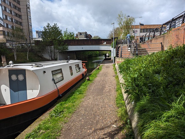
Uxbridge to Harefield West
 
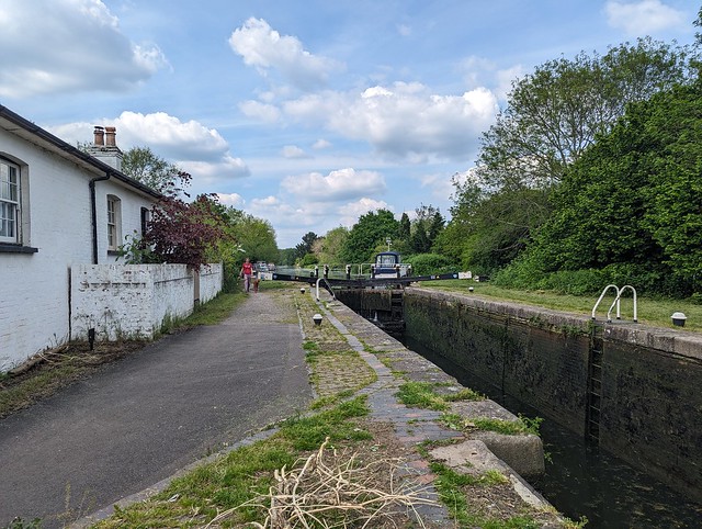
Most of this section follows the Grand Union Canal main line and before long I’m at Uxbridge Lock where I cross the canal on the turnover bridge, a brick built bridge designed with ramps so that horses towing the boats could cross from one side to the other without having to be unhitched. I noted that the lock keeper’s house is for sale and although this one has 4 bedrooms, 3 bathrooms, and the same guide price £799,950 my previous comment about having everyone and his dog trekking past your front door applies here too.
 
 London LOOP Section 12, Grand Union Canal, Uxbridge Lock
 
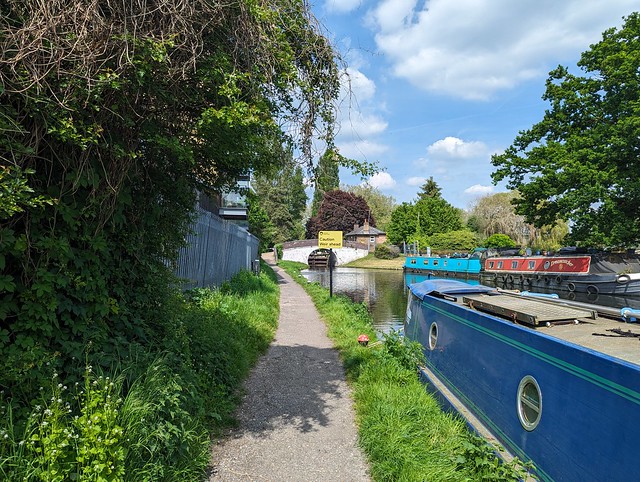
 There were plenty of boats moored along this pleasant stretch of canal although I only saw one moving. Carrying on and we’re 81 miles from Braunston and soon a branch of our old companion the River Colne joins the canal on the far side before the canal passes under the A40 Western Avenue, just before it becomes the M40 motorway. Both will eventually take you to Birmingham but one is a bit quicker than the other. At Bridge 183 I recrossed the canal and saw a boat that sadly wasn’t going anywhere soon.
 
 London LOOP Section 12, sunken boat, Grand Union Canal north of Western Avenue
 
 Again I could see glimpses of the River Colne off to the left running parallel to the canal and the trees along this section gave welcome shade. I’d noticed earlier a couple of  orange ships’ or maybe oil rig lifeboats converted to houseboats and here were two more. I’m not sure how practical it is to move these particularly through locks, or even if they do move given that one looked to have a look of permanency about its mooring, as well as more fenders than would seem necessary.
 
 London LOOP Section 12, canal boat variety
 
 At Denham Deep Lock the guide says the lock cottage is the beautifully set Fran’s Tea Garden. It was shut so I didn’t linger but carried on to Bridge 182. The bridge and lock numbers go down as you travel away from London since the canal was built from the midlands to London. This is the opposite to what you might expect, we’re used to roads etc. numbering the other way. At Bridge 182 I crossed the canal again and turned left onto the wide path of the Colne Valley Trail between the canal and Long Lake. This tree lined track then passed under Denham Railway Viaduct which carries the Chiltern Main Line linking London Marylebone with Birmingham over the canal and a branch of the River Colne.
 
 London LOOP Section 12, Denham Railway Viaduct, Chiltern Main Line
 
 Beyond the Denham Viaduct on the right is Harefield Lake No.2 and here I realised something that hadn’t previously occurred to me. I hadn’t made the connection between the Colne Valley and HS2 until I looked across the lake and saw the construction of the new Colne Valley Viaduct in progress. I’d seen photos but only in the “flesh” is the scale of this fabulous piece of civil engineering apparent.
 
 London LOOP Section 12, Colne Valley Viaduct (HS2)
 
 What a shame that due to short-sighted government it might never realize its full potential, at least not in any timescale I’m likely to see 🙁
At the end of the lake the Loop passes under the completed section of the viaduct deck on temporary pontoons around one of the supports so you get a fairly close up look at the structure and I don’t care what anyone says, it’s pretty cool. Oh and you have to press the button and wait for a green light before proceeding under the viaduct, which felt a little odd.
 
 London LOOP Section 12, Colne Valley Viaduct (HS2)
 
 Beyond the lakes and Harefield Marina the way follows a wide track and then winds through the woods. The guide and the way marks aren’t particularly clear on this part and I had to resort to GPS to ensure I was on the right path to eventually emerge onto Moorhall Road. Left here and up over a bridge and down some sketchy steps through the nettles and fly-tipped rubbish to join the Grand Union Canal again. Back on the towpath and beginning to question my life choices but now determined to complete Section 12 today I passed by Widewater Lock.
 
 London LOOP Section 12, Widewater Lock, Grand Union Canal
 
 Then under a rather decrepit bridge and onwards to Black Jack’s Lock. I can’t find anything to say who Black Jack was but Black Jack’s Mill stood between the river and canal, was apparently a location in Dr. Who and the 1964 comedy film The Bargee starring Harry H. Corbett, better known as Harold from Steptoe and Son. The Bargee  is worth looking out for if you’ve never seen it.
 
 London LOOP Section 12, Black Jacks Lock, Grand Union Canal
 
The lock was used in The Bargee as well and apparently the nearby thatched Jack’s Cottage was once the home of actress Ann Todd (The Seventh Veil) and was a filming location for Basil Brush. We’re in that area here, West London not far from several film studios. Full disclosure, I gleaned the above information from the blog Edith’s Streets which I’ve just bookmarked as a future time sink 🙂
 
I continued along the towpath over a footbridge above a rushing weir (the River Colne again) and over a high footbridge across the Troy Arm, past offices on the far side of the canal, and eventually to the Coy Carp Inn (yes, it is spelt like that) where Section 12 leaves the canal, crossing it on a narrow busy bridge with traffic lights and up a winding lane to finish at a nondescript junction with Summerhouse Lane.
 
 London LOOP Section 12, Summerhouse lane, end of Section 12.
 
Section 12 ✔︎
 
And then I went back to the Coy Carp and had what I felt was a well earned pint!
 
 London LOOP Section 12, section completion treat!
 
 While enjoying that I checked the TfL Go app for how to get back to West Drayton for the train home. It said U9 from just up the hill to New Park Rd. Harefield then cross the road and get U9 to Uxbridge and U1 from there to West Drayton Station. So I followed those instructions despite a nagging suspicion and having got off the first bus I then rejoined it on the other side of the road a few minutes later, albeit it was now much fuller having been to the hospital in the meantime. The driver gave me a funny look, I just rolled my eyes and said “TfL Go app”. Fortunately Uncle Sadiq’s Hopper Fare meant this pointless exercise didn’t cost any extra, all three buses were covered by a single journey charge.
 
I arrived home a bit after 8pm, knackered but with at least some sense of achievement. Then I dozed off watching Top of the Pops on BBC4, went to bed, and completely missed the Aurora Borealis, not imagining it would be visible from my house. The photos posted on Instagram by a near-neighbour prove I was very wrong. Bugger 🙁
 
 
 London LOOP Section 12
 

London Loop Section 11 (part 2).

May 10th

 
Nice day for a walk, let’s find out what the second part of London Loop Section 11 looks like. It might have dried out by now. (Spoiler: Nope.)
I got a train to West Drayton then returned to the canal towpath under bridge 192 and headed north past the large Tesco supermarket and under a couple of bridges to reach the junction with the Slough Arm of the Grand Union Canal. Crossing over the main line of the canal on a black metal footbridge to the Slough Arm towpath.
 
 London LOOP Section 11, Grand Union Canal, Slough Arm
 
 This canal was the last canal to be built in the country apart from the larger ship canals, opening in 1882 and running for five miles and servicing the local brickfields. Fortunately i didn’t have to walk the whole five miles so avoided going to Slough. I passed first the entrance to the Packet Boat Marina on the far bank, crossed the Frays River on the aqueduct, and crossed over the canal at Trout Lane. The route leaves the canal here and winds its way through the woods, eventually arriving at a gate into a small car park at the end of Packet Boat Lane. Earlier in the year this was reported as flooded, the River Colne being adjacent on the left but the puddle now was only an inch or two deep so no problem.
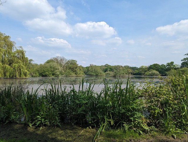
The other side of the car park lies Little Britain Lake, so named because it’s shaped - very vaguely - like the mainland of the British Isles. Obviously you can’t tell that from ground level.
 
 London LOOP Section 11, Little Britain Lake
 
 From here there’s a bridge over the River Colne and the Loop runs along the Buckinghamshire side of the river. Except not today. Today it runs in the river, being flooded and impassable from the bottom of the ramp down from the footbridge. I sent the Inner London Ramblers an update to confirm that Section 11 is still blocked here.
 
 London LOOP Section 11, River Colne in flood near Little Britain Lake
 
 So I retraced my steps and went along Packet Boat Lane, past the Public Toilets (the Gents was locked, disappointingly) and left up Old Mill Lane. This is the unofficial diversion route which if the Colne continues to flood in future probably ought to become official. Although Old Mill Lane is a little narrow and once past the lake there’s no footpath. It wasn’t too busy today though that might be different at the weekends or school holidays. It does pass between the River Colne and the Frays River though and at one point all that separates them is the raised road.
 
 London LOOP Section 11, Old Mill Lane, River Colne to left, Frays River to right.
 
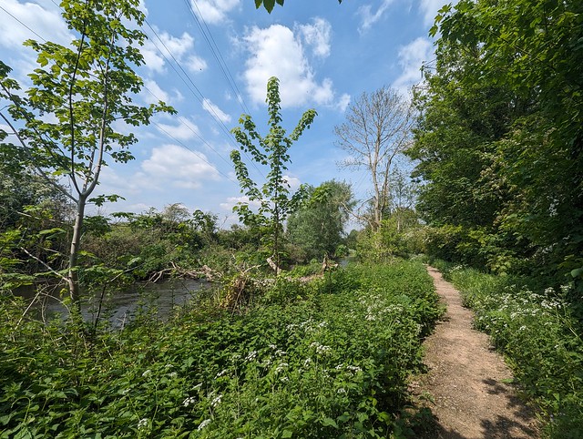
 This lane is part of the Colne Valley Trail way marked route and I followed it until reaching Iver Lane opposite the West London Industrial Park which has a large collection of what used to be called “man lifts” but these days are usually referred to as “cherry-pickers”, or officially Mobile Elevating Work Platforms. Available in blue, red, or yellow they were an unexpected burst of colour in the bright sunshine. Turning left up Iver Lane and crossing over I rejoined the Loop where it headed off north between the industrial park and the River Colne, here thankfully keeping within its banks. With the high steel fence of the industrial park on the right this is potentially a pretty grim bit of footpath but today with the sun reflecting off the river I found myself walking through large clouds (or whatever the collective noun is) of blue Dragonflies which alleviated the scene quite a bit, even if none of them would remain still long enough to capture a photo. Once past the fence and away from the sounds of industry the way along the river was quite rural so long as you didn’t look up at the cables and towers carrying 275,000 volts between Iver and Laleham and 132,000 volts between Iver and Slough.
 
 London LOOP Section 11, River Colne near Uxbridge
 
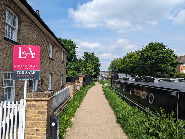
 Eventually I had to leave this bucolic scene behind, curving away from the riverside to join Longbridge Way, crossing Cowley Mill Road, and going down Culvert Way to meet the Grand Union Canal again on the outskirts of Uxbridge. I turned left onto the towpath by a house that was up for sale, out of curiosity I later looked up what a 3 bedroom, 2 bathroom canalside property might fetch in Uxbridge and at a guide price of fifty quid short of £800k I decided I wouldn’t want every bugger walking right past my front door 😀
 
 London LOOP Section 11, Grand Union Canal, Culvert lane, Uxbridge
 
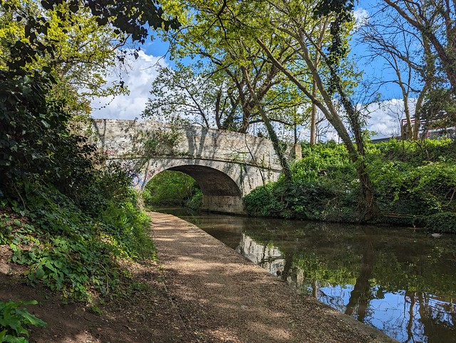
 From here it was all along the towpath to the end of Section 11, with lots of interesting boats and a bridge with a built-in defensive Pillbox until just past some big steel and glass buildings on the far bank I got to Bridge 185 where the Oxford Road crosses the canal and which marks the end of Section 11.
 
 London LOOP Section 11, Bridge 185, Oxford Road, Uxbridge
 
 Section 11 ✔︎
 
Just the other side of the bridge lies the Swan & Bottle pub, with a waterside garden (because we’ve met up with the River Colne again) where it would have been rude not to stop and sit with a nice pint of Yardbird and consider my next steps. It was still sunny, it was only twenty past one, Section 12 beckoned...
 
 
 London LOOP Section 11


Wednesday, 24 April 2024

East Grinstead Classic Bus Running day.

21st April

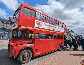
For my birthday this year I went for a ride on this:

East Grinstead Classic Bus Running Day, RM1009 at East Grinstead

and this:

East Grinstead Classic Bus Running Day, RT604 at East Grinstead

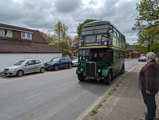
and this:

East Grinstead Classic Bus Running Day, RT3148 at Godstone Green

and this (which as far as I can recall is the first time I've ridden on an RF, certainly a Green Line one):

East Grinstead Classic Bus Running Day, AEC Regal IV RF28 LYF 379 at Godstone Green

and this:

East Grinstead Classic Bus Running Day, Leyland Titan B15 OHV 747Y at East Grinstead

and this:

East Grinstead Classic Bus Running Day, AEC Regal IV RF271 at Turners Hill

and had a rather good day in and around East Grinstead, seeing a bit of the country I'm not that familiar with.

I also got to meet, albeit briefly, Pete of Pete And His Bus fame.

Bus running days are a rare occasion when you can actually ride other people's classic vehicles rather than just look at them. For free too, although I made sure to buy the programme/timetable the tenner for which goes towards the costs. You don't want to think about the mpg figures for these vehicles! 

I'm not sure that the planned timetable "survived first contact with the enemy" but there were plenty of different buses of varying ages to see and I'm sure I missed some of them but here's the

Flickr Album

London Loop, Section 11 (part one).

April 19th

At the end of section 10 I could have got a train home from Hayes & Harlington station but chose to press on along Section 11 to West Drayton, a convenient point for me to both break off and to return another day to complete the section. Reports had suggested that the latter part of Section 11 might still be impassable due to flooding from the River Colne or at least if not then probably very muddy. That’s my excuse anyway. So having stopped briefly in Hayes town centre to grab a coffee and find a loo I rejoined the LOOP under Bridge 200 and headed west along the Grand Union towpath, past a cast iron milepost “Braunston 87 Miles”, and under bridges 199 and 198, past a Mallard mum with 10 (or 11, you try counting them!) very small fuzzy ducklings. Then under bridge 196 (I don’t know where 197 went) where a convenient bench presented itself on which to pause, watch a couple of boats go by, and eat the piece of home-made bread pudding I remembered I’d packed that morning.
 
 London LOOP Section 11, Bridge 196, Rigby Lane.
 
 Just before the next cast iron milepost (Braunston 86 Miles) the LOOP leaves the nice level towpath and turns right through a metal gate leading to Stockley Park. This 1980s business park, golf course, and country park is built on former brickfields and dumping ground, upon which about 140,000 new trees and shrubs were planted to create a woodland area.
 
 London LOOP Section 11, Stockley Park, an avenue of Lime trees.
 
 Across the entrance drive and alongside the golf course the route passes through an avenue of Lime trees, their spring foliage bright green, then through the edge of the business park and past the modern Golf Clubhouse where it bears right and starts to climb up past the entrance to the tenth tee and onward to the A-frame bridge across Stockley Road. About here I encountered the only other obvious “LOOPer” that day, closely and a little uncertainly following the route on his mobile phone screen.
 
 London LOOP Section 11, Stockley Road bridge.
 
 I passed ‘phone man’ on the way up the gravel track towards the viewpoint, which I diverted to up the short steep climb to the right of the path. You can see quite a way from this high point in Stockley Country Park although most of the details are obscured by tree cover. ‘Phone man’ passed by below while I was taking in the view.
 
 London LOOP Section 11, Stockley Country Park, viewpoint panorama.
 
Down from the viewpoint and back on the main path SSW across the country park and into the woodland along narrow paths partly obstructed by fallen trees until I got to the metal gate at Horton Road. Where ‘phone man’ suddenly appeared behind me so I’ve no idea which way his phone had taken him through the woods. On the other side of the road there is a choice of onward route, either following the roads or the “recommended alternative” along a new gravel path, Weston Walk, through a small park to an odd grassy mound like an Iron Age tumulus with a path around the base. I chose the latter obviously.
 
 London LOOP Section 11, Weston Walk mound.
 
 Beyond the mound a set of steps leads back down to the Grand Union towpath, to turn right to rejoin section 11 of the LOOP. Seems to be popular with afternoon joggers and pram-pushers but from here it’s straight along the canal, with the Great Western main line on the other side, under Horton Road bridge (193) towards West Drayton.
 
 London LOOP Section 11, Grand Union Canal, West Drayton.
 
 The next bridge (192) is adjacent to West Drayton railway station so that’s where I called it for the day and got the train home. I hope to be back when things have had a chance to dry out a bit on the rest of Section 11 when I’ll continue along the Grand Union and then up by the Colne to Uxbridge.
 
 
 London LOOP Section 11
 
 And I didn’t even get wet on this bit.
 

Tuesday, 23 April 2024

London LOOP, section 10.

April 19th

I want to walk the London Outer Orbital Path, usually tautologically referred to as the London Loop. This trail, nearly 150 miles long almost encircles Greater London, split into 24 sections between Erith station and Purfleet. The sections all start/finish close to public transport nodes making it really convenient if you live inside the loop. I don’t live inside the loop so it will be quite inconvenient, especially given the limited public transport options where I do live. I might never actually complete the whole thing but if I don’t start somewhere then I certainly won’t finish it. So what better place to start than the nearest bit, Section 10 from Hatton Cross to Hayes & Harlington. I downloaded the map and guides for Section 10 from the Inner London Ramblers website and picked the following Friday as the day to make a start. Yes of course that turned out to be the only day that week when rain was forecast because Sod’s Law applies. 🙄
 
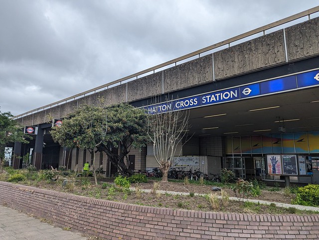
Two buses and a tube got me to Hatton Cross Underground station, at which I’d never previously got on or off, so ✔︎. From there it’s a short walk alongside the A30 Great South West Road to the start of Section 10 proper by the bridge over the River Crane.
 
 London LOOP Section 10, Cranebank.
 
 This is River Crane Park and the path heads north through the woods beside the river and out into an open space and once you are away from the road it almost feels like countryside. On leaving the open space the route runs through suburban semis with double glazed windows to mitigate the sound of the jets on the flightpath overhead, streets not too dissimilar to the one on which I was born. On reaching the A4 Bath Road I crossed and turned left, at which point enough rain arrived that I had to put on my waterproof coat and then crossed back over the River Crane on the road bridge.
 
 London LOOP Section 10, Bath Road bridge over the River Crane.
 
 Shortly after which the route turned right into the next green bit, Berkeley Meadows, named after the ancient English landowning family whose name also gave us the square in which nightingales sang and the hunt from which we get the rhyming slang, "berk". Exiting the path at the north end and crossing the road carefully it’s into the woods along muddy paths alongside the Crane until reaching the large open field which is Cranford Country Park. Across which the rain was now blowing horizontally from the left 💦
 
 London LOOP Section 10, Cranford Country Park.
 
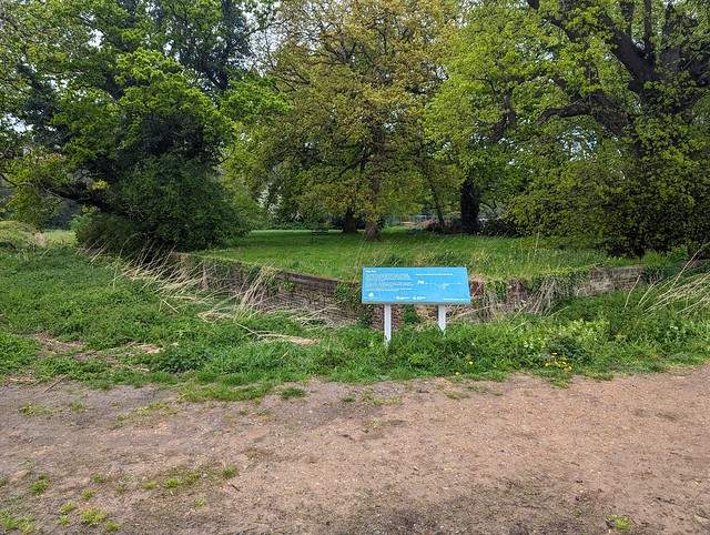
 And across which I had to walk diagonally to get to the exit after passing the Ha-Ha which separated the garden of Cranford House, one of the homes of the Earls of Berkeley (now demolished) from the open parkland. A Ha-Ha being a ditch with a vertical wall on the inner side designed to keep deer, livestock, peasants etc. out of the garden without the wall spoiling the view from the house. Ha-ha supposedly being what people said when they saw it. Or fell into it. 
 
 London LOOP Section 10, Ha-Ha, Cranford House.
 
 I was too wet to laugh at it but by the time I’d crossed the car park the sun had come out and I found a dryish bench under a large Yew in the churchyard of St. Dunstan’s Cranford on which to pause and eat my picnic sandwich. Doesn’t look like it’s right next to the M4 Motorway, does it?
 
 London LOOP Section 10, St. Dunstan's Church, Cranford.
 
 They didn’t build it next to the motorway of course because that wasn’t there when the Saxons built the first church, or in the 15th and 17th centuries when the current building was constructed. The church is locked outside of mass times so I missed seeing the memorial to the comedian Tony Hancock and the memorials to the many berks sorry, Berkeleys that lie within. Picnic consumed I crossed the cobbled (setts) yard and passed under the arch of the old stable block, then under the motorway and turned right into the wonderfully named Dog Kennel Covert, a strip of woodland through which runs the Loop, the Hillingdon Trail, and the River Crane also known here as the Yeading Brook which forms the boundary between the boroughs of Hounslow and Hillingdon. For a bit of urban edgelands it had a pretty good display of Bluebells.
 
 London LOOP Section 10, Dog Kennel Covert bluebells.
 
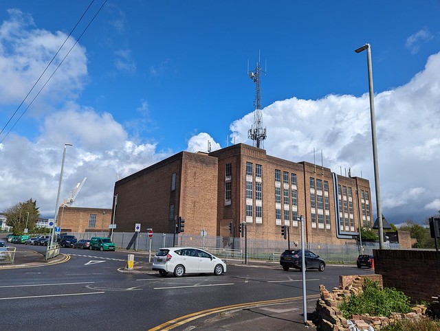
 Emerging from the park via Watersplash Lane my eye was drawn to a large art deco factory or office on North Hyde Road, topped by an incongruously large cellsite aerial tower. I can’t find any information about this building, it seems to be outside the area of the former Nestle factory site across North Hyde Gardens. Something to do with the electricity substation to its north maybe?  If you know, comment below.
 
 London LOOP Section 10, North Hyde Road, what's this building?
 
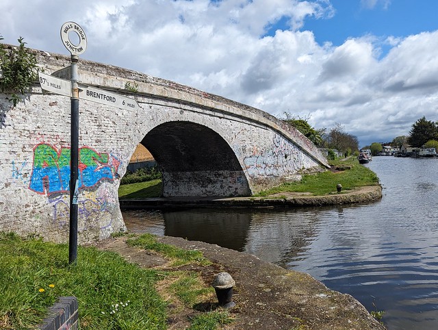
 Passing the above building and bearing round to the left and up onto the  flyover of The Parkway (A312), across the Grand Union Canal and down a long zig-zag ramp to the canal towpath and a little diversion to Bull’s Bridge Junction where the Paddington Arm joins the main Grand Union, giving London a direct link to the national canal network rather than via the Thames at Brentford. Next to the white painted brick Bull's Bridge is a finger post giving the distances to Brentford 6 miles, Paddington 13½ miles, and Braunston 87½ miles. Or it would do if some twat hadn’t snapped off half the sign pointing to Braunston. Cut off their goolies I say.
 
 London LOOP Section 10, Bull's Bridge Junction, Grand Union Canal.
 
 Retracing my steps along the canal towards Braunston  and under the flyover the end of section 10 was almost in sight. Just a stroll along the towpath underneath the railway bridge carrying the Great Western main line and Crossrail Purple train Elizabeth Line then to Bridge 200, Station Road, the end of Section 10 near Hayes & Harlington Station.
 
 London LOOP Section 10, Grand Union Canal, Hayes, End of LL10.
 
 Section 10 ✔︎
 
I could have got the train home from here but the sun was out, it was only half past one, and I could manage another few miles so I continued on Section 11 to West Drayton. Post about that to follow.
 
 
 London LOOP Section 10